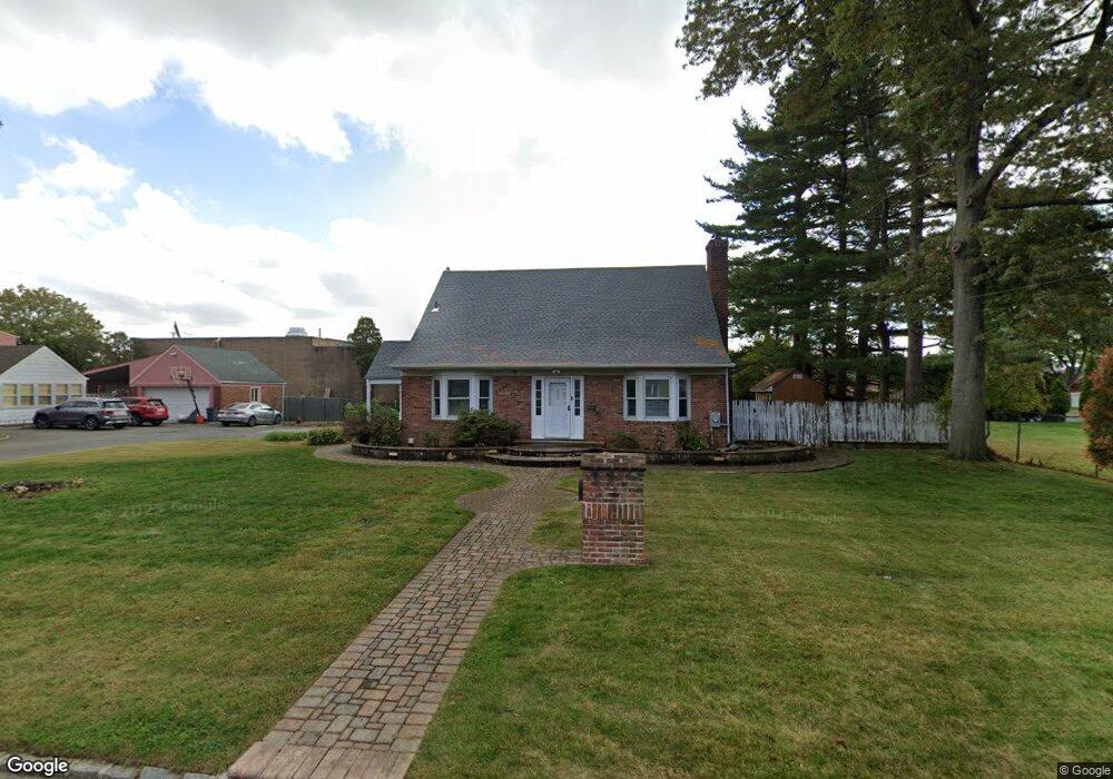
588 Bryant St Westbury, NY 11590
Estimated Value: $709,000 - $709,669
--
Bed
1
Bath
1,642
Sq Ft
$432/Sq Ft
Est. Value
About This Home
This home is located at 588 Bryant St, Westbury, NY 11590 and is currently estimated at $709,335, approximately $431 per square foot. 588 Bryant St is a home located in Nassau County with nearby schools including Westbury Middle School, Westbury High School, and St Brigid/Our Lady Of Hope Regional School.
Ownership History
Date
Name
Owned For
Owner Type
Purchase Details
Closed on
Dec 18, 2017
Sold by
Fannie Mae
Bought by
Alagheband Shadi Chrystal and Alagheband Mehran
Current Estimated Value
Purchase Details
Closed on
Aug 17, 2016
Sold by
Referee Of Nassau County and Stadler Esq
Bought by
Federal National Mortgage Association
Create a Home Valuation Report for This Property
The Home Valuation Report is an in-depth analysis detailing your home's value as well as a comparison with similar homes in the area
Home Values in the Area
Average Home Value in this Area
Purchase History
| Date | Buyer | Sale Price | Title Company |
|---|---|---|---|
| Alagheband Shadi Chrystal | $341,000 | -- | |
| Alagheband Shadi Chrystal | $341,000 | -- | |
| Federal National Mortgage Association | $596,649 | None Available | |
| Federal National Mortgage Association | $596,649 | None Available |
Source: Public Records
Mortgage History
| Date | Status | Borrower | Loan Amount |
|---|---|---|---|
| Closed | Federal National Mortgage Association | $0 |
Source: Public Records
Tax History Compared to Growth
Tax History
| Year | Tax Paid | Tax Assessment Tax Assessment Total Assessment is a certain percentage of the fair market value that is determined by local assessors to be the total taxable value of land and additions on the property. | Land | Improvement |
|---|---|---|---|---|
| 2025 | $11,531 | $376 | $230 | $146 |
| 2024 | $2,776 | $378 | $232 | $146 |
| 2023 | $11,762 | $385 | $236 | $149 |
| 2022 | $11,762 | $385 | $236 | $149 |
| 2021 | $11,831 | $380 | $233 | $147 |
| 2020 | $11,345 | $560 | $444 | $116 |
| 2019 | $13,714 | $749 | $594 | $155 |
| 2018 | $13,714 | $749 | $0 | $0 |
| 2017 | $10,289 | $749 | $594 | $155 |
| 2016 | $13,285 | $749 | $594 | $155 |
| 2015 | $2,875 | $749 | $594 | $155 |
| 2014 | $2,875 | $749 | $594 | $155 |
| 2013 | $2,698 | $749 | $594 | $155 |
Source: Public Records
Map
Nearby Homes
- 20 Longfellow Ave
- 646 Whittier St
- 671 Whittier St
- 54 School St Unit 315
- 544 Dryden St
- 2001 Wellington Ct
- 906 Bromton Dr
- 2040 Wellington Ct
- 1982 Stratford Dr
- 806 Oliver Ave
- 1148 Howard Dr
- 9 Grayston St
- 254 Brook St
- 130 Post Ave Unit 202
- 130 Post Ave Unit 303
- 130 Post Ave Unit 322
- 130 Post Ave Unit 316
- 537 Church St
- 330 Maple Ave Unit 25
- 474 Newton St
- 588 Bryant St
- 594 Bryant St
- 585 Bryant St
- 591 Bryant St
- 579 Bryant St
- 597 Bryant St
- 573 Bryant St
- 600 Bryant St
- 567 Bryant St
- 590 Whittier St
- 584 Whittier St
- 601 Old Country Rd
- 596 Whittier St
- 609 Bryant St
- 578 Whittier St
- 602 Whittier St
- 572 Whittier St
- 561 Bryant St
- 44 Longfellow Ave
- 38 Longfellow Ave