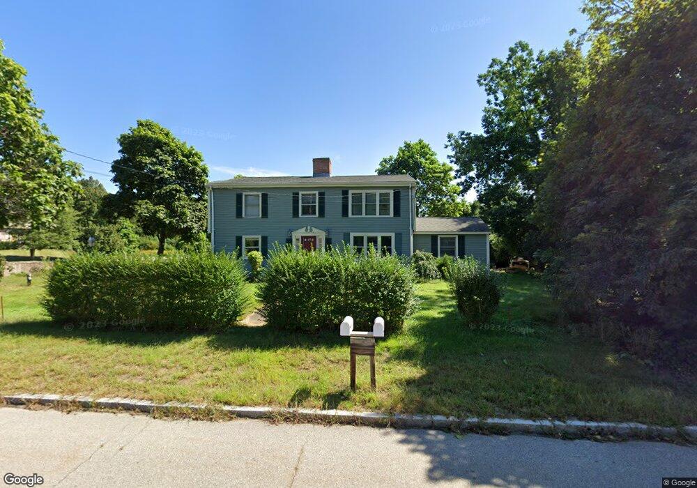
588 East St Wrentham, MA 02093
Estimated Value: $723,000 - $1,057,000
3
Beds
3
Baths
2,988
Sq Ft
$281/Sq Ft
Est. Value
About This Home
This home is located at 588 East St, Wrentham, MA 02093 and is currently estimated at $840,927, approximately $281 per square foot. 588 East St is a home located in Norfolk County with nearby schools including Delaney Elementary School, Charles E Roderick, and Foxborough Regional Charter School.
Create a Home Valuation Report for This Property
The Home Valuation Report is an in-depth analysis detailing your home's value as well as a comparison with similar homes in the area
Home Values in the Area
Average Home Value in this Area
Tax History Compared to Growth
Tax History
| Year | Tax Paid | Tax Assessment Tax Assessment Total Assessment is a certain percentage of the fair market value that is determined by local assessors to be the total taxable value of land and additions on the property. | Land | Improvement |
|---|---|---|---|---|
| 2025 | $7,062 | $609,300 | $273,300 | $336,000 |
| 2024 | $6,941 | $578,400 | $273,300 | $305,100 |
| 2023 | $7,085 | $561,400 | $248,400 | $313,000 |
| 2022 | $6,585 | $481,700 | $223,500 | $258,200 |
| 2021 | $6,389 | $454,100 | $199,700 | $254,400 |
| 2020 | $6,103 | $428,300 | $182,200 | $246,100 |
| 2019 | $5,940 | $420,700 | $182,200 | $238,500 |
| 2018 | $5,941 | $417,200 | $182,300 | $234,900 |
| 2017 | $5,576 | $391,300 | $178,800 | $212,500 |
| 2016 | $5,321 | $372,600 | $173,600 | $199,000 |
| 2015 | $4,888 | $326,300 | $151,800 | $174,500 |
| 2014 | $4,838 | $316,000 | $146,000 | $170,000 |
Source: Public Records
Map
Nearby Homes
- 1 Lorraine Metcalf Dr
- 362 East St
- 270 Dedham St
- 65 Pond St
- 25 Foxboro Rd
- 10 Nature View Dr
- 15 Nature View Dr
- 11 Goodwin Dr
- 7 Hill St Unit 10
- 10 W Birch Rd
- 483 Thurston St
- 0 W Birch Rd
- 71 Pond St
- 20 Valley St Unit 20
- 120 Hawes St
- 3 Oak Rd
- 319 Taunton St
- 246 Forest Grove Ave
- 131 Creek St Unit 7
- 11 Earle Stewart Ln