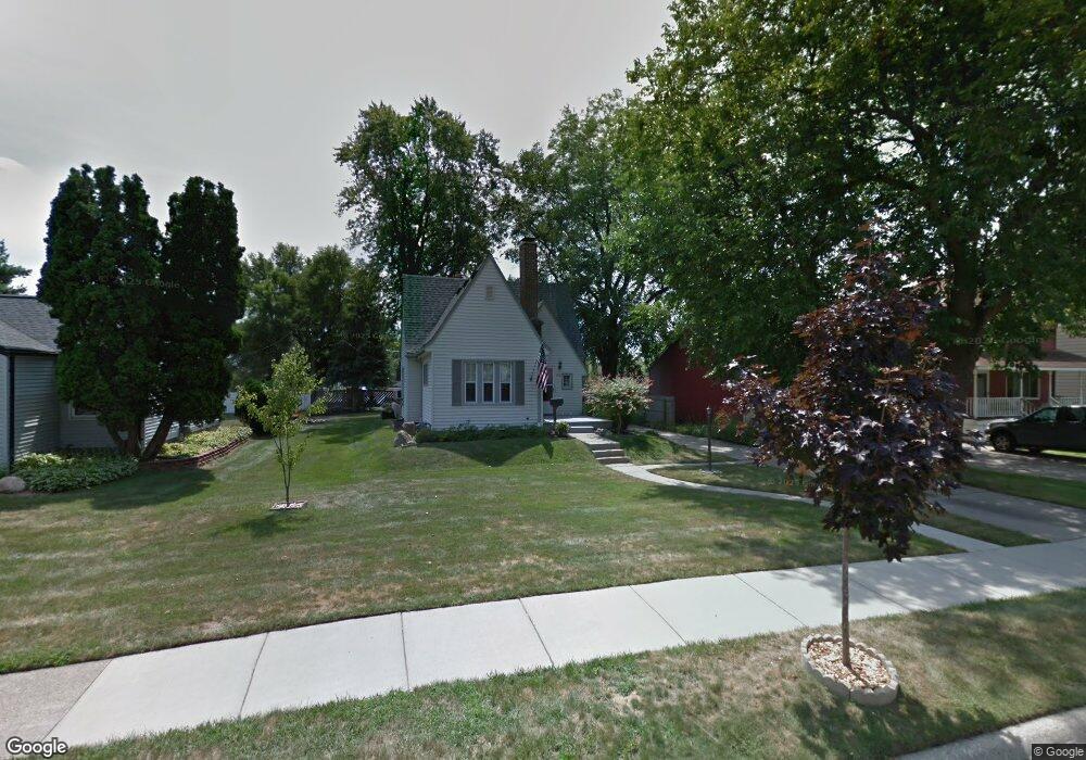
588 Lincoln Ave Clawson, MI 48017
Estimated Value: $250,000 - $288,000
2
Beds
1
Bath
1,002
Sq Ft
$261/Sq Ft
Est. Value
About This Home
This home is located at 588 Lincoln Ave, Clawson, MI 48017 and is currently estimated at $261,682, approximately $261 per square foot. 588 Lincoln Ave is a home located in Oakland County with nearby schools including Clawson High School, Guardian Angels School, and Bishop Foley Catholic High School.
Ownership History
Date
Name
Owned For
Owner Type
Purchase Details
Closed on
Jun 10, 2022
Sold by
Proimos Margo A and Proimos Kimberly S
Bought by
Proimos Margo A and Jones Kimberly S
Current Estimated Value
Home Financials for this Owner
Home Financials are based on the most recent Mortgage that was taken out on this home.
Original Mortgage
$169,250
Outstanding Balance
$164,495
Interest Rate
8.31%
Mortgage Type
New Conventional
Estimated Equity
$97,187
Purchase Details
Closed on
Jan 30, 1997
Sold by
Corney Richard
Bought by
Jones Kimberly S
Create a Home Valuation Report for This Property
The Home Valuation Report is an in-depth analysis detailing your home's value as well as a comparison with similar homes in the area
Home Values in the Area
Average Home Value in this Area
Purchase History
| Date | Buyer | Sale Price | Title Company |
|---|---|---|---|
| Proimos Margo A | -- | None Listed On Document | |
| Jones Kimberly S | $120,000 | -- |
Source: Public Records
Mortgage History
| Date | Status | Borrower | Loan Amount |
|---|---|---|---|
| Open | Proimos Margo A | $169,250 |
Source: Public Records
Tax History Compared to Growth
Tax History
| Year | Tax Paid | Tax Assessment Tax Assessment Total Assessment is a certain percentage of the fair market value that is determined by local assessors to be the total taxable value of land and additions on the property. | Land | Improvement |
|---|---|---|---|---|
| 2024 | $2,459 | $116,920 | $0 | $0 |
| 2023 | $2,357 | $109,110 | $0 | $0 |
| 2022 | $2,376 | $97,190 | $0 | $0 |
| 2021 | $2,328 | $88,870 | $0 | $0 |
| 2020 | $2,255 | $83,600 | $0 | $0 |
| 2019 | $2,330 | $77,980 | $0 | $0 |
| 2018 | $2,313 | $71,770 | $0 | $0 |
| 2017 | $2,300 | $66,390 | $0 | $0 |
| 2016 | $2,335 | $60,940 | $0 | $0 |
| 2015 | -- | $55,780 | $0 | $0 |
| 2014 | -- | $48,440 | $0 | $0 |
| 2011 | -- | $44,830 | $0 | $0 |
Source: Public Records
Map
Nearby Homes
- 769 Coolidge Ave
- 925 E 14 Mile Rd
- 940 Coolidge Ave
- 151 Fisher Ct
- 927 Goodale Ave
- 31 Walper Ave
- 1101 Donald Ave
- 625 Whitcomb Ave
- 42 Gladwin Ave
- 104 Charlevoix St
- 1612 Genesee Ave
- 321 N Washington Ave
- 359 Sheffield Dr
- 216 Woodside Rd
- 1108 Millard Ave
- 25 Lyons Dr
- 1322 Whitcomb Ave
- 325 Lyons Dr
- 1023 Amelia Ave
- 501 E Sunnybrook Dr
- 568 Lincoln Ave
- 596 Lincoln Ave
- 562 Lincoln Ave
- 595 Bowers St
- 593 Lincoln Ave
- 579 Lincoln Ave
- 612 Lincoln Ave
- 544 Lincoln Ave Unit Bldg-Unit
- 544 Lincoln Ave
- 605 Bowers St
- 611 Bowers St
- 555 Lincoln Ave
- 619 Bowers St
- 632 Lincoln Ave
- 326 Lerner Ave
- 545 Lincoln Ave
- 629 Bowers St
- 336 Lerner Ave
- 642 Lincoln Ave
- 325 Lerner Ave