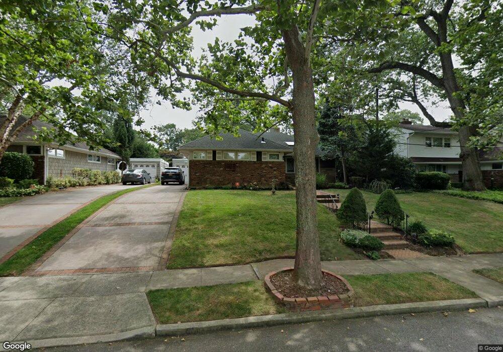
588 Mohawk Rd West Hempstead, NY 11552
Estimated Value: $752,000 - $796,539
3
Beds
2
Baths
1,401
Sq Ft
$553/Sq Ft
Est. Value
About This Home
This home is located at 588 Mohawk Rd, West Hempstead, NY 11552 and is currently estimated at $774,270, approximately $552 per square foot. 588 Mohawk Rd is a home located in Nassau County with nearby schools including Chestnut Street School, West Hempstead Secondary School, and Grace Lutheran School.
Ownership History
Date
Name
Owned For
Owner Type
Purchase Details
Closed on
Jun 25, 2021
Sold by
Musacchio Trust
Bought by
Gilles Arabella
Current Estimated Value
Home Financials for this Owner
Home Financials are based on the most recent Mortgage that was taken out on this home.
Original Mortgage
$615,000
Outstanding Balance
$558,528
Interest Rate
2.96%
Mortgage Type
New Conventional
Estimated Equity
$215,742
Purchase Details
Closed on
Jan 9, 2004
Sold by
Musacchio Louis
Create a Home Valuation Report for This Property
The Home Valuation Report is an in-depth analysis detailing your home's value as well as a comparison with similar homes in the area
Home Values in the Area
Average Home Value in this Area
Purchase History
| Date | Buyer | Sale Price | Title Company |
|---|---|---|---|
| Gilles Arabella | $615,000 | Old Republic Title | |
| -- | -- | -- |
Source: Public Records
Mortgage History
| Date | Status | Borrower | Loan Amount |
|---|---|---|---|
| Open | Gilles Arabella | $615,000 |
Source: Public Records
Tax History Compared to Growth
Tax History
| Year | Tax Paid | Tax Assessment Tax Assessment Total Assessment is a certain percentage of the fair market value that is determined by local assessors to be the total taxable value of land and additions on the property. | Land | Improvement |
|---|---|---|---|---|
| 2025 | $11,832 | $430 | $174 | $256 |
| 2024 | $3,550 | $433 | $175 | $258 |
| 2023 | $12,271 | $433 | $175 | $258 |
| 2022 | $12,271 | $433 | $175 | $258 |
| 2021 | $9,859 | $413 | $167 | $246 |
| 2020 | $7,522 | $609 | $417 | $192 |
| 2019 | $4,161 | $864 | $592 | $272 |
| 2018 | $3,757 | $864 | $0 | $0 |
| 2017 | $6,077 | $864 | $592 | $272 |
| 2016 | $10,017 | $864 | $592 | $272 |
| 2015 | $3,476 | $864 | $592 | $272 |
| 2014 | $3,476 | $864 | $592 | $272 |
| 2013 | $3,245 | $864 | $592 | $272 |
Source: Public Records
Map
Nearby Homes
- 924 Otsego Ct
- 919 Pinelake Dr
- 0 Rhodes Ln
- 450 Rhodes Ln
- 10 Atlas Ave
- 9 Coral Ct
- 899 Cleveland St
- 486 Champlain Ave
- 401 Ocean Ave
- 1025 Ontario Rd
- 7 Hopatcong Ave
- 1024 Mahopac Rd
- 853 Arthur St
- 841 Woodfield Rd
- 771 Maple Place
- 81 Gerard Ave W
- 71 Dogwood Ave
- 1070 Mahopac Rd
- 95 Dogwood Ave
- 4 Malverne Ave
- 594 Mohawk Rd
- 578 Mohawk Rd
- 1118 Sunapee Rd
- 600 Mohawk Rd
- 1090 Walden Place
- 601 Arnold Rd
- 599 Mohawk Rd
- 1089 Walden Place
- 1109 Sunapee Rd
- 608 Mohawk Rd
- 1125 Sunapee Rd
- 609 Arnold Rd
- 576 Mohawk Rd
- 1103 Sunapee Rd
- 598 Emerson Dr
- 1079 Walden Place
- 588 Emerson Dr
- 604 Emerson Dr
- 615 Arnold Rd
- 565 Mohawk Rd