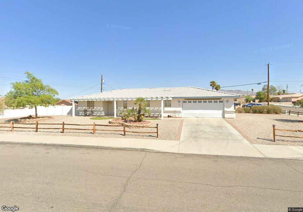
588 Roanoke Dr Lake Havasu City, AZ 86406
Estimated Value: $380,968 - $503,000
--
Bed
1
Bath
1,383
Sq Ft
$324/Sq Ft
Est. Value
About This Home
This home is located at 588 Roanoke Dr, Lake Havasu City, AZ 86406 and is currently estimated at $448,742, approximately $324 per square foot. 588 Roanoke Dr is a home located in Mohave County with nearby schools including Starline Elementary School, Thunderbolt Middle School, and Lake Havasu High School.
Ownership History
Date
Name
Owned For
Owner Type
Purchase Details
Closed on
Jul 29, 2014
Sold by
Sutterfield Wesley L and Sutterfield Kay L
Bought by
Linn & Kay Sutterfield Revocable Family
Current Estimated Value
Purchase Details
Closed on
Jan 14, 1999
Sold by
Bennett Stephen T and Bennett Song C
Bought by
Sutterfield Wesley L and Sutterfield Kay L
Home Financials for this Owner
Home Financials are based on the most recent Mortgage that was taken out on this home.
Original Mortgage
$50,000
Interest Rate
6.73%
Create a Home Valuation Report for This Property
The Home Valuation Report is an in-depth analysis detailing your home's value as well as a comparison with similar homes in the area
Home Values in the Area
Average Home Value in this Area
Purchase History
| Date | Buyer | Sale Price | Title Company |
|---|---|---|---|
| Linn & Kay Sutterfield Revocable Family | -- | None Available | |
| Sutterfield Wesley L | $78,500 | First American Title |
Source: Public Records
Mortgage History
| Date | Status | Borrower | Loan Amount |
|---|---|---|---|
| Closed | Sutterfield Wesley L | $50,000 |
Source: Public Records
Tax History Compared to Growth
Tax History
| Year | Tax Paid | Tax Assessment Tax Assessment Total Assessment is a certain percentage of the fair market value that is determined by local assessors to be the total taxable value of land and additions on the property. | Land | Improvement |
|---|---|---|---|---|
| 2026 | -- | -- | -- | -- |
| 2025 | $1,448 | $33,457 | $0 | $0 |
| 2024 | $1,448 | $36,315 | $0 | $0 |
| 2023 | $1,448 | $30,581 | $0 | $0 |
| 2022 | $1,385 | $22,514 | $0 | $0 |
| 2021 | $1,551 | $20,865 | $0 | $0 |
| 2019 | $1,475 | $18,045 | $0 | $0 |
| 2018 | $1,425 | $16,616 | $0 | $0 |
| 2017 | $1,412 | $15,716 | $0 | $0 |
| 2016 | $1,281 | $14,547 | $0 | $0 |
| 2015 | $1,228 | $12,517 | $0 | $0 |
Source: Public Records
Map
Nearby Homes
- 3135 Cotati Dr
- 2970 War Eagle Dr
- 532 Roanoke Dr
- 3150 Star Dr
- 3040 Gypsy Dr
- 2910 Coconino Dr
- 3066 Star Dr
- 815 Rolling Hills Plaza N
- 786 Powder Dr
- 700 Apache Dr
- 691 Rolling Hills Dr
- 2951 Saddleback Dr
- 2997 Edgewood Dr
- 3261 Thundercloud Dr
- 850 Thunderbolt Ave
- 680 Yosemite Dr
- 3306 Cinnamon Dr
- 2890 Yuma Dr
- 2876 Plaza Del Oro
- 3235 Silverspoon Dr
- 687 Thunderbolt Ave
- 687 Thunderbolt Ave
- 671 Apache Dr
- 669 Apache Dr
- 685 Thunderbolt Ave
- 686 Thunderbolt Ave
- 667 Apache Dr
- 675 Thunderbolt Ave
- 676 Thunderbolt Ave
- 676 Thunderbolt Ave
- 591 Roanoke Dr
- 696 Thunderbolt Ave
- 664 Apache Dr
- 660 Apache Dr
- 670 Thunderbolt Ave
- 665 Apache Dr
- 665 Thunderbolt Ave
- 581 Roanoke Dr
- 658 Apache Dr
- 668 Apache Dr