Estimated Value: $545,000 - $671,000
--
Bed
--
Bath
2,523
Sq Ft
$239/Sq Ft
Est. Value
About This Home
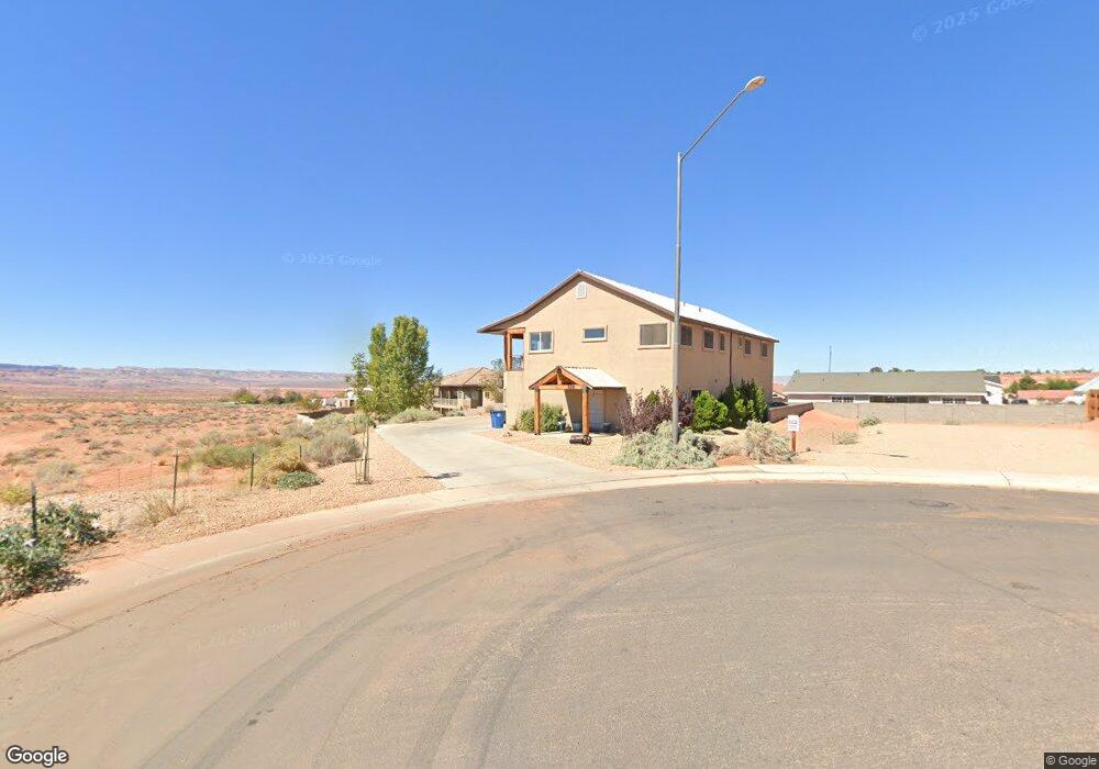
This home is located at 588 Robert Ln, Page, AZ 86040 and is currently estimated at $603,010, approximately $239 per square foot. 588 Robert Ln is a home with nearby schools including Desert View Elementary Intermediate School, Lake View Elementary Primary School, and Page Middle School.
Ownership History
Date
Name
Owned For
Owner Type
Purchase Details
Closed on
Oct 2, 2012
Sold by
Bushell Kylie Louise
Bought by
Adams Camilla M and Adams Brigham F
Current Estimated Value
Home Financials for this Owner
Home Financials are based on the most recent Mortgage that was taken out on this home.
Original Mortgage
$208,129
Outstanding Balance
$143,169
Interest Rate
3.37%
Mortgage Type
FHA
Estimated Equity
$459,841
Purchase Details
Closed on
Feb 11, 2009
Sold by
Slavens J Dean and Slavens Judy L
Bought by
Preston Jared Michael and Bushell Kylie Louise
Create a Home Valuation Report for This Property
The Home Valuation Report is an in-depth analysis detailing your home's value as well as a comparison with similar homes in the area
Home Values in the Area
Average Home Value in this Area
Purchase History
| Date | Buyer | Sale Price | Title Company |
|---|---|---|---|
| Adams Camilla M | $212,000 | Pioneer Title Agency Inc | |
| Preston Jared Michael | $62,900 | First American Title Ins Co |
Source: Public Records
Mortgage History
| Date | Status | Borrower | Loan Amount |
|---|---|---|---|
| Open | Adams Camilla M | $208,129 |
Source: Public Records
Tax History Compared to Growth
Tax History
| Year | Tax Paid | Tax Assessment Tax Assessment Total Assessment is a certain percentage of the fair market value that is determined by local assessors to be the total taxable value of land and additions on the property. | Land | Improvement |
|---|---|---|---|---|
| 2025 | $1,941 | $45,247 | -- | -- |
| 2024 | $1,941 | $42,119 | -- | -- |
| 2023 | $1,731 | $34,198 | $0 | $0 |
| 2022 | $1,731 | $30,342 | $0 | $0 |
| 2021 | $2,043 | $29,500 | $0 | $0 |
| 2020 | $1,560 | $28,982 | $0 | $0 |
| 2019 | $1,502 | $26,483 | $0 | $0 |
| 2018 | $1,520 | $25,683 | $0 | $0 |
| 2017 | $1,454 | $24,925 | $0 | $0 |
| 2016 | $1,333 | $23,881 | $0 | $0 |
| 2015 | $1,383 | $24,160 | $0 | $0 |
Source: Public Records
Map
Nearby Homes
- 39 W Jerome St
- 22 Sunset St Unit 22
- 2 Echo Ct
- 134 Calle Hermosa
- 57 Aero Ave
- 8.35 Acres S Parcel Rainbow Dr
- 265 Myrtle Dr
- 451 Ticaboo Canyon Dr Unit 33
- 461 Ticaboo Canyon Dr Unit 34
- 12 Sumner Cove
- 142 Bryce Canyon Dr
- 152 Bryce Canyon Dr
- 30 Tek Ct
- 130 Tek Ct Unit 95
- 665 N Anasazi Dr Unit Lot 19
- 142 Dunn Dr
- 1334 E Rock Ledge Ln
- 1260 Patrick Henry Ct
- 1140 Independence
- 1140 S Independence Dr