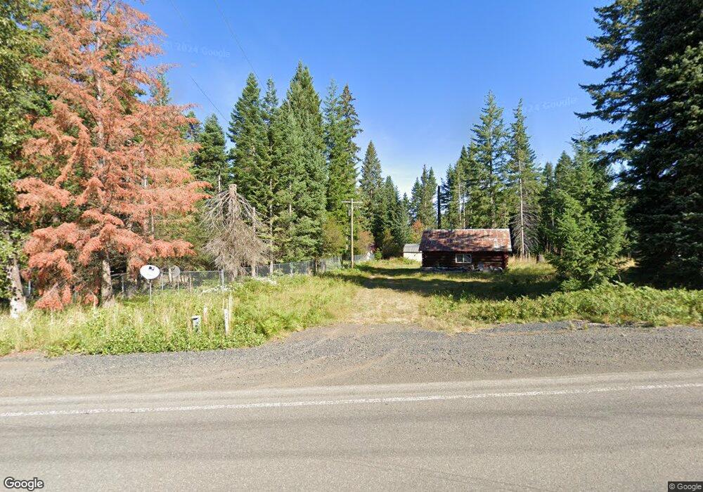
58815 Highway 204 Weston, OR 97886
Estimated Value: $85,000 - $186,000
--
Bed
1
Bath
520
Sq Ft
$231/Sq Ft
Est. Value
About This Home
This home is located at 58815 Highway 204, Weston, OR 97886 and is currently estimated at $119,926, approximately $230 per square foot. 58815 Highway 204 is a home located in Umatilla County with nearby schools including Athena Elementary School, Weston Middle School, and Weston-McEwen High School.
Ownership History
Date
Name
Owned For
Owner Type
Purchase Details
Closed on
Nov 18, 2016
Sold by
Allessio John
Bought by
Williams Teresa
Current Estimated Value
Purchase Details
Closed on
Jan 11, 2013
Sold by
Paul Thomas Roger
Bought by
Allessio John J and Allessio Teresa L
Home Financials for this Owner
Home Financials are based on the most recent Mortgage that was taken out on this home.
Original Mortgage
$21,000
Interest Rate
3.27%
Mortgage Type
Seller Take Back
Create a Home Valuation Report for This Property
The Home Valuation Report is an in-depth analysis detailing your home's value as well as a comparison with similar homes in the area
Home Values in the Area
Average Home Value in this Area
Purchase History
| Date | Buyer | Sale Price | Title Company |
|---|---|---|---|
| Williams Teresa | -- | None Available | |
| Allessio John J | $25,000 | Amerititle | |
| Paul Thomas Roger | -- | Amerititle |
Source: Public Records
Mortgage History
| Date | Status | Borrower | Loan Amount |
|---|---|---|---|
| Previous Owner | Allessio John J | $21,000 |
Source: Public Records
Tax History Compared to Growth
Tax History
| Year | Tax Paid | Tax Assessment Tax Assessment Total Assessment is a certain percentage of the fair market value that is determined by local assessors to be the total taxable value of land and additions on the property. | Land | Improvement |
|---|---|---|---|---|
| 2024 | $702 | $48,180 | $26,780 | $21,400 |
| 2023 | $683 | $46,780 | $26,000 | $20,780 |
| 2022 | $639 | $45,420 | $0 | $0 |
| 2021 | $645 | $44,100 | $24,520 | $19,580 |
| 2020 | $629 | $42,820 | $23,810 | $19,010 |
| 2018 | $601 | $40,370 | $22,450 | $17,920 |
| 2017 | $586 | $39,200 | $21,800 | $17,400 |
| 2016 | $545 | $38,060 | $21,160 | $16,900 |
| 2015 | $535 | $34,850 | $19,370 | $15,480 |
| 2014 | $480 | $34,850 | $19,370 | $15,480 |
Source: Public Records
Map
Nearby Homes
- 58504 Wildwood Loop
- 61515 Highway 204
- 78248 Mcintyre Rd
- 78248 McIntryre Rd
- 0 Vacant Land Unit 24319177
- 0 Vacant Land Unit 21132733
- 000 Coyote Ridge Rd
- 77667 Jack Pine Ln
- 81268 S Fork Walla River Rd
- 54884 Day Rd
- 402 E Main St
- 103 S Arman St
- 604 S Broad St
- 212 S Water St
- 100 W Wallace St
- 406 W Mill St
- 54693 Bingham Rd
- 54068 Walla River Rd
- 224 SE 20th Place
- 211 SE 20th Place
- 58815 Highway 204
- 78411 Finch Ln
- 78414 Basket Mountain Rd
- 58871 Highway 204
- 58783 Highway 204
- 58783 Highway 204
- 78437 Basket Mountain Rd
- 58868 Highway 204
- 58868 Highway 204
- 58868 Highway 204
- 78461 Basket Mountain Rd
- 58868 Oregon 204
- 58872 Highway 204
- 78448 Finch Ln
- 58824 Highway 204
- 78501 Basket Mountain Rd
- 58830 Oregon 204
- 58830 Highway 204
- 79361 Basket Mountain Rd Unit 33
- 78520 Basket Mountain Rd