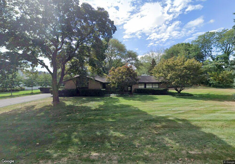
5882 Blandford Rd Bloomfield Hills, MI 48302
Estimated Value: $480,000 - $641,000
3
Beds
3
Baths
1,867
Sq Ft
$306/Sq Ft
Est. Value
About This Home
This home is located at 5882 Blandford Rd, Bloomfield Hills, MI 48302 and is currently estimated at $571,657, approximately $306 per square foot. 5882 Blandford Rd is a home located in Oakland County with nearby schools including Conant Elementary School, South Hills Middle School, and Bloomfield Hills High School.
Ownership History
Date
Name
Owned For
Owner Type
Purchase Details
Closed on
Nov 18, 2024
Sold by
Kaptur Vincent Daniel and Kaptur Lisa Kay
Bought by
Kaptur Vincent Daniel and Kaptur Vincent D
Current Estimated Value
Purchase Details
Closed on
Jul 13, 1998
Sold by
Berkowitz Diane L
Bought by
Kaptur Vincent Daniel
Home Financials for this Owner
Home Financials are based on the most recent Mortgage that was taken out on this home.
Original Mortgage
$174,000
Interest Rate
7.03%
Create a Home Valuation Report for This Property
The Home Valuation Report is an in-depth analysis detailing your home's value as well as a comparison with similar homes in the area
Home Values in the Area
Average Home Value in this Area
Purchase History
| Date | Buyer | Sale Price | Title Company |
|---|---|---|---|
| Kaptur Vincent Daniel | -- | Michigan Land Title | |
| Kaptur Vincent Daniel | -- | Michigan Land Title | |
| Kaptur Vincent Daniel | $217,500 | -- |
Source: Public Records
Mortgage History
| Date | Status | Borrower | Loan Amount |
|---|---|---|---|
| Previous Owner | Kaptur Vincent Daniel | $174,000 |
Source: Public Records
Tax History Compared to Growth
Tax History
| Year | Tax Paid | Tax Assessment Tax Assessment Total Assessment is a certain percentage of the fair market value that is determined by local assessors to be the total taxable value of land and additions on the property. | Land | Improvement |
|---|---|---|---|---|
| 2024 | $2,007 | $222,700 | $0 | $0 |
| 2023 | $1,942 | $190,580 | $0 | $0 |
| 2022 | $3,650 | $183,610 | $0 | $0 |
| 2021 | $3,624 | $170,670 | $0 | $0 |
| 2020 | $1,776 | $166,610 | $0 | $0 |
| 2019 | $3,410 | $162,950 | $0 | $0 |
| 2018 | $3,426 | $158,270 | $0 | $0 |
| 2017 | $3,401 | $154,170 | $0 | $0 |
| 2016 | $3,408 | $147,410 | $0 | $0 |
| 2015 | -- | $123,910 | $0 | $0 |
| 2014 | -- | $105,040 | $0 | $0 |
| 2011 | -- | $79,820 | $0 | $0 |
Source: Public Records
Map
Nearby Homes
- 5630 S Adams Way
- 5741 Snowshoe Cir
- 6360 Hills Dr
- 6450 Gilbert Lake Rd
- 750 Trailwood Path Unit B
- 450 Billingsgate Ct Unit C
- 1760 Trailwood Path
- 5904 Wing Lake Rd
- 5129 Woodlands Ln
- 5137 Woodlands Dr Unit 24
- 5361 Echo Rd
- 00 Telegraph Rd
- 0 Telegraph Rd
- 6660 Woodbank Dr
- 5080 Tootmoor Rd
- 6572 Spruce Dr
- 5825 Lahser Rd
- 5100 Kings Gate Way
- 3546 Bloomfield Club Dr
- 3880 Oakland Dr
- 5916 Blandford Rd
- 5780 Blandford Rd
- 5901 Blandford Rd
- 5861 Burnham Rd
- 5895 Burnham Rd
- 5861 Blandford Ct
- 5925 Burnham Rd
- 5764 Blandford Rd
- 5934 Blandford Rd
- 5971 Burnham Rd
- 5919 Blandford Rd
- 5833 Burnham Rd
- 5759 Blandford Rd
- 5839 Blandford Ct
- 5880 Burnham Rd Unit Bldg-Unit
- 5880 Burnham Rd
- 5799 Blandford New Build
- 5956 Blandford Rd
- 5748 Blandford Rd
- 5830 Snowshoe Cir Unit Bldg-Unit