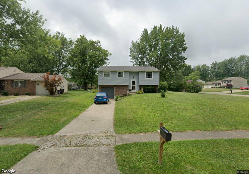
5884 Whippoorwill Hollow Dr Milford, OH 45150
Estimated Value: $248,000 - $285,000
3
Beds
1
Bath
984
Sq Ft
$273/Sq Ft
Est. Value
About This Home
This home is located at 5884 Whippoorwill Hollow Dr, Milford, OH 45150 and is currently estimated at $268,929, approximately $273 per square foot. 5884 Whippoorwill Hollow Dr is a home located in Clermont County with nearby schools including Milford Senior High School, St. Andrew - St. Elizabeth Ann Seton School, and St. Mark's Lutheran School.
Ownership History
Date
Name
Owned For
Owner Type
Purchase Details
Closed on
May 25, 1999
Sold by
Hutton Jeffrey P
Bought by
Norton William Monica
Current Estimated Value
Home Financials for this Owner
Home Financials are based on the most recent Mortgage that was taken out on this home.
Original Mortgage
$92,450
Outstanding Balance
$23,788
Interest Rate
6.99%
Mortgage Type
FHA
Estimated Equity
$245,141
Create a Home Valuation Report for This Property
The Home Valuation Report is an in-depth analysis detailing your home's value as well as a comparison with similar homes in the area
Home Values in the Area
Average Home Value in this Area
Purchase History
| Date | Buyer | Sale Price | Title Company |
|---|---|---|---|
| Norton William Monica | $92,450 | -- |
Source: Public Records
Mortgage History
| Date | Status | Borrower | Loan Amount |
|---|---|---|---|
| Open | Norton William Monica | $92,450 |
Source: Public Records
Tax History Compared to Growth
Tax History
| Year | Tax Paid | Tax Assessment Tax Assessment Total Assessment is a certain percentage of the fair market value that is determined by local assessors to be the total taxable value of land and additions on the property. | Land | Improvement |
|---|---|---|---|---|
| 2024 | $3,340 | $73,300 | $15,300 | $58,000 |
| 2023 | $3,374 | $73,300 | $15,300 | $58,000 |
| 2022 | $3,145 | $52,010 | $10,850 | $41,160 |
| 2021 | $3,148 | $52,010 | $10,850 | $41,160 |
| 2020 | $3,017 | $52,010 | $10,850 | $41,160 |
| 2019 | $2,518 | $41,200 | $10,080 | $31,120 |
| 2018 | $2,519 | $41,200 | $10,080 | $31,120 |
| 2017 | $2,479 | $41,200 | $10,080 | $31,120 |
| 2016 | $2,406 | $35,810 | $8,750 | $27,060 |
| 2015 | $2,245 | $35,810 | $8,750 | $27,060 |
| 2014 | $2,245 | $35,810 | $8,750 | $27,060 |
| 2013 | $2,084 | $32,240 | $10,500 | $21,740 |
Source: Public Records
Map
Nearby Homes
- 1382 Lela Ln
- 1468 Corbin Dr
- 1485 Foxtale Ct
- .6438 ac Buckwheat Rd
- .0288 ac Buckwheat Rd
- 6049 Delfair Ln
- 5852 Monassas Run Rd
- 6034 Delfair Ln
- 5975 Buckwheat Rd
- 5818 Mount Vernon Dr
- 5818 Jeb Stuart Dr
- 5942 Pinto Place
- 5614 Water Mills Dr
- 5811 Monassas Run Dr
- 1201 Sorrel Ln
- 5613 Water Mills Dr
- 5065 Cross Creek Ln
- 1289 Woodville Pike
- 1399 Wade Rd
- 1290 Michael Ln
- 5892 Whippoorwill Hollow Dr
- 5878 Whippoorwill Hollow Dr
- 5894 Whippoorwill Hollow Dr
- 5883 Whippoorwill Hollow Dr
- 5881 Whippoorwill Hollow Dr
- 5891 Whippoorwill Hollow Dr
- 5893 Whippoorwill Hollow Dr
- 5876 Whippoorwill Hollow Dr
- 1352 Cottonwood Dr
- 5879 Whippoorwill Hollow Dr
- 5889 Whippoorwill Hollow Dr
- 5896 Whippoorwill Hollow Dr
- 5895 Whippoorwill Hollow Dr
- 5887 Whippoorwill Hollow Dr
- 1354 Cottonwood Dr
- 5877 Whippoorwill Hollow Dr
- 5897 Whippoorwill Hollow Dr
- 5898 Whippoorwill Hollow Dr
- 5875 Whippoorwill Hollow Dr
- 1356 Cottonwood Dr