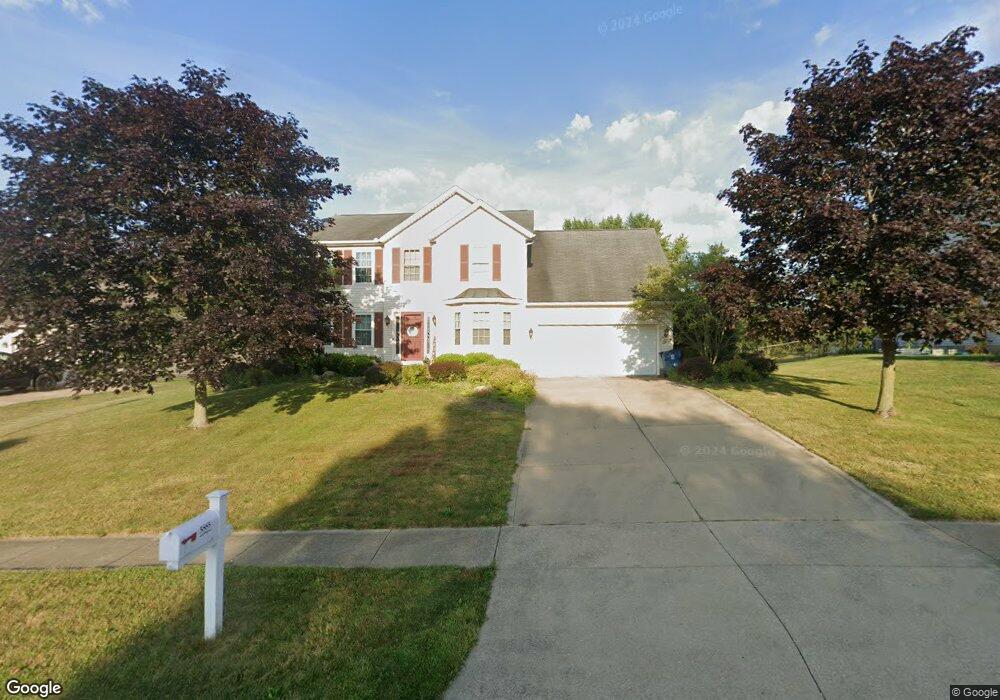
5885 Sky Ridge Ave NE Louisville, OH 44641
Estimated Value: $302,450 - $368,000
4
Beds
3
Baths
2,106
Sq Ft
$160/Sq Ft
Est. Value
About This Home
This home is located at 5885 Sky Ridge Ave NE, Louisville, OH 44641 and is currently estimated at $336,863, approximately $159 per square foot. 5885 Sky Ridge Ave NE is a home located in Stark County with nearby schools including Louisville High School, East Branch Preparatory Academy Wright Preparatory Academy, and St. Thomas Aquinas High School & Middle School.
Ownership History
Date
Name
Owned For
Owner Type
Purchase Details
Closed on
Jan 8, 2003
Sold by
Lee Michael R and Lee Susan B
Bought by
Mckimmie Jason M and Mccabe Mckimmie Kellie A
Current Estimated Value
Home Financials for this Owner
Home Financials are based on the most recent Mortgage that was taken out on this home.
Original Mortgage
$140,000
Outstanding Balance
$60,639
Interest Rate
6.23%
Mortgage Type
Purchase Money Mortgage
Estimated Equity
$276,224
Purchase Details
Closed on
Jul 30, 2002
Sold by
Munson Land Corp
Bought by
Lee Michael R
Create a Home Valuation Report for This Property
The Home Valuation Report is an in-depth analysis detailing your home's value as well as a comparison with similar homes in the area
Home Values in the Area
Average Home Value in this Area
Purchase History
| Date | Buyer | Sale Price | Title Company |
|---|---|---|---|
| Mckimmie Jason M | $175,000 | -- | |
| Lee Michael R | $26,900 | -- |
Source: Public Records
Mortgage History
| Date | Status | Borrower | Loan Amount |
|---|---|---|---|
| Open | Mckimmie Jason M | $140,000 |
Source: Public Records
Tax History Compared to Growth
Tax History
| Year | Tax Paid | Tax Assessment Tax Assessment Total Assessment is a certain percentage of the fair market value that is determined by local assessors to be the total taxable value of land and additions on the property. | Land | Improvement |
|---|---|---|---|---|
| 2025 | -- | $87,330 | $19,780 | $67,550 |
| 2024 | -- | $87,330 | $19,780 | $67,550 |
| 2023 | $3,222 | $64,650 | $12,500 | $52,150 |
| 2022 | $3,212 | $64,650 | $12,500 | $52,150 |
| 2021 | $3,217 | $64,650 | $12,500 | $52,150 |
| 2020 | $2,824 | $59,890 | $11,240 | $48,650 |
| 2019 | $2,836 | $59,890 | $11,240 | $48,650 |
| 2018 | $2,826 | $59,890 | $11,240 | $48,650 |
| 2017 | $2,726 | $55,130 | $10,680 | $44,450 |
| 2016 | $2,705 | $55,930 | $9,660 | $46,270 |
| 2015 | $2,730 | $55,930 | $9,660 | $46,270 |
| 2014 | $769 | $52,510 | $9,070 | $43,440 |
| 2013 | $1,387 | $52,510 | $9,070 | $43,440 |
Source: Public Records
Map
Nearby Homes
- 6030 Holderman Ave
- 5623 Shallow Creek Ave
- 5109 Columbus Rd NE
- 0 Pilot Knob Ave NE
- 3951 Glenoak Dr NE
- 5208 Oakridge Dr
- 6150 Pilot View Cir
- 6210 Columbus Rd NE
- 5700 Glena St
- 1561 Noel St
- 6079 Eastlawn St NE
- Goldenrod Plan at Orchard Park - Aspire Single Family Collection
- Forsythia Plan at Orchard Park - Aspire Single Family Collection
- Oleander Plan at Orchard Park - Aspire Single Family Collection
- Water Lily Plan at Orchard Park - Aspire Single Family Collection
- Beckfield Plan at Orchard Park - Aspire Townhome Collection
- 424 Honeycrisp Dr NE
- 420 Honeycrisp Dr NE
- 2974 Mcintosh Dr NE
- 2969 Mcintosh Dr NE
- 5869 Sky Ridge Ave NE
- 5913 Sky Ridge Ave NE
- 65 Sky Ridge Ave NE
- 31 Sky Ridge Ave NE
- 31 Lot Sky Ridge Ave NE
- 65 Lot Sky Ridge Ave NE
- 5852 Sky Ridge NE
- 5931 Sky Ridge Ave NE
- 5857 Sky Ridge Ave NE
- 5910 Sky Ridge Ave NE
- 5870 Sky Ridge Ave NE
- 5923 Willa Cir
- 5930 Sky Ridge Ave NE
- 5852 Sky Ridge Ave NE
- 31 Sky Ridge Cir
- 5856 Sky Ridge Ave NE
- 5957 Sky Ridge Ave NE
- 5411 Columbus Rd
- 5929 Star Park Cir NE
- 5971 Holderman Ave