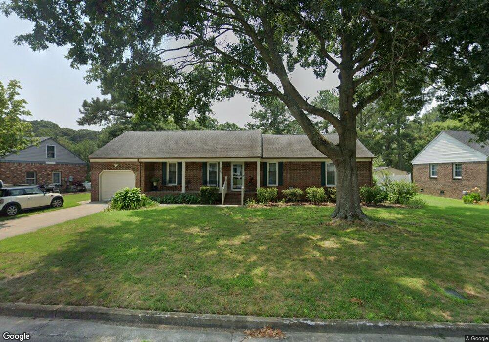
5889 Woodside Ln Portsmouth, VA 23703
Churchland NeighborhoodEstimated Value: $354,000 - $374,000
4
Beds
2
Baths
1,522
Sq Ft
$238/Sq Ft
Est. Value
About This Home
This home is located at 5889 Woodside Ln, Portsmouth, VA 23703 and is currently estimated at $362,459, approximately $238 per square foot. 5889 Woodside Ln is a home located in Portsmouth City with nearby schools including Churchland Primary/Intermediate School, Churchland Middle School, and Churchland High School.
Ownership History
Date
Name
Owned For
Owner Type
Purchase Details
Closed on
May 31, 2022
Sold by
Loretta Pridgen Frances
Bought by
Mackiernan Douglas D and Mackiernan Cynthia P
Current Estimated Value
Purchase Details
Closed on
Nov 10, 2009
Sold by
Sec Of Veterans Affairs
Bought by
Pridgen Frances
Home Financials for this Owner
Home Financials are based on the most recent Mortgage that was taken out on this home.
Original Mortgage
$112,000
Interest Rate
5.02%
Mortgage Type
New Conventional
Purchase Details
Closed on
Jun 23, 2009
Sold by
Johnie R Muncy Sub Tr
Bought by
Sec Of Veterans Affairs
Purchase Details
Closed on
Jun 1, 2004
Sold by
Ransom Patrick
Bought by
Kidd Michael
Home Financials for this Owner
Home Financials are based on the most recent Mortgage that was taken out on this home.
Original Mortgage
$152,250
Interest Rate
5.99%
Mortgage Type
VA
Create a Home Valuation Report for This Property
The Home Valuation Report is an in-depth analysis detailing your home's value as well as a comparison with similar homes in the area
Home Values in the Area
Average Home Value in this Area
Purchase History
| Date | Buyer | Sale Price | Title Company |
|---|---|---|---|
| Mackiernan Douglas D | $315,000 | Jdm Title | |
| Pridgen Frances | $172,000 | -- | |
| Sec Of Veterans Affairs | $149,887 | -- | |
| Kidd Michael | $149,000 | -- |
Source: Public Records
Mortgage History
| Date | Status | Borrower | Loan Amount |
|---|---|---|---|
| Previous Owner | Pridgen Frances | $112,000 | |
| Previous Owner | Kidd Michael | $152,250 |
Source: Public Records
Tax History Compared to Growth
Tax History
| Year | Tax Paid | Tax Assessment Tax Assessment Total Assessment is a certain percentage of the fair market value that is determined by local assessors to be the total taxable value of land and additions on the property. | Land | Improvement |
|---|---|---|---|---|
| 2025 | $4,208 | $333,060 | $115,580 | $217,480 |
| 2024 | $4,208 | $328,190 | $115,580 | $212,610 |
| 2023 | $3,798 | $303,850 | $115,580 | $188,270 |
| 2022 | $3,470 | $266,920 | $90,450 | $176,470 |
| 2021 | $3,083 | $237,150 | $60,680 | $176,470 |
| 2020 | $3,045 | $234,260 | $57,790 | $176,470 |
| 2019 | $2,936 | $225,850 | $57,790 | $168,060 |
| 2018 | $2,936 | $225,850 | $57,790 | $168,060 |
| 2017 | $2,936 | $225,850 | $57,790 | $168,060 |
| 2016 | $2,936 | $225,850 | $57,790 | $168,060 |
| 2015 | $2,827 | $217,450 | $57,790 | $159,660 |
| 2014 | $2,762 | $217,450 | $57,790 | $159,660 |
Source: Public Records
Map
Nearby Homes
- 21 Windy Pines Crescent
- 4444 Southampton Arch
- 4619 River Shore Rd
- 5833 Hawthorne Ln
- 4726 River Shore Rd
- 5728 Hawthorne Ln
- 4224 Burnham Dr
- 8 Compass Ct
- 4232 Summerset Dr
- 4200 Quince Rd
- 5693 Rivermill Cir
- 4071 Long Point Blvd
- 17 Shoal Ct
- 6750 Burbage Landing Cir
- 5606 Gregory Ct
- 4100 Mayfair Way
- 6602 James Point Ct
- 4028 Swannanoa Dr
- 5807 Dunkin St
- 5028 Bay Cir
- 5885 Woodside Ln
- 5891 Woodside Ln
- 5851 Woodside Ln
- 4410 Echo Ct
- 4408 Echo Ct
- 5886 Woodside Cir
- 4501 Twin Pines Rd
- 4406 Echo Ct
- 5849 Woodside Ln
- 5850 Woodside Ln
- 5882 Woodside Cir
- 4503 Twin Pines Rd
- 4404 Echo Ct
- 5854 Woodside Cir
- 5878 Woodside Cir
- 5847 Woodside Ln
- 5846 Woodside Ln
- 4402 Echo Ct
- 9 Windy Pines Crescent
- 4505 Twin Pines Rd