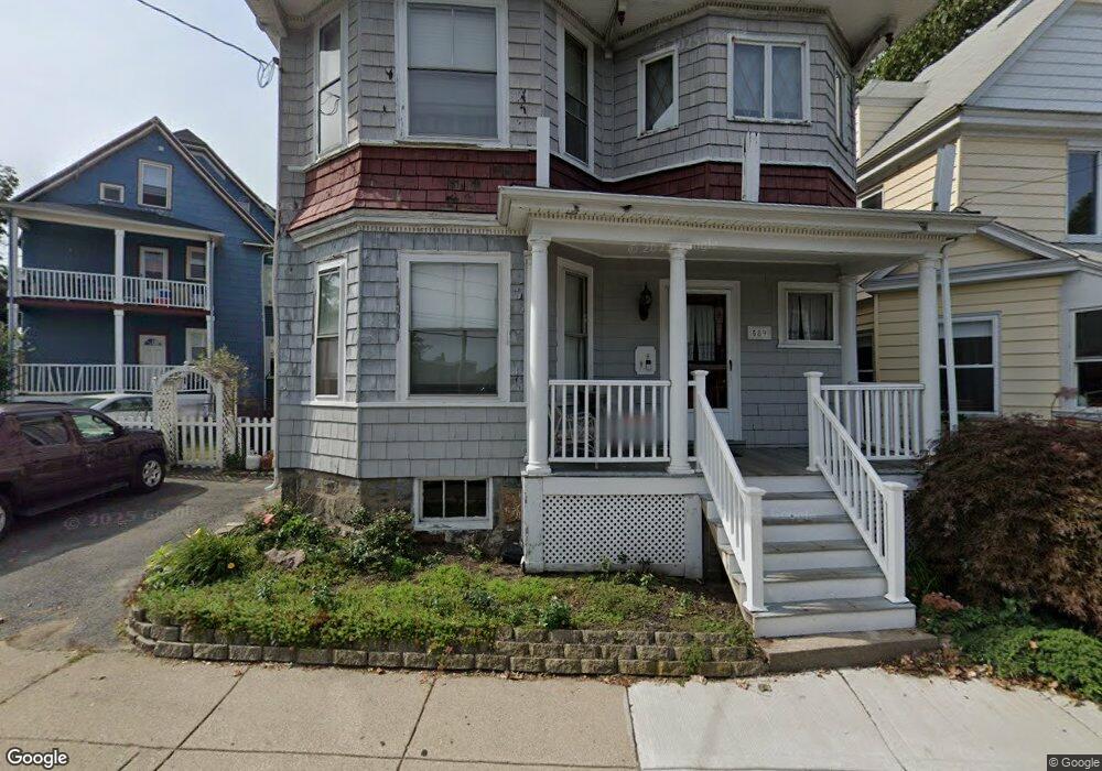
589 Freeport St Dorchester, MA 02122
Neponset-Port Norfolk NeighborhoodEstimated Value: $867,000 - $1,099,000
5
Beds
3
Baths
3,551
Sq Ft
$288/Sq Ft
Est. Value
About This Home
This home is located at 589 Freeport St, Dorchester, MA 02122 and is currently estimated at $1,022,650, approximately $287 per square foot. 589 Freeport St is a home located in Suffolk County with nearby schools including Neighborhood House Charter School and Helen Y. Davis Leadership Academy Charter Public School.
Ownership History
Date
Name
Owned For
Owner Type
Purchase Details
Closed on
Oct 27, 1995
Sold by
Mahoney Charles F
Bought by
Lupo Francis
Current Estimated Value
Create a Home Valuation Report for This Property
The Home Valuation Report is an in-depth analysis detailing your home's value as well as a comparison with similar homes in the area
Home Values in the Area
Average Home Value in this Area
Purchase History
| Date | Buyer | Sale Price | Title Company |
|---|---|---|---|
| Lupo Francis | $125,000 | -- |
Source: Public Records
Mortgage History
| Date | Status | Borrower | Loan Amount |
|---|---|---|---|
| Open | Lupo Francis | $255,000 | |
| Closed | Lupo Francis | $180,000 | |
| Closed | Lupo Francis | $30,000 | |
| Closed | Lupo Francis | $120,000 |
Source: Public Records
Tax History Compared to Growth
Tax History
| Year | Tax Paid | Tax Assessment Tax Assessment Total Assessment is a certain percentage of the fair market value that is determined by local assessors to be the total taxable value of land and additions on the property. | Land | Improvement |
|---|---|---|---|---|
| 2025 | $10,435 | $901,100 | $198,600 | $702,500 |
| 2024 | $10,141 | $930,400 | $214,200 | $716,200 |
| 2023 | $9,343 | $869,900 | $200,300 | $669,600 |
| 2022 | $9,101 | $836,500 | $192,600 | $643,900 |
| 2021 | $8,500 | $796,600 | $183,400 | $613,200 |
| 2020 | $7,489 | $709,200 | $159,300 | $549,900 |
| 2019 | $6,922 | $656,700 | $121,700 | $535,000 |
| 2018 | $6,746 | $643,700 | $121,700 | $522,000 |
| 2017 | $6,196 | $585,100 | $121,700 | $463,400 |
| 2016 | $5,960 | $541,800 | $121,700 | $420,100 |
| 2015 | $5,205 | $429,800 | $116,200 | $313,600 |
| 2014 | $4,819 | $383,100 | $116,200 | $266,900 |
Source: Public Records
Map
Nearby Homes
- 223 Neponset Ave Unit 2
- 36 Mckone St Unit 2
- 36 Mckone St
- 36 Mckone St Unit 1
- 217 Neponset Ave Unit 33
- 8 Mckone St
- 51 Coffey St Unit 51C
- 3 N Munroe Terrace
- 4 Payne St Unit 5
- 60 Houghton St Unit 62
- 43 Chickatawbut St
- 45 Chickatawbut St Unit 1
- 22 Chickatawbut St Unit 2
- 378 Neponset Ave
- 34 Houghton St
- 108 King St Unit 3
- 104 King St Unit 2
- 96 King St Unit 1
- 6 Agawam St
- 400-412 Neponset Ave
- 587 Freeport St
- 244 Neponset Ave
- 244 Neponset Ave Unit 1
- 248 Neponset Ave Unit 250
- 248 Neponset Ave Unit 2
- 250 Neponset Ave
- 250 Neponset Ave
- 585 Freeport St
- 242 Neponset Ave
- 604 Freeport St Unit 1
- 604-606 Freeport St Unit 6
- 604 Freeport St Unit 606
- 604 Freeport St Unit 606
- 604 Freeport St Unit 606
- 604 Freeport St Unit 606
- 604 Freeport St Unit 606
- 604 Freeport St Unit 606
- 604 Freeport St Unit PH
- 604 Freeport St Unit 2
- 604 Freeport St Unit 6