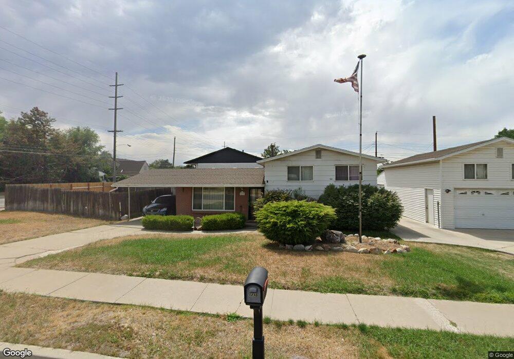
5890 Sanford Dr Salt Lake City, UT 84123
Estimated Value: $447,000 - $537,000
3
Beds
1
Bath
970
Sq Ft
$496/Sq Ft
Est. Value
About This Home
This home is located at 5890 Sanford Dr, Salt Lake City, UT 84123 and is currently estimated at $480,688, approximately $495 per square foot. 5890 Sanford Dr is a home located in Salt Lake County with nearby schools including Viewmont Elementary School, Riverview Junior High School, and Murray High School.
Ownership History
Date
Name
Owned For
Owner Type
Purchase Details
Closed on
Mar 9, 2009
Sold by
Orton Debra L
Bought by
D & O Mark Llc
Current Estimated Value
Purchase Details
Closed on
Dec 16, 1997
Sold by
Ortin Douglas L and Ortin Debra L
Bought by
Orton Debra L
Purchase Details
Closed on
Oct 3, 1994
Sold by
Moschetti Dawn
Bought by
Orton Douglas L and Orton Debra L
Home Financials for this Owner
Home Financials are based on the most recent Mortgage that was taken out on this home.
Original Mortgage
$54,900
Interest Rate
8.5%
Create a Home Valuation Report for This Property
The Home Valuation Report is an in-depth analysis detailing your home's value as well as a comparison with similar homes in the area
Home Values in the Area
Average Home Value in this Area
Purchase History
| Date | Buyer | Sale Price | Title Company |
|---|---|---|---|
| D & O Mark Llc | -- | None Available | |
| Orton Debra L | -- | -- | |
| Orton Douglas L | -- | -- |
Source: Public Records
Mortgage History
| Date | Status | Borrower | Loan Amount |
|---|---|---|---|
| Previous Owner | Orton Douglas L | $54,900 |
Source: Public Records
Tax History Compared to Growth
Tax History
| Year | Tax Paid | Tax Assessment Tax Assessment Total Assessment is a certain percentage of the fair market value that is determined by local assessors to be the total taxable value of land and additions on the property. | Land | Improvement |
|---|---|---|---|---|
| 2025 | $2,012 | $467,800 | $100,900 | $366,900 |
| 2024 | $2,012 | $446,300 | $97,300 | $349,000 |
| 2023 | $1,877 | $398,800 | $91,000 | $307,800 |
| 2022 | $2,005 | $405,000 | $89,200 | $315,800 |
| 2021 | $1,769 | $315,100 | $66,900 | $248,200 |
| 2020 | $1,608 | $271,000 | $66,900 | $204,100 |
| 2019 | $1,624 | $264,500 | $66,900 | $197,600 |
| 2018 | $1,458 | $242,300 | $65,100 | $177,200 |
| 2017 | $1,336 | $223,800 | $65,100 | $158,700 |
| 2016 | $1,222 | $197,700 | $68,500 | $129,200 |
| 2015 | $1,511 | $222,000 | $66,800 | $155,200 |
| 2014 | $1,437 | $209,300 | $63,700 | $145,600 |
Source: Public Records
Map
Nearby Homes
- 5937 S Sanford Dr
- 523 W Loyal Dr
- 5964 S 610 W
- 5730 S 590 W
- 5689 S Spacerama Dr
- 6080 S 700 W
- 649 Bulldog Cir
- 5981 S Sultan Cir
- 5909 S Sultan Cir
- 5730 S 180 W
- 6172 S Clear St
- 5513 S 670 W
- 267 Noah Cir
- 910 W Brandermill Cove
- 5888 S Sagewood Dr
- 56 W 6025 S
- 1056 W Turnberry Cove
- 5564 S Yellow Fin Way
- 5889 S Kingston Way
- 5860 Kingston Way
- 548 W 5900 S
- 5878 Sanford Dr
- 5893 Sanford Dr
- 5893 S Sanford Dr
- 5885 Sanford Dr
- 5870 Sanford Dr
- 580 W 5900 S
- 5910 Sanford Dr
- 5910 S Sanford Dr
- 704 W Signal Hill Dr
- 772 W Marconi Way
- 756 W Marconi Way
- 5427 S Wilco Way
- 762 W Marconi Way
- 768 W Marconi Way Unit 2382458-68184
- 5873 Sanford Dr
- 5873 S Sanford Dr
- 5909 Sanford Dr
- 5909 S Sanford Dr
- 5879 S 590 W