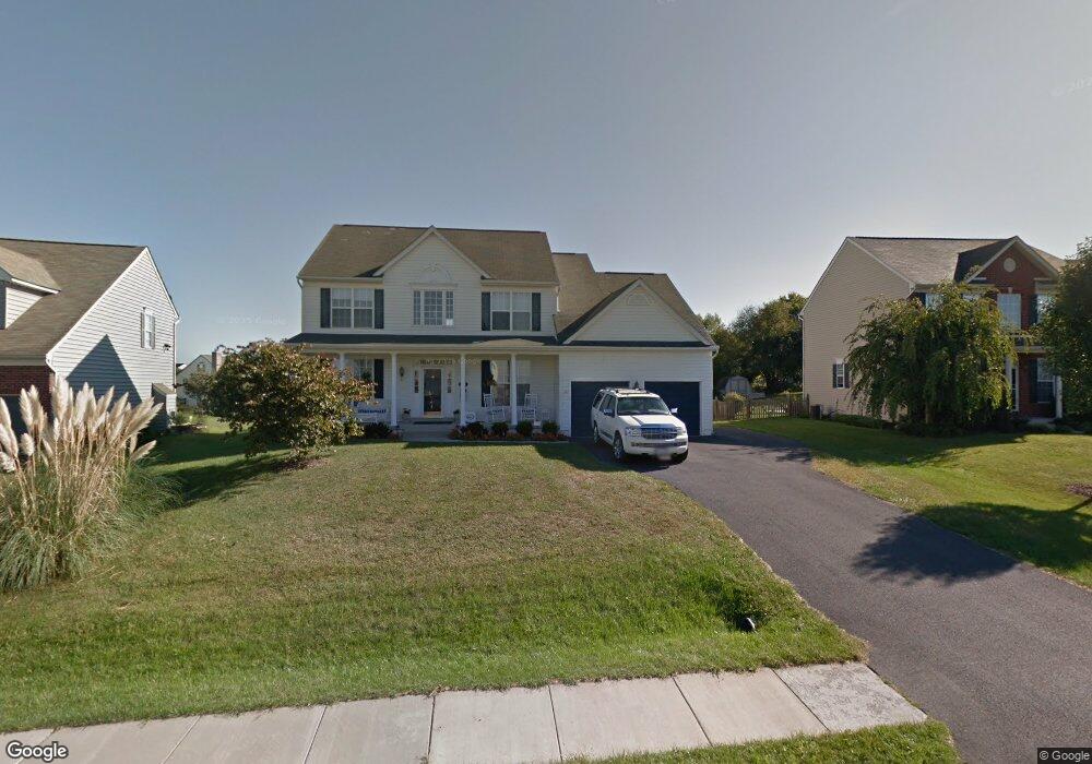
5892 Union Ridge Dr Adamstown, MD 21710
Estimated Value: $691,892 - $714,000
--
Bed
4
Baths
2,694
Sq Ft
$263/Sq Ft
Est. Value
About This Home
This home is located at 5892 Union Ridge Dr, Adamstown, MD 21710 and is currently estimated at $708,223, approximately $262 per square foot. 5892 Union Ridge Dr is a home located in Frederick County with nearby schools including Carroll Manor Elementary School, Ballenger Creek Middle School, and Tuscarora High School.
Ownership History
Date
Name
Owned For
Owner Type
Purchase Details
Closed on
Jul 19, 2004
Sold by
Ausherman Homes Inc
Bought by
Bennett David M and Bennett Christy H
Current Estimated Value
Purchase Details
Closed on
Jul 15, 2004
Sold by
Ausherman Homes Inc
Bought by
Bennett David M and Bennett Christy H
Purchase Details
Closed on
Feb 17, 2004
Sold by
Ausherman Hilda L
Bought by
Ausherman Homes Inc
Create a Home Valuation Report for This Property
The Home Valuation Report is an in-depth analysis detailing your home's value as well as a comparison with similar homes in the area
Home Values in the Area
Average Home Value in this Area
Purchase History
| Date | Buyer | Sale Price | Title Company |
|---|---|---|---|
| Bennett David M | $449,170 | -- | |
| Bennett David M | $449,170 | -- | |
| Ausherman Homes Inc | $262,925 | -- |
Source: Public Records
Mortgage History
| Date | Status | Borrower | Loan Amount |
|---|---|---|---|
| Closed | Bennett David M | -- |
Source: Public Records
Tax History Compared to Growth
Tax History
| Year | Tax Paid | Tax Assessment Tax Assessment Total Assessment is a certain percentage of the fair market value that is determined by local assessors to be the total taxable value of land and additions on the property. | Land | Improvement |
|---|---|---|---|---|
| 2025 | $6,371 | $559,667 | -- | -- |
| 2024 | $6,371 | $518,900 | $115,700 | $403,200 |
| 2023 | $5,909 | $501,200 | $0 | $0 |
| 2022 | $5,703 | $483,500 | $0 | $0 |
| 2021 | $5,395 | $465,800 | $115,700 | $350,100 |
| 2020 | $5,395 | $456,933 | $0 | $0 |
| 2019 | $5,292 | $448,067 | $0 | $0 |
| 2018 | $5,235 | $439,200 | $115,700 | $323,500 |
| 2017 | $4,947 | $439,200 | $0 | $0 |
| 2016 | $4,781 | $397,467 | $0 | $0 |
| 2015 | $4,781 | $376,600 | $0 | $0 |
| 2014 | $4,781 | $376,600 | $0 | $0 |
Source: Public Records
Map
Nearby Homes
- 5880 Union Ridge Dr
- 5798 Morland Dr N
- 5523 Modly Ct
- 2735 Tuscarora St
- 2731 Tuscarora St
- 2730 Tuscarora St
- 2734 Tuscarora St
- Macon II Plan at The Enclave at Carrollton Manor
- Adamstown Plan at The Enclave at Carrollton Manor
- Fayetteville Plan at The Enclave at Carrollton Manor
- Oban Plan at The Enclave at Carrollton Manor
- 000 Modly Ct
- 00 Modly Ct
- 00000 Modly Ct
- 0000 Modly Ct
- 2727 Bill Dorsey Blvd
- 2422 Doubs Ct
- 2730 John Mills Rd
- 3039 Ballenger Creek Pike
- 6230 Manor Woods Rd
- 5890 Union Ridge Dr
- 5894 Union Ridge Dr
- 2828 Haddington Ct
- 5888 Union Ridge Dr
- 5896 Union Ridge Dr
- 5891 Union Ridge Dr
- 2826 Haddington Ct
- 5768 Morland Dr N
- 5889 Union Ridge Dr
- 5886 Union Ridge Dr
- 5766 Morland Dr N
- 5893 Union Ridge Dr
- 5898 Union Ridge Dr
- 5770 Morland Dr N
- 2827 Haddington Ct
- 5884 Union Ridge Dr
- 5895 Union Ridge Dr
- 2702 Longfield Place
- 5772 Morland Dr N
- 2825 Haddington Ct