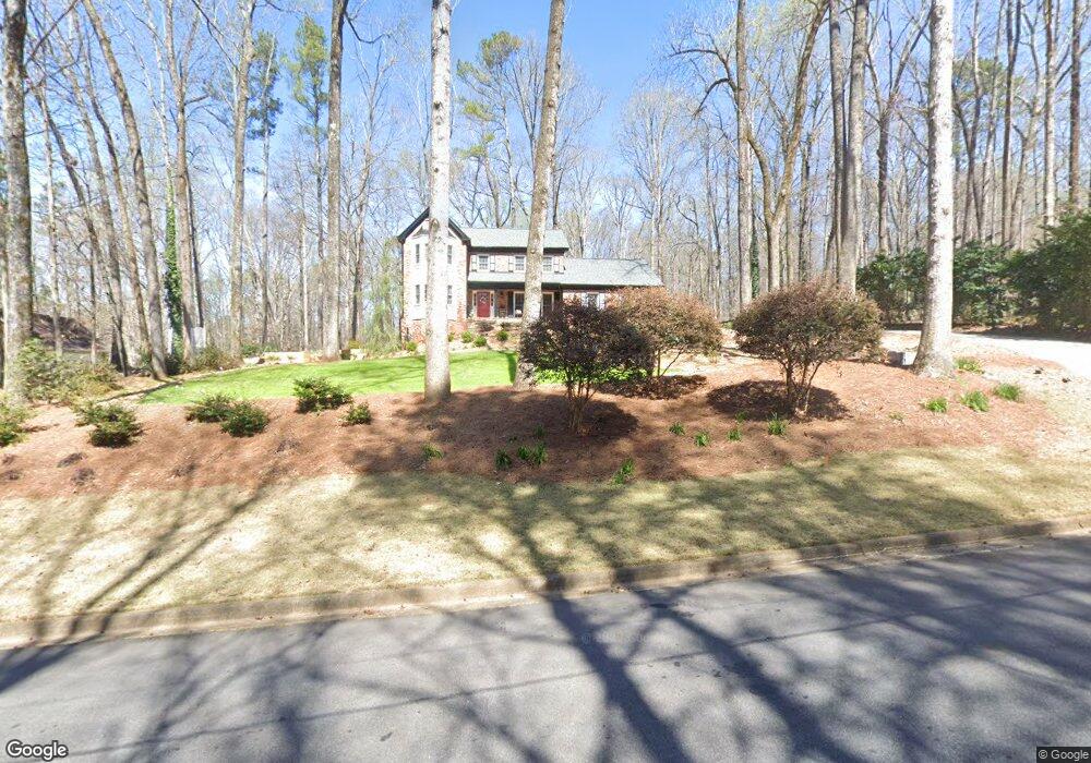
5895 Hammersmith Rd Unit 4 Stone Mountain, GA 30087
Smoke Rise NeighborhoodEstimated Value: $481,996 - $610,000
4
Beds
3
Baths
2,554
Sq Ft
$213/Sq Ft
Est. Value
About This Home
This home is located at 5895 Hammersmith Rd Unit 4, Stone Mountain, GA 30087 and is currently estimated at $545,249, approximately $213 per square foot. 5895 Hammersmith Rd Unit 4 is a home located in Gwinnett County with nearby schools including Camp Creek Elementary School, Trickum Middle School, and Parkview High School.
Ownership History
Date
Name
Owned For
Owner Type
Purchase Details
Closed on
Jul 22, 2020
Sold by
Nelson Peggy Pardee
Bought by
Pardee Peggy Rene and Peggy Rene Pardee Liv Tr
Current Estimated Value
Purchase Details
Closed on
Jan 6, 2012
Sold by
Nelson Mark Stuart
Bought by
Nelson Peggy Pardee
Purchase Details
Closed on
Aug 26, 1996
Sold by
Noles Billy R Gayle L
Bought by
Nelson Mark S Peggy
Create a Home Valuation Report for This Property
The Home Valuation Report is an in-depth analysis detailing your home's value as well as a comparison with similar homes in the area
Home Values in the Area
Average Home Value in this Area
Purchase History
| Date | Buyer | Sale Price | Title Company |
|---|---|---|---|
| Pardee Peggy Rene | -- | -- | |
| Nelson Peggy Pardee | -- | -- | |
| Nelson Mark S Peggy | $203,000 | -- |
Source: Public Records
Mortgage History
| Date | Status | Borrower | Loan Amount |
|---|---|---|---|
| Closed | Nelson Mark S Peggy | $0 |
Source: Public Records
Tax History
| Year | Tax Paid | Tax Assessment Tax Assessment Total Assessment is a certain percentage of the fair market value that is determined by local assessors to be the total taxable value of land and additions on the property. | Land | Improvement |
|---|---|---|---|---|
| 2025 | $4,964 | $173,800 | $38,000 | $135,800 |
| 2024 | $5,786 | $207,680 | $38,000 | $169,680 |
| 2023 | $5,786 | $180,440 | $41,680 | $138,760 |
| 2022 | $4,634 | $153,680 | $37,680 | $116,000 |
| 2021 | $4,168 | $128,200 | $31,280 | $96,920 |
| 2020 | $4,198 | $128,200 | $31,280 | $96,920 |
| 2019 | $3,881 | $118,840 | $31,280 | $87,560 |
| 2018 | $3,557 | $103,680 | $25,680 | $78,000 |
| 2016 | $3,384 | $94,720 | $20,480 | $74,240 |
| 2015 | $3,413 | $94,720 | $20,480 | $74,240 |
| 2014 | $3,430 | $94,720 | $20,480 | $74,240 |
Source: Public Records
Map
Nearby Homes
- 292 Old Rosser Rd
- 353 Old Rosser Rd
- 5416 Pheasant Run
- 2393 Flintlock Dr Unit 19
- 29 Lankford Rd
- 5825 Golden West Trail SW
- 127 Old Rosser Rd SW
- 5776 Princeton Run Trail
- 2360 Ivey Oaks Place
- 5806 Princeton Run Trail
- 5505 Princeton Run Trail
- 507 Castleaire Dr Unit 1
- 87 Thorncrest Ct
- 5798 Lost Grove Dr NW
- 164 Thorncrest Ct
- 5788 Lost Grove Dr NW
- 5013 Oakwood Dr
- 5005 Oakwood Dr
- 5019 Oakwood Dr
- 5011 Oakwood Dr
- 5905 Hammersmith Rd
- 5885 Hammersmith Rd
- 5875 Hammersmith Rd
- 5915 Hammersmith Rd Unit 4
- 41 Parkstone Ct Unit 4
- 41 Parkstone Ct
- 51 Parkstone Ct Unit 5
- 51 Parkstone Ct
- 31 Parkstone Ct
- 5904 Hammersmith Rd Unit 4
- 5894 Hammersmith Rd
- 289 Barnsley Dr Unit 8
- 289 Barnsley Dr
- 5865 Hammersmith Rd
- 61 Parkstone Ct
- 5925 Hammersmith Rd
- 5914 Hammersmith Rd
- 21 Parkstone Ct Unit 2
- 5864 Hammersmith Rd
- 299 Barnsley Dr
Your Personal Tour Guide
Ask me questions while you tour the home.