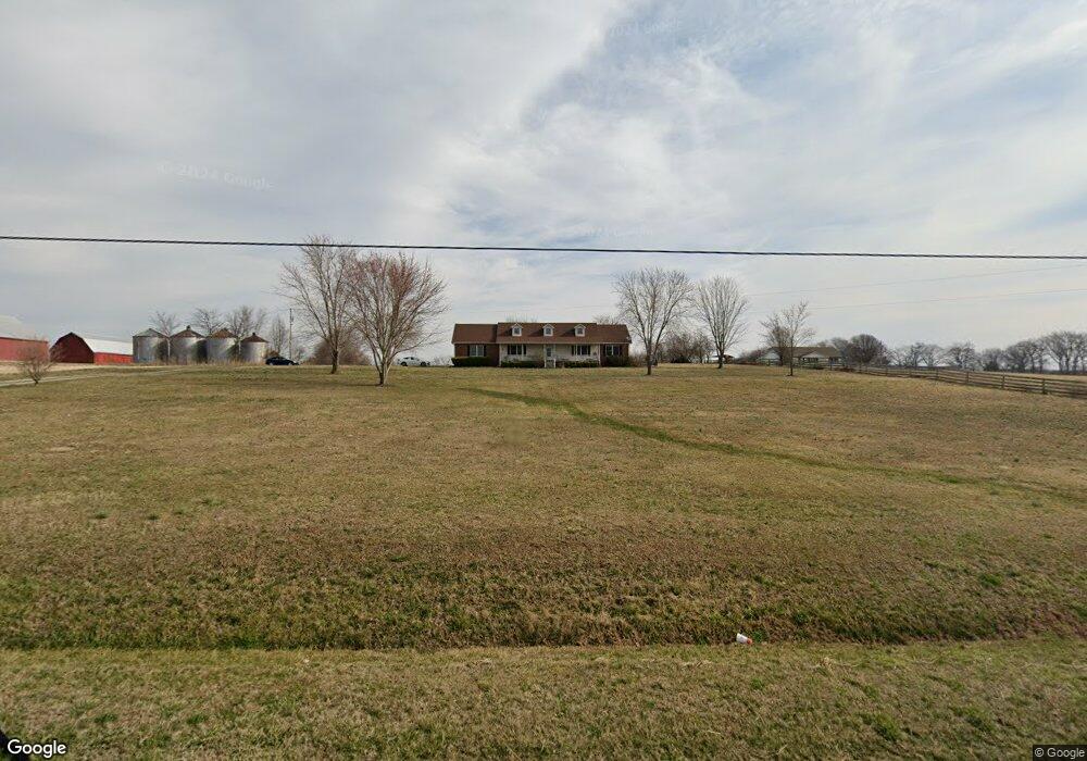
5899 Highway 161 Springfield, TN 37172
Estimated Value: $396,698 - $485,000
About This Home
This home is located at 5899 Highway 161, Springfield, TN 37172 and is currently estimated at $441,925, approximately $248 per square foot. 5899 Highway 161 is a home located in Robertson County with nearby schools including Jo Byrns Elementary School and Jo Byrns High School.
Ownership History
We collect this data history from publicly available records. To have your information removed, we recommend requesting removal directly through your county’s website.
Purchase Details
Home Financials for this Owner
Home Financials are based on the most recent Mortgage that was taken out on this home.Purchase Details
Home Financials for this Owner
Home Financials are based on the most recent Mortgage that was taken out on this home.Purchase Details
Home Values in the Area
Average Home Value in this Area
Purchase History
We collect this data history from publicly available records. To have your information removed, we recommend requesting removal directly through your county’s website.
| Date | Buyer | Sale Price | Title Company |
|---|---|---|---|
| -- | -- | ||
| $157,000 | -- | ||
| $26,000 | -- |
Mortgage History
We collect this data history from publicly available records. To have your information removed, we recommend requesting removal directly through your county’s website.
| Date | Status | Borrower | Loan Amount |
|---|---|---|---|
| Previous Owner | $158,488 | ||
| Previous Owner | $161,310 |
Tax History
We collect this data history from publicly available records. To have your information removed, we recommend requesting removal directly through your county’s website.
| Year | Tax Paid | Tax Assessment Tax Assessment Total Assessment is a certain percentage of the fair market value that is determined by local assessors to be the total taxable value of land and additions on the property. | Land | Improvement |
|---|---|---|---|---|
| 2025 | $1,824 | $101,350 | $30,950 | $70,400 |
| 2024 | $1,824 | $101,350 | $30,950 | $70,400 |
| 2023 | $1,824 | $101,350 | $30,950 | $70,400 |
| 2022 | $1,511 | $58,650 | $8,450 | $50,200 |
| 2021 | $1,511 | $58,650 | $8,450 | $50,200 |
| 2020 | $1,511 | $58,650 | $8,450 | $50,200 |
| 2019 | $1,511 | $58,650 | $8,450 | $50,200 |
| 2018 | $1,511 | $58,650 | $8,450 | $50,200 |
| 2017 | $1,392 | $45,125 | $8,750 | $36,375 |
| 2016 | $1,392 | $45,125 | $8,750 | $36,375 |
| 2015 | $1,336 | $45,125 | $8,750 | $36,375 |
| 2014 | $1,336 | $45,125 | $8,750 | $36,375 |
Map
- 5535 Highway 161
- 5306 Minnis Rd Unit 1
- 5306 Minnis Rd Unit 3
- 5306 Minnis Rd Unit 2
- 2 Minnis Rd Unit 2
- 0 Wayman Dunn Rd
- 5963 Wayman Dunn Rd
- 5 Highway161
- 11 Highway161
- 4 Highway161
- 8 Highway161
- 2908 Gunn Rd
- 5254 Highway 161
- 6471 Highway 161
- 3 Valley Rd Unit 3
- 5960 Valley Rd Unit 2
- 4927 Minnis Rd
- 6180 Crawford Store Rd
- 4919 Pulliam Hardaway Rd
- 0 Smiths Grove Church Rd
Ask me questions while you tour the home.