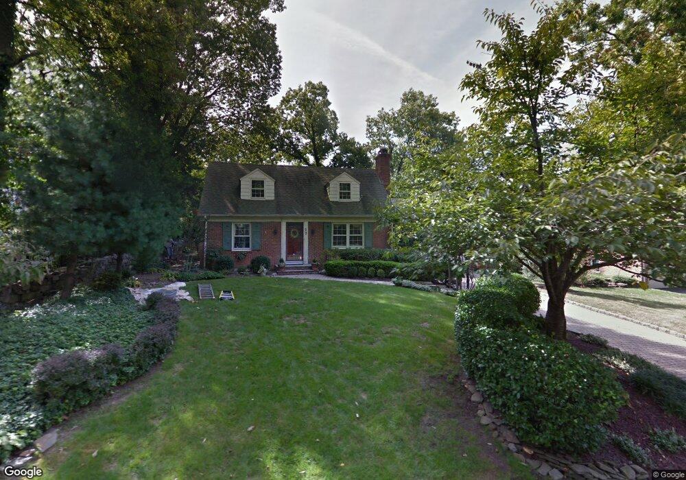
59 Beverly Rd Summit, NJ 07901
Estimated Value: $1,004,000 - $1,618,000
3
Beds
3
Baths
2,141
Sq Ft
$641/Sq Ft
Est. Value
About This Home
This home is located at 59 Beverly Rd, Summit, NJ 07901 and is currently estimated at $1,372,565, approximately $641 per square foot. 59 Beverly Rd is a home located in Union County with nearby schools including L C Johnson Summit Middle School, Summit Sr High School, and Kent Place School.
Ownership History
Date
Name
Owned For
Owner Type
Purchase Details
Closed on
Jul 11, 2023
Sold by
Mcgovern Glenda
Bought by
Lindquist Ryan and Lindquist Kathryn
Current Estimated Value
Home Financials for this Owner
Home Financials are based on the most recent Mortgage that was taken out on this home.
Original Mortgage
$849,999
Outstanding Balance
$827,112
Interest Rate
6.13%
Mortgage Type
New Conventional
Estimated Equity
$545,453
Purchase Details
Closed on
Jul 20, 2020
Sold by
Mcgovern Glenda
Bought by
Mcgovern Edward and Mcgovern Glenda
Purchase Details
Closed on
Feb 19, 2002
Sold by
Mcgovern Edward
Bought by
Mcgovern Glenda
Purchase Details
Closed on
Dec 18, 1999
Sold by
Maxim Ronald E and Maxim Karin A
Bought by
Mcgovern Edward and Mcgovern Glenda
Home Financials for this Owner
Home Financials are based on the most recent Mortgage that was taken out on this home.
Original Mortgage
$252,700
Interest Rate
7.83%
Purchase Details
Closed on
Dec 1, 1997
Sold by
Smith James Ohara and Smith Gwili Ann
Bought by
Maxim Ronald E and Maxim Karin A
Home Financials for this Owner
Home Financials are based on the most recent Mortgage that was taken out on this home.
Original Mortgage
$357,600
Interest Rate
6.5%
Create a Home Valuation Report for This Property
The Home Valuation Report is an in-depth analysis detailing your home's value as well as a comparison with similar homes in the area
Home Values in the Area
Average Home Value in this Area
Purchase History
| Date | Buyer | Sale Price | Title Company |
|---|---|---|---|
| Lindquist Ryan | $1,133,333 | First American Title | |
| Lindquist Ryan | $1,133,333 | First American Title | |
| Mcgovern Edward | -- | None Available | |
| Mcgovern Glenda | -- | -- | |
| Mcgovern Glenda | -- | -- | |
| Mcgovern Edward | $579,000 | -- | |
| Maxim Ronald E | $447,000 | -- |
Source: Public Records
Mortgage History
| Date | Status | Borrower | Loan Amount |
|---|---|---|---|
| Open | Lindquist Ryan | $849,999 | |
| Closed | Lindquist Ryan | $849,999 | |
| Previous Owner | Mcgovern Edward | $252,700 | |
| Previous Owner | Maxim Ronald E | $357,600 |
Source: Public Records
Tax History
| Year | Tax Paid | Tax Assessment Tax Assessment Total Assessment is a certain percentage of the fair market value that is determined by local assessors to be the total taxable value of land and additions on the property. | Land | Improvement |
|---|---|---|---|---|
| 2025 | $14,092 | $323,500 | $154,900 | $168,600 |
| 2024 | $13,998 | $323,500 | $154,900 | $168,600 |
| 2023 | $13,998 | $323,500 | $154,900 | $168,600 |
| 2022 | $13,856 | $323,500 | $154,900 | $168,600 |
| 2021 | $13,966 | $323,500 | $154,900 | $168,600 |
| 2020 | $14,105 | $323,500 | $154,900 | $168,600 |
| 2019 | $14,121 | $323,500 | $154,900 | $168,600 |
| 2018 | $14,030 | $323,500 | $154,900 | $168,600 |
| 2017 | $14,121 | $323,500 | $154,900 | $168,600 |
| 2016 | $13,914 | $323,500 | $154,900 | $168,600 |
| 2015 | $13,642 | $323,500 | $154,900 | $168,600 |
| 2014 | $13,289 | $323,500 | $154,900 | $168,600 |
Source: Public Records
Map
Nearby Homes
- 25 Bedford Rd
- 49 Norwood Ave
- 76 Woodland Ave
- 23 Euclid Ave
- 107 Kent Place Blvd
- 11 Euclid Ave Unit 4D
- 14 Euclid Ave Unit 102
- 1 Euclid Ave Unit 3B
- 275 Woodland Ave
- 60 Fernwood Rd
- 149 Hillcrest Ave
- 55 Oxbow Ln
- 133 Summit Ave Unit 16A
- 11 Brantwood Dr
- 8 Dunnder Dr
- 215 Kent Place Blvd
- 25 Dogwood Dr
- 42 Locust Dr
- 1 Irving Place
- 49 Minton Ave
Your Personal Tour Guide
Ask me questions while you tour the home.