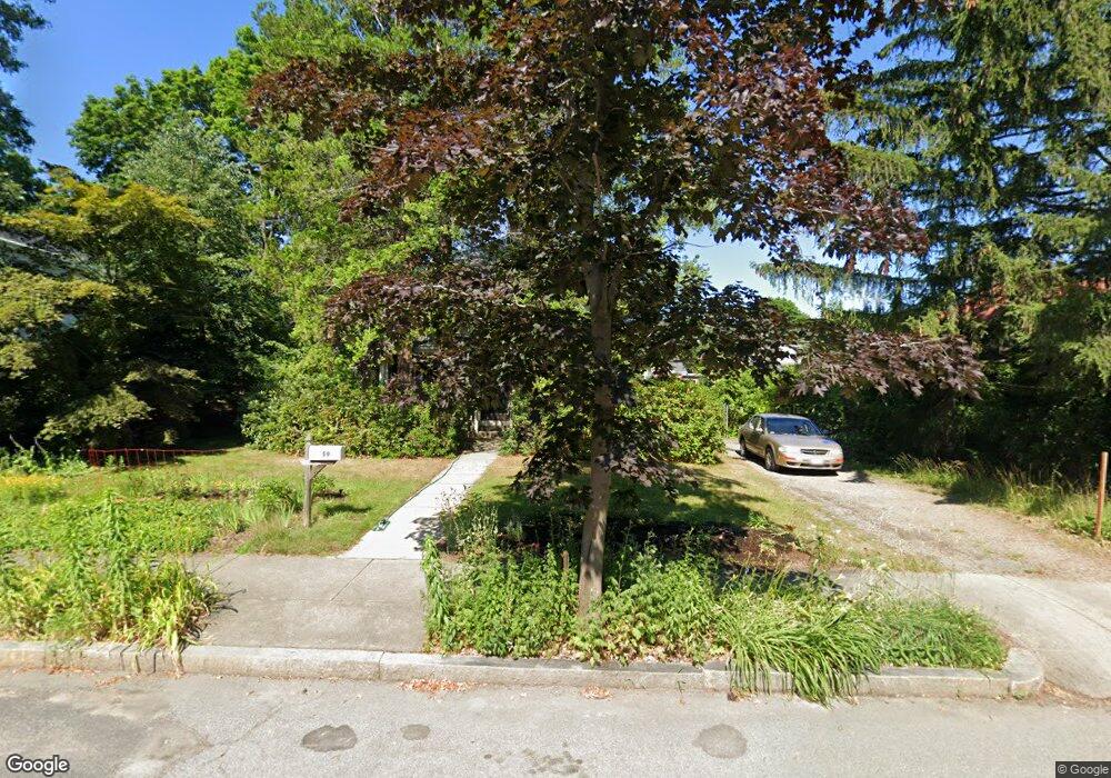
59 Brookside Ave Newtonville, MA 02460
Newtonville NeighborhoodEstimated Value: $1,373,000 - $1,484,000
4
Beds
3
Baths
2,173
Sq Ft
$655/Sq Ft
Est. Value
About This Home
This home is located at 59 Brookside Ave, Newtonville, MA 02460 and is currently estimated at $1,423,320, approximately $655 per square foot. 59 Brookside Ave is a home located in Middlesex County with nearby schools including Horace Mann Elementary School, F.A. Day Middle School, and Newton North High School.
Ownership History
Date
Name
Owned For
Owner Type
Purchase Details
Closed on
Aug 1, 2024
Sold by
Pike Daniel E and Litman-Pike Barbara
Bought by
59 Brookside Avenue Rt and Pike
Current Estimated Value
Purchase Details
Closed on
Jun 30, 2014
Sold by
Pike Daniel E
Bought by
Litman-Pike Bara and Pike Daniel E
Create a Home Valuation Report for This Property
The Home Valuation Report is an in-depth analysis detailing your home's value as well as a comparison with similar homes in the area
Home Values in the Area
Average Home Value in this Area
Purchase History
| Date | Buyer | Sale Price | Title Company |
|---|---|---|---|
| 59 Brookside Avenue Rt | -- | None Available | |
| 59 Brookside Avenue Rt | -- | None Available | |
| Litman-Pike Bara | -- | -- | |
| Litman-Pike Bara | -- | -- |
Source: Public Records
Mortgage History
| Date | Status | Borrower | Loan Amount |
|---|---|---|---|
| Previous Owner | Litman-Pike Bara | $155,000 |
Source: Public Records
Tax History Compared to Growth
Tax History
| Year | Tax Paid | Tax Assessment Tax Assessment Total Assessment is a certain percentage of the fair market value that is determined by local assessors to be the total taxable value of land and additions on the property. | Land | Improvement |
|---|---|---|---|---|
| 2025 | $10,610 | $1,082,700 | $894,000 | $188,700 |
| 2024 | $10,260 | $1,051,200 | $868,000 | $183,200 |
| 2023 | $9,588 | $941,800 | $666,900 | $274,900 |
| 2022 | $9,173 | $872,000 | $617,500 | $254,500 |
| 2021 | $8,851 | $822,600 | $582,500 | $240,100 |
| 2020 | $8,588 | $822,600 | $582,500 | $240,100 |
| 2019 | $8,345 | $798,600 | $565,500 | $233,100 |
| 2018 | $7,908 | $730,900 | $510,800 | $220,100 |
| 2017 | $7,667 | $689,500 | $481,900 | $207,600 |
| 2016 | $7,333 | $644,400 | $450,400 | $194,000 |
| 2015 | $6,992 | $602,200 | $420,900 | $181,300 |
Source: Public Records
Map
Nearby Homes
- 43 Walker St
- 935 Washington St (Rear Facing) Unit 11
- 935 Washington St Unit 8
- 911 Washington St
- 27 Fairway Dr
- 40 Fairway Dr
- 140 Mount Vernon St
- 15 Edinboro Terrace
- 90 Highland Ave
- 20 Birch Hill Rd
- 27 Cross St Unit 27
- 299 Albemarle Rd
- 611 Watertown St Unit 14
- 33 Birch Hill Rd
- 354 Linwood Ave Unit 1
- 57 Walnut St
- 22 Walnut Place Unit 1
- 112 Washington Park Unit 1
- 318 Austin St Unit A
- 77 Court St Unit 205
- 55 Brookside Ave
- 67 Brookside Ave
- 430 Albemarle Rd
- 440 Albemarle Rd
- 438 Albemarle Rd
- 75 Brookside Ave Unit 2
- 75 Brookside Ave Unit 77
- 49 Brookside Ave
- 77 Brookside Ave Unit A
- 77 Brookside Ave Unit 3
- 77 Brookside Ave
- 60 Brookside Ave
- 8 Harrington St Unit 10
- 68 Brookside Ave
- 12 Harrington St Unit 14
- 12 Harrington St Unit 12
- 14 Harrington St Unit 14
- 14 Harrington St
- 12 Harrington St Unit 1
- 4 Harrington St Unit 1