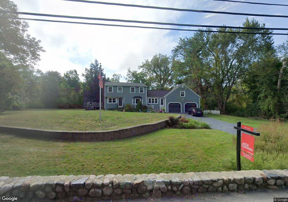
59 Captain Pierce Rd Scituate, MA 02066
Estimated Value: $841,000 - $878,605
5
Beds
3
Baths
2,100
Sq Ft
$411/Sq Ft
Est. Value
About This Home
This home is located at 59 Captain Pierce Rd, Scituate, MA 02066 and is currently estimated at $863,901, approximately $411 per square foot. 59 Captain Pierce Rd is a home located in Plymouth County with nearby schools including Hatherly Elementary School, Lester J. Gates Middle School, and Scituate High School.
Ownership History
Date
Name
Owned For
Owner Type
Purchase Details
Closed on
May 30, 2003
Sold by
Byrne Sean T and Byrne Marion O
Bought by
Brazao Emanuel A and Brazao Michelle E
Current Estimated Value
Purchase Details
Closed on
Jun 13, 2002
Sold by
Pond William and Pond Carolyn M
Bought by
Byrne Sean T and Byrne Marion O
Create a Home Valuation Report for This Property
The Home Valuation Report is an in-depth analysis detailing your home's value as well as a comparison with similar homes in the area
Home Values in the Area
Average Home Value in this Area
Purchase History
| Date | Buyer | Sale Price | Title Company |
|---|---|---|---|
| Brazao Emanuel A | $480,000 | -- | |
| Byrne Sean T | $260,000 | -- |
Source: Public Records
Mortgage History
| Date | Status | Borrower | Loan Amount |
|---|---|---|---|
| Open | Byrne Sean T | $400,000 | |
| Closed | Byrne Sean T | $48,611 |
Source: Public Records
Tax History Compared to Growth
Tax History
| Year | Tax Paid | Tax Assessment Tax Assessment Total Assessment is a certain percentage of the fair market value that is determined by local assessors to be the total taxable value of land and additions on the property. | Land | Improvement |
|---|---|---|---|---|
| 2025 | $7,638 | $764,600 | $380,800 | $383,800 |
| 2024 | $7,487 | $722,700 | $346,200 | $376,500 |
| 2023 | $7,586 | $681,600 | $332,200 | $349,400 |
| 2022 | $7,422 | $588,100 | $302,400 | $285,700 |
| 2021 | $5,038 | $543,700 | $288,000 | $255,700 |
| 2020 | $7,029 | $520,700 | $276,900 | $243,800 |
| 2019 | $4,680 | $504,900 | $271,500 | $233,400 |
| 2018 | $4,568 | $492,200 | $282,000 | $210,200 |
| 2017 | $6,659 | $472,600 | $270,700 | $201,900 |
| 2016 | $6,363 | $450,000 | $248,100 | $201,900 |
| 2015 | $5,748 | $438,800 | $236,900 | $201,900 |
Source: Public Records
Map
Nearby Homes
- 59 Captain Peirce Rd
- 27 Ann Vinal Rd
- 54 Woodland Rd
- 22 Kings Way
- 14 Aberdeen Dr
- 378 Tilden Rd
- 112 Hollett St
- 32 Fairview Ave
- 30 Irving Rd
- 16 3 Ring Rd
- 10 Benjamin Ln Unit 10
- 209 Hatherly Rd
- 17 Bradford Ave
- 29 Country Club Cir
- 3 Grace Way Unit 3
- 1 Grace Way Unit 1
- 9 Kyle Path
- 111 Elm St
- 115 Elm St
- 11 Forest Ln
- 58 Captain Peirce Rd
- 8 Woodland Rd
- 54 Captain Peirce Rd
- 49 Captain Peirce Rd
- 10 Woodland Rd
- 50 Captain Peirce Rd
- 183 Lawson Rd
- 75 Dreamwold Rd
- 75 Dreamwold Rd
- 45 Captain Pierce Rd
- 171 Lawson Rd
- 44 Captain Pierce Rd
- 16 Woodland Rd
- 11 Woodland Rd
- 44 Captain Peirce Rd
- 44 Captain Peirce Rd Unit 1
- 44 Captain Peirce Road Lots 2+3
- 39 Captain Pierce Rd
- 76 Dreamwold Rd
- 42 Captain Peirce Rd Unit 42