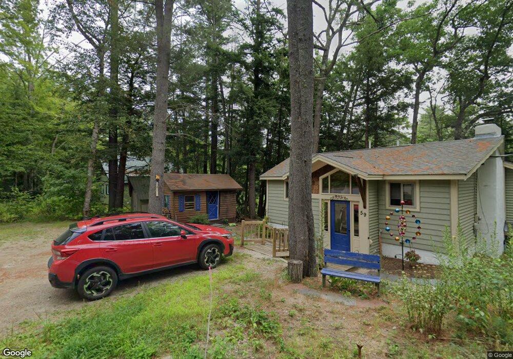
59 Covered Bridge Ln Bartlett, NH 03812
Bartlett AreaEstimated Value: $539,913 - $683,000
About This Home
This home is located at 59 Covered Bridge Ln, Bartlett, NH 03812 and is currently estimated at $607,728, approximately $357 per square foot. 59 Covered Bridge Ln is a home with nearby schools including Josiah Bartlett Elementary School.
Ownership History
We collect this data history from publicly available records. To have your information removed, we recommend requesting removal directly through your county’s website.
Purchase Details
Home Financials for this Owner
Home Financials are based on the most recent Mortgage that was taken out on this home.Purchase Details
Home Values in the Area
Average Home Value in this Area
Purchase History
We collect this data history from publicly available records. To have your information removed, we recommend requesting removal directly through your county’s website.
| Date | Buyer | Sale Price | Title Company |
|---|---|---|---|
| $329,000 | None Available | ||
| $389,000 | -- |
Mortgage History
We collect this data history from publicly available records. To have your information removed, we recommend requesting removal directly through your county’s website.
| Date | Status | Borrower | Loan Amount |
|---|---|---|---|
| Open | $263,200 |
Tax History
We collect this data history from publicly available records. To have your information removed, we recommend requesting removal directly through your county’s website.
| Year | Tax Paid | Tax Assessment Tax Assessment Total Assessment is a certain percentage of the fair market value that is determined by local assessors to be the total taxable value of land and additions on the property. | Land | Improvement |
|---|---|---|---|---|
| 2024 | $2,447 | $438,600 | $143,600 | $295,000 |
| 2023 | $2,263 | $438,600 | $143,600 | $295,000 |
| 2022 | $2,180 | $438,600 | $143,600 | $295,000 |
| 2021 | $2,128 | $223,300 | $95,100 | $128,200 |
| 2020 | $2,157 | $223,300 | $95,100 | $128,200 |
| 2019 | $2,086 | $223,300 | $95,100 | $128,200 |
| 2018 | $2,039 | $223,300 | $95,100 | $128,200 |
| 2016 | $1,889 | $198,800 | $74,000 | $124,800 |
| 2015 | $1,897 | $198,800 | $74,000 | $124,800 |
| 2014 | $1,946 | $198,800 | $74,000 | $124,800 |
| 2010 | $1,135 | $124,000 | $56,100 | $67,900 |
Map
- 48 Covered Bridge Ln
- 404 U S 302
- 106 Covered Bridge Ln
- 815 W Side Rd
- 41 Linden Rd
- 4F Seasons at Attitash Rd
- 4D the Seasons at Attitash Rd
- 14 Seasons at Attitash Rd Unit A
- 14 Seasons at Attitash Rd Unit E
- 9A Seasons at Attitash Rd Unit 9A
- 14G the Seasons at Attitash Unit G
- 17 The Meadows Rd
- 7 Cathedral Trail
- 243 Cow Hill Rd Unit 5
- 9 River Run Dr
- 1 River Run Rd Unit 1-O
- 6P River Run Dr Unit P
- 8T River Run Dr Unit T
- 8J River Run Dr Unit J
- 8H River Run Dr Unit H
- 49 Covered Bridge Ln
- 53 Covered Bridge Ln
- 45 Covered Bridge Ln
- 48 Covered Bridge Ln
- 52 Covered Bridge Ln
- 42 Covered Bridge Ln
- 40 Covered Bridge Ln
- 273 Covered Bridge Ln
- 37 Covered Bridge Ln
- 5 Pine Glen Rd
- 6 Pine Glen Rd Unit 6
- 5 Pine Glen Rd Unit 5
- 4 Pine Glen Rd
- 40 Covered Bridge Ln
- 8 Pine Glen Rd Unit 8
- 17 Aspen Dr
- 55 Oak Ridge Rd
- 103 Oak Ridge Rd
- 90 Oak Ridge Rd
- 29 Aspen Dr
Ask me questions while you tour the home.