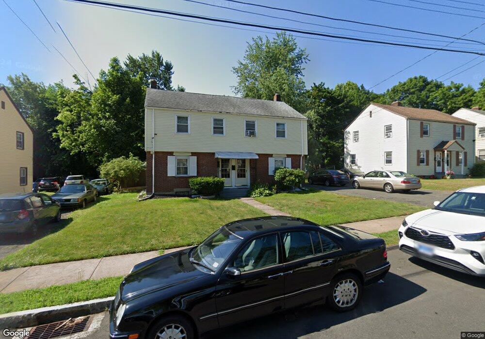
59 E Burnham St Unit 61 Hartford, CT 06112
Blue Hills NeighborhoodEstimated Value: $286,018 - $412,000
3
Beds
1
Bath
1,938
Sq Ft
$186/Sq Ft
Est. Value
About This Home
This home is located at 59 E Burnham St Unit 61, Hartford, CT 06112 and is currently estimated at $360,505, approximately $186 per square foot. 59 E Burnham St Unit 61 is a home located in Hartford County with nearby schools including Rawson School, Breakthrough Magnet School - North Campus, and West Middle School.
Ownership History
Date
Name
Owned For
Owner Type
Purchase Details
Closed on
Jul 18, 1988
Sold by
Burke Martin S Est
Bought by
Aldridge Lloyd L
Current Estimated Value
Home Financials for this Owner
Home Financials are based on the most recent Mortgage that was taken out on this home.
Original Mortgage
$110,000
Interest Rate
10.57%
Mortgage Type
Purchase Money Mortgage
Create a Home Valuation Report for This Property
The Home Valuation Report is an in-depth analysis detailing your home's value as well as a comparison with similar homes in the area
Home Values in the Area
Average Home Value in this Area
Purchase History
| Date | Buyer | Sale Price | Title Company |
|---|---|---|---|
| Aldridge Lloyd L | $137,500 | -- |
Source: Public Records
Mortgage History
| Date | Status | Borrower | Loan Amount |
|---|---|---|---|
| Closed | Aldridge Lloyd L | $41,600 | |
| Closed | Aldridge Lloyd L | $110,000 |
Source: Public Records
Tax History
| Year | Tax Paid | Tax Assessment Tax Assessment Total Assessment is a certain percentage of the fair market value that is determined by local assessors to be the total taxable value of land and additions on the property. | Land | Improvement |
|---|---|---|---|---|
| 2025 | $4,977 | $72,177 | $5,292 | $66,885 |
| 2024 | $4,977 | $72,177 | $5,292 | $66,885 |
| 2023 | $4,977 | $72,177 | $5,292 | $66,885 |
| 2022 | $3,882 | $72,177 | $5,292 | $66,885 |
| 2021 | $3,882 | $52,255 | $6,300 | $45,955 |
| 2020 | $3,882 | $52,255 | $6,300 | $45,955 |
| 2019 | $3,882 | $52,255 | $6,300 | $45,955 |
| 2018 | $3,751 | $50,493 | $6,087 | $44,406 |
| 2016 | $3,812 | $51,311 | $5,798 | $45,513 |
| 2015 | $3,631 | $48,873 | $5,522 | $43,351 |
| 2014 | $3,542 | $47,678 | $5,387 | $42,291 |
Source: Public Records
Map
Nearby Homes
- 97 E Burnham St
- 97 Boothbay St
- 11 Pershing St Unit 13
- 26 Baltic St Unit 28
- 35 Baltic St
- 747 Blue Hills Ave
- 18 Darby St
- 13 Patton Rd
- 70 Burnham St Unit 72
- 67 Elizabeth Ave
- 200 Hartland St
- 110 Darby St
- 86 Hartland St
- 90 Manchester St
- 180 Brookline Ave
- 171 N Canaan St
- 83 Colebrook St Unit 85
- 51 Pembroke St
- 216 Cornwall St
- 39 Wade Ave
- 63 E Burnham St Unit 65
- 53 E Burnham St Unit 55
- 60 E Burnham St
- 56 E Burnham St
- 64 E Burnham St
- 69 E Burnham St Unit 71
- 49 E Burnham St Unit 51
- 68 E Burnham St
- 52 E Burnham St
- 72 E Burnham St
- 75 E Burnham St Unit 77
- 58 E Harold St Unit 60
- 48 E Burnham St
- 68 E Harold St
- 130 Lebanon St Unit 132
- 54 E Harold St Unit 56
- 76 E Burnham St
- 44 E Burnham St
- 48 E Harold St Unit 50
- 124 Lebanon St Unit 126