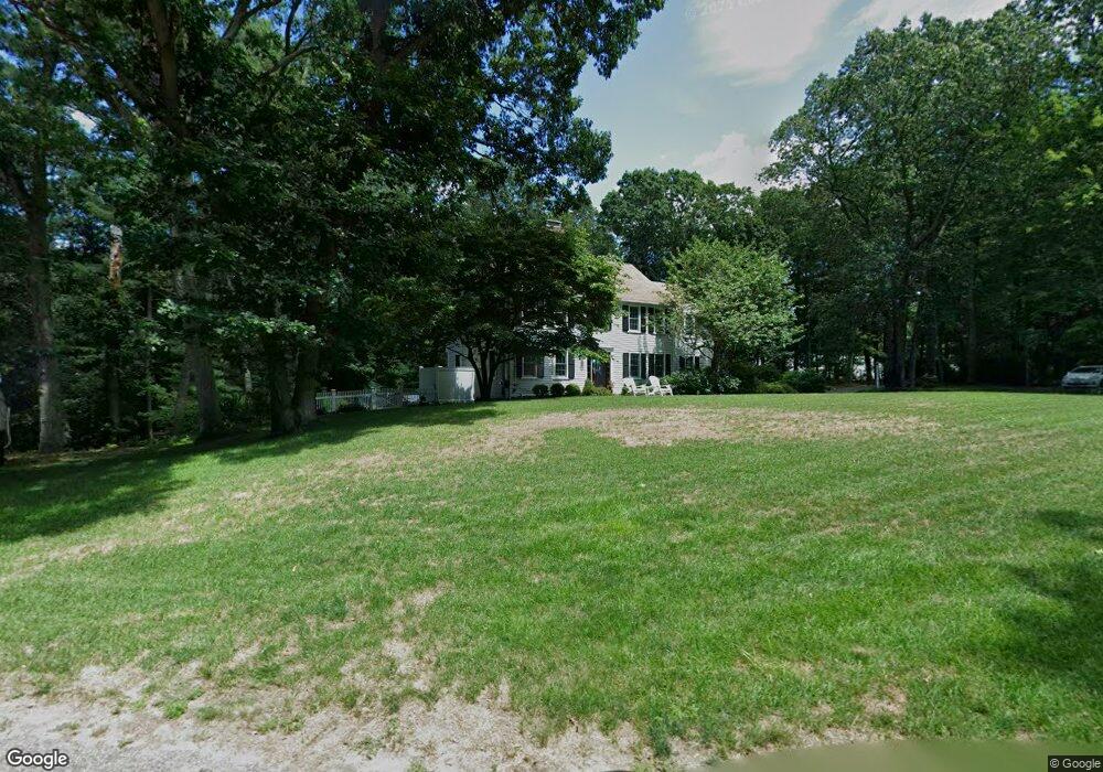
59 Flint Locke Dr Duxbury, MA 02332
Estimated Value: $976,971 - $1,103,000
4
Beds
4
Baths
2,452
Sq Ft
$420/Sq Ft
Est. Value
About This Home
This home is located at 59 Flint Locke Dr, Duxbury, MA 02332 and is currently estimated at $1,028,993, approximately $419 per square foot. 59 Flint Locke Dr is a home located in Plymouth County with nearby schools including Chandler Elementary School, Alden School, and Duxbury Middle School.
Ownership History
Date
Name
Owned For
Owner Type
Purchase Details
Closed on
Jun 28, 2007
Sold by
El-Amine Adrian K and El-Amine Pamela A
Bought by
Estabrooks Scott and Estabrooks Alison
Current Estimated Value
Purchase Details
Closed on
Oct 22, 1993
Sold by
Drake Richard M and Drake Donna M
Bought by
El-Amine Adnan K and El-Amine Pamela A M
Create a Home Valuation Report for This Property
The Home Valuation Report is an in-depth analysis detailing your home's value as well as a comparison with similar homes in the area
Home Values in the Area
Average Home Value in this Area
Purchase History
| Date | Buyer | Sale Price | Title Company |
|---|---|---|---|
| Estabrooks Scott | $565,000 | -- | |
| El-Amine Adnan K | $218,865 | -- | |
| Estabrooks Scott | $565,000 | -- | |
| El-Amine Adnan K | $218,865 | -- |
Source: Public Records
Mortgage History
| Date | Status | Borrower | Loan Amount |
|---|---|---|---|
| Open | El-Amine Adnan K | $417,000 | |
| Closed | El-Amine Adnan K | $37,686 |
Source: Public Records
Tax History Compared to Growth
Tax History
| Year | Tax Paid | Tax Assessment Tax Assessment Total Assessment is a certain percentage of the fair market value that is determined by local assessors to be the total taxable value of land and additions on the property. | Land | Improvement |
|---|---|---|---|---|
| 2025 | $7,099 | $700,100 | $280,400 | $419,700 |
| 2024 | $6,953 | $691,200 | $280,600 | $410,600 |
| 2023 | $7,410 | $693,200 | $380,700 | $312,500 |
| 2022 | $7,902 | $615,400 | $321,300 | $294,100 |
| 2021 | $7,992 | $551,900 | $290,600 | $261,300 |
| 2020 | $7,842 | $534,900 | $259,700 | $275,200 |
| 2019 | $7,964 | $542,500 | $256,500 | $286,000 |
| 2018 | $7,562 | $498,800 | $224,400 | $274,400 |
| 2017 | $7,358 | $474,400 | $213,500 | $260,900 |
| 2016 | $7,173 | $461,300 | $200,400 | $260,900 |
| 2015 | $7,196 | $461,300 | $200,400 | $260,900 |
Source: Public Records
Map
Nearby Homes
- 19 Flint Locke Dr
- 30 Cushing Dr
- 6 Priscilla Rd
- 117 Soule Ave
- 53 Bay Farm Rd Unit 53
- 20 Island Creek Rd
- 59 Priscilla Ave
- 40 Bay Farm Rd Unit 40
- 65 Tussock Brook Rd
- 10 Summerhouse Ln
- 80 Parks St Unit 6
- 80 Parks St Unit 5
- 66 Seabury Point Rd
- 37 Tarkiln Rd
- 94 Buckboard Rd
- 24 Tremont St
- 197 Off Tarkiln Rd
- 1 Tarkiln Rd
- 124 Evergreen St
- 6 Kingstown Way
- 71 Flint Locke Dr
- 43 Flint Locke Dr
- 53 Flint Locke Dr
- 62 Flint Locke Dr
- 56 Flint Locke Dr
- 80 Flint Locke Dr
- 79 Flint Locke Dr
- 35 Flint Locke Dr
- 35 Flint Locke Dr Unit A
- 30 Flint Locke Dr
- 43 Oak St
- 57 Oak St
- 29 Oak St
- 151 Flint Locke Dr
- 97 Flint Locke Dr
- 202 Tremont St
- 180 Tremont St
- 161 Flint Locke Dr
- 10 Flint Locke Dr
- 158 Tremont St