
Seller's Agent in 2025
Angela Sanderson
Lowe Key Realty, Llc
(843) 307-8977
49 Total Sales
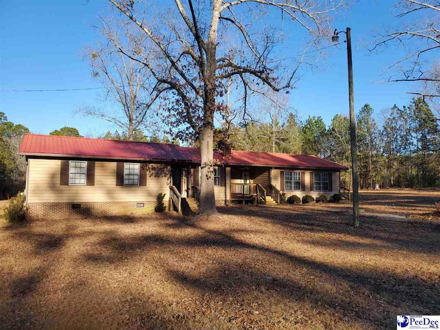
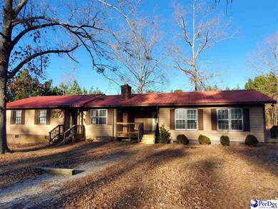
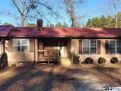
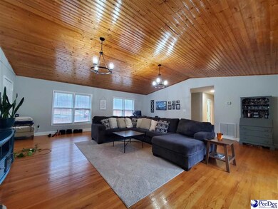
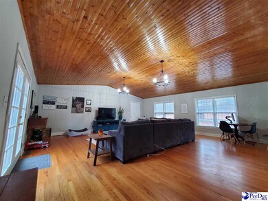
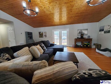

**Welcome to Your New Home at 59 JC Barefoot Rd!** Escape to this beautiful 3-bedroom, 2.5-bathroom home situated on a generous 4.2-acre lot, offering the perfect blend of rural charm and modern convenience. As you enter, you’ll be greeted by a spacious family room that invites relaxation and entertainment. The formal living room features a cozy fireplace, perfect for intimate gatherings or quiet evenings at home. Enjoy family meals in the bright dining area, seamlessly connected to the living spaces. This property is a dream for hobbyists and DIY enthusiasts, boasting a large workshop complete with double roll-up doors, allowing for easy access and plenty of storage. Additionally, a covered carport provides extra space for vehicles or equipment. Located in the highly regarded Plainview Elementary and McBee Middle and High School districts. The ample land gives you the freedom to create your own outdoor paradise, all while enjoying the benefits of no restrictions. Whether you envision gardens, recreation, or simply scenic views, the possibilities are endless! Don’t miss out on this incredible opportunity to make 59 JC Barefoot Rd your haven. Schedule a showing today and experience everything this property has to offer!
Last Agent to Sell the Property
Lowe Key Realty, Llc License #118287 Listed on: 01/28/2025
| Date | Type | Sale Price | Title Company |
|---|---|---|---|
| Deed | $250,000 | None Listed On Document | |
| Deed | $250,000 | None Listed On Document | |
| Deed | $70,000 | None Available |
| Date | Status | Loan Amount | Loan Type |
|---|---|---|---|
| Open | $10,000 | No Value Available | |
| Closed | $10,000 | No Value Available | |
| Open | $246,165 | New Conventional | |
| Closed | $246,165 | New Conventional | |
| Previous Owner | $67,550 | FHA |
| Date | Event | Price | List to Sale | Price per Sq Ft |
|---|---|---|---|---|
| 05/06/2025 05/06/25 | Sold | $250,000 | -3.8% | $142 / Sq Ft |
| 04/24/2025 04/24/25 | Off Market | $259,900 | -- | -- |
| 02/14/2025 02/14/25 | Price Changed | $259,900 | -1.9% | $148 / Sq Ft |
| 01/28/2025 01/28/25 | For Sale | $264,900 | -- | $151 / Sq Ft |
| Year | Tax Paid | Tax Assessment Tax Assessment Total Assessment is a certain percentage of the fair market value that is determined by local assessors to be the total taxable value of land and additions on the property. | Land | Improvement |
|---|---|---|---|---|
| 2025 | $1,119 | $0 | $0 | $0 |
| 2024 | $938 | $7,550 | $510 | $7,040 |
| 2023 | $3,577 | $11,320 | $750 | $10,570 |
| 2022 | $553 | $4,660 | $510 | $4,150 |
| 2021 | $551 | $4,660 | $510 | $4,150 |
| 2020 | $545 | $4,080 | $500 | $3,580 |
| 2019 | $1,418 | $4,080 | $500 | $3,580 |
| 2018 | $1,402 | $4,080 | $500 | $3,580 |
| 2015 | $448 | $4,080 | $500 | $3,580 |
| 2014 | -- | $4,080 | $500 | $3,580 |
Seller's Agent in 2025
Angela Sanderson
Lowe Key Realty, Llc
(843) 307-8977
49 Total Sales
Source: Pee Dee REALTOR® Association
MLS Number: 20250354
APN: 218-000-000-062
Disclaimer: Certain information contained herein is derived from information provided by parties other than Homes.com. All information provided is deemed reliable, but is not guaranteed to be accurate and should be independently verified.
![]() IDX information is provided exclusively for personal, non-commercial use, and may not be used for any purpose other than to identify prospective properties consumers may be interested in purchasing. Information is deemed reliable but not guaranteed.
IDX information is provided exclusively for personal, non-commercial use, and may not be used for any purpose other than to identify prospective properties consumers may be interested in purchasing. Information is deemed reliable but not guaranteed.
Ask me questions while you tour the home.