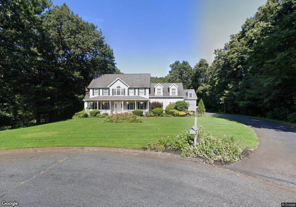
59 Juniper Hill Somers, CT 06071
Estimated Value: $654,000 - $740,000
4
Beds
3
Baths
3,403
Sq Ft
$206/Sq Ft
Est. Value
About This Home
This home is located at 59 Juniper Hill, Somers, CT 06071 and is currently estimated at $700,971, approximately $205 per square foot. 59 Juniper Hill is a home located in Tolland County with nearby schools including Somers Elementary School, Mabelle B. Avery Middle School, and Somers High School.
Ownership History
Date
Name
Owned For
Owner Type
Purchase Details
Closed on
Aug 20, 2001
Sold by
Buck Bldrs Llc
Bought by
Buck Blaine and Richard Karen
Current Estimated Value
Home Financials for this Owner
Home Financials are based on the most recent Mortgage that was taken out on this home.
Original Mortgage
$200,000
Interest Rate
6.5%
Create a Home Valuation Report for This Property
The Home Valuation Report is an in-depth analysis detailing your home's value as well as a comparison with similar homes in the area
Home Values in the Area
Average Home Value in this Area
Purchase History
| Date | Buyer | Sale Price | Title Company |
|---|---|---|---|
| Buck Blaine | $288,000 | -- | |
| Buck Blaine | $288,000 | -- |
Source: Public Records
Mortgage History
| Date | Status | Borrower | Loan Amount |
|---|---|---|---|
| Open | Buck Blaine | $206,500 | |
| Closed | Buck Blaine | $100,000 | |
| Closed | Buck Blaine | $200,000 |
Source: Public Records
Tax History
| Year | Tax Paid | Tax Assessment Tax Assessment Total Assessment is a certain percentage of the fair market value that is determined by local assessors to be the total taxable value of land and additions on the property. | Land | Improvement |
|---|---|---|---|---|
| 2025 | $9,945 | $329,200 | $84,800 | $244,400 |
| 2024 | $9,534 | $329,200 | $84,800 | $244,400 |
| 2023 | $9,320 | $329,200 | $84,800 | $244,400 |
| 2022 | $9,073 | $329,200 | $84,800 | $244,400 |
| 2021 | $8,776 | $329,200 | $84,800 | $244,400 |
| 2020 | $8,740 | $319,320 | $83,720 | $235,600 |
| 2019 | $8,792 | $321,220 | $92,020 | $229,200 |
| 2018 | $8,792 | $321,220 | $92,020 | $229,200 |
| 2017 | $8,139 | $319,550 | $90,350 | $229,200 |
| 2016 | $7,740 | $319,550 | $90,350 | $229,200 |
| 2015 | $7,364 | $315,100 | $105,300 | $209,800 |
| 2014 | $7,364 | $315,100 | $105,300 | $209,800 |
Source: Public Records
Map
Nearby Homes
- 47 Juniper Hill
- 47 Juniper Hill Unit DR
- 47 Juniper Hill
- 46 Brae Burn Rd
- 60 Juniper Hill
- 46 Brae Burn Dr
- 52 Juniper Hill
- 51 Juniper Hill
- 48 Juniper Hill
- 40 Brae Burn Rd
- 912 Main St
- 904 Main St
- 47 Brae Burn Rd
- 60 Juniper Hill Dr
- 32 Brae Burn Rd
- 39 Brae Burn Rd
- 907 Main St
- 33 Brae Burn Rd
- 30 Juniper Hill
- 22 Brae Burn Rd
Your Personal Tour Guide
Ask me questions while you tour the home.