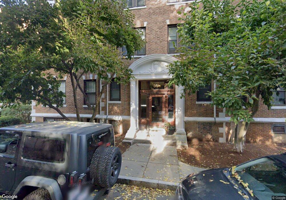
59 Lanark Rd Unit 7 Brighton, MA 02135
Commonwealth NeighborhoodEstimated Value: $390,469 - $415,000
1
Bed
1
Bath
553
Sq Ft
$724/Sq Ft
Est. Value
About This Home
This home is located at 59 Lanark Rd Unit 7, Brighton, MA 02135 and is currently estimated at $400,617, approximately $724 per square foot. 59 Lanark Rd Unit 7 is a home located in Suffolk County with nearby schools including Torah Academy, Shaloh House Jewish Day School, and Bais Yaakov Of Boston High School.
Ownership History
Date
Name
Owned For
Owner Type
Purchase Details
Closed on
Nov 28, 2000
Sold by
Silver Nini and Silver Helen
Bought by
Spiegel William and Spiegel Irina
Current Estimated Value
Home Financials for this Owner
Home Financials are based on the most recent Mortgage that was taken out on this home.
Original Mortgage
$100,000
Interest Rate
7.78%
Mortgage Type
Purchase Money Mortgage
Purchase Details
Closed on
Apr 6, 1994
Sold by
Fdic
Bought by
Silver Helen and Silver Nini
Purchase Details
Closed on
May 28, 1992
Sold by
Abrams Stuart
Bought by
First Mutual Bk Svgs
Create a Home Valuation Report for This Property
The Home Valuation Report is an in-depth analysis detailing your home's value as well as a comparison with similar homes in the area
Home Values in the Area
Average Home Value in this Area
Purchase History
| Date | Buyer | Sale Price | Title Company |
|---|---|---|---|
| Spiegel William | $125,000 | -- | |
| Silver Helen | $40,000 | -- | |
| First Mutual Bk Svgs | $24,500 | -- |
Source: Public Records
Mortgage History
| Date | Status | Borrower | Loan Amount |
|---|---|---|---|
| Open | First Mutual Bk Svgs | $104,000 | |
| Closed | First Mutual Bk Svgs | $100,000 |
Source: Public Records
Tax History
| Year | Tax Paid | Tax Assessment Tax Assessment Total Assessment is a certain percentage of the fair market value that is determined by local assessors to be the total taxable value of land and additions on the property. | Land | Improvement |
|---|---|---|---|---|
| 2025 | $3,960 | $342,000 | $0 | $342,000 |
| 2024 | $3,915 | $359,200 | $0 | $359,200 |
| 2023 | $3,858 | $359,200 | $0 | $359,200 |
| 2022 | $3,687 | $338,900 | $0 | $338,900 |
| 2021 | $3,616 | $338,900 | $0 | $338,900 |
| 2020 | $3,154 | $298,700 | $0 | $298,700 |
| 2019 | $3,087 | $292,900 | $0 | $292,900 |
| 2018 | $2,869 | $273,800 | $0 | $273,800 |
| 2017 | $2,686 | $253,600 | $0 | $253,600 |
| 2016 | $2,559 | $232,600 | $0 | $232,600 |
| 2015 | $2,537 | $209,500 | $0 | $209,500 |
| 2014 | $2,395 | $190,400 | $0 | $190,400 |
Source: Public Records
Map
Nearby Homes
- 36 Cummings Rd Unit 1
- 140 Kilsyth Rd Unit 8
- 100 Lanark Rd Unit 8
- 1691 Commonwealth Ave Unit 31
- 24 Selkirk Rd Unit 24-4
- 47 Englewood Ave
- 30 Kinross Rd Unit 1
- 38 Ransom Rd Unit 12
- 38 Ransom Rd Unit 3
- 65 Strathmore Rd Unit 49
- 1641 Commonwealth Ave Unit 16
- 3 Englewood Ave Unit 9
- 8 Kinross Rd Unit 2
- 36 Colborne Rd
- 1778 Beacon St Unit 302
- 57 Nottinghill Rd
- 31 Orkney Rd Unit 54
- 113-115 Nottinghill Rd
- 26 Chiswick Rd Unit 6
- 17 Strathmore Rd Unit 2
- 59 Lanark Rd Unit 12
- 59 Lanark Rd Unit 11
- 59 Lanark Rd Unit 10
- 59 Lanark Rd Unit 9
- 59 Lanark Rd Unit 8
- 59 Lanark Rd Unit 6
- 59 Lanark Rd Unit 5
- 59 Lanark Rd Unit 4
- 59 Lanark Rd Unit 3
- 59 Lanark Rd Unit 2
- 59 Lanark Rd Unit 1
- 59 Lanark Rd Unit 3
- 59 Lanark Rd Unit 1
- 59 Lanark Rd Unit 2
- 59 Lanark Rd Unit 1,59
- 59 Lanark Rd Unit 9
- 59 Lanark Rd Unit 4
- 59 Lanark Rd
- 59 Lanark Rd Unit 12
- 59 Lanark Rd Unit 11