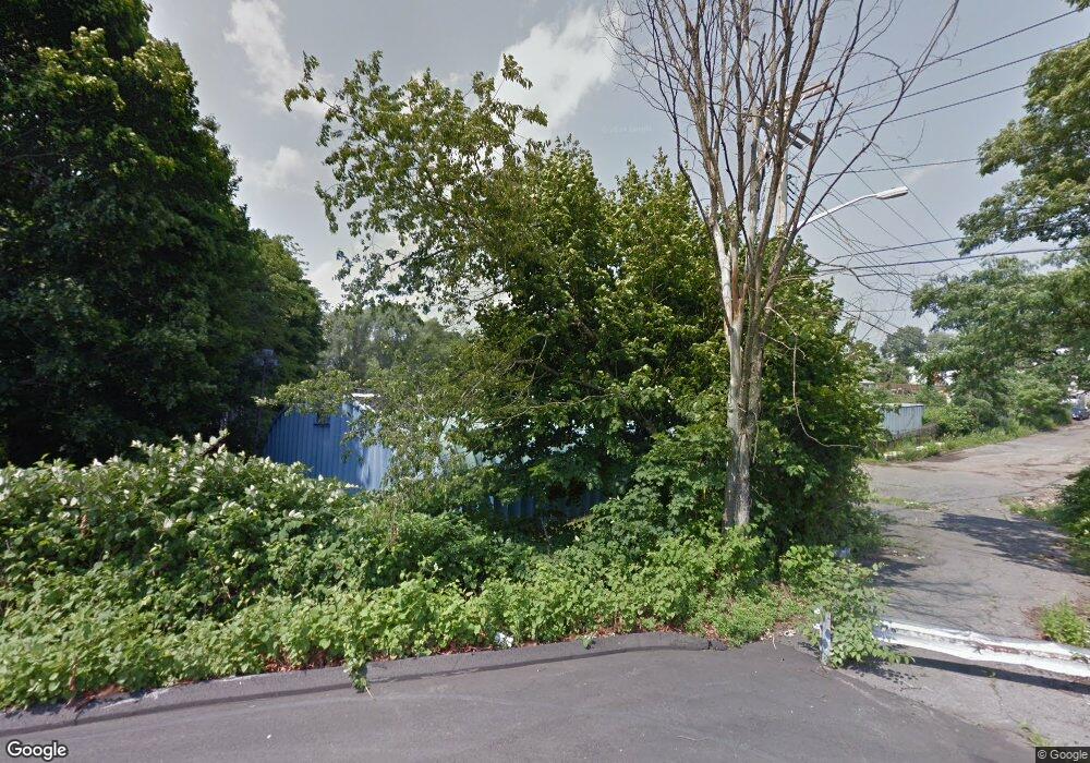
59 Locust St West Haven, CT 06516
Allingtown NeighborhoodEstimated Value: $447,086
--
Bed
--
Bath
2,800
Sq Ft
$160/Sq Ft
Est. Value
About This Home
This home is located at 59 Locust St, West Haven, CT 06516 and is currently estimated at $447,086, approximately $159 per square foot. 59 Locust St is a home located in New Haven County with nearby schools including Carrigan 5/6 Intermediate School, Harry M. Bailey Middle School, and West Haven High School.
Ownership History
Date
Name
Owned For
Owner Type
Purchase Details
Closed on
Feb 22, 2024
Sold by
S & P Locust Ave Re Llc
Bought by
E D Real Estate Mgmt Llc
Current Estimated Value
Purchase Details
Closed on
Apr 7, 2023
Sold by
S & P Locust Avenue Real Es
Bought by
S & P Locust Avenue Real Es
Purchase Details
Closed on
Feb 26, 2018
Sold by
Girasuolo Samuel
Bought by
S & P Locust Ave Re Llc
Create a Home Valuation Report for This Property
The Home Valuation Report is an in-depth analysis detailing your home's value as well as a comparison with similar homes in the area
Home Values in the Area
Average Home Value in this Area
Purchase History
| Date | Buyer | Sale Price | Title Company |
|---|---|---|---|
| E D Real Estate Mgmt Llc | $390,000 | None Available | |
| E D Real Estate Mgmt Llc | $390,000 | None Available | |
| S & P Locust Avenue Real Es | -- | None Available | |
| S & P Locust Avenue Real Es | -- | None Available | |
| S & P Locust Ave Re Llc | -- | -- | |
| S & P Locust Ave Re Llc | -- | -- |
Source: Public Records
Tax History Compared to Growth
Tax History
| Year | Tax Paid | Tax Assessment Tax Assessment Total Assessment is a certain percentage of the fair market value that is determined by local assessors to be the total taxable value of land and additions on the property. | Land | Improvement |
|---|---|---|---|---|
| 2025 | $7,252 | $213,220 | $164,920 | $48,300 |
| 2024 | $5,558 | $116,060 | $98,910 | $17,150 |
| 2023 | $5,388 | $116,060 | $98,910 | $17,150 |
| 2022 | $5,274 | $115,640 | $98,490 | $17,150 |
| 2021 | $5,275 | $115,640 | $98,490 | $17,150 |
| 2020 | $5,472 | $106,260 | $87,990 | $18,270 |
| 2019 | $5,387 | $106,260 | $87,990 | $18,270 |
| 2018 | $5,241 | $106,260 | $87,990 | $18,270 |
| 2017 | $5,077 | $106,260 | $87,990 | $18,270 |
| 2016 | $4,923 | $106,260 | $87,990 | $18,270 |
| 2015 | $4,335 | $106,540 | $82,740 | $23,800 |
| 2014 | $4,249 | $106,540 | $82,740 | $23,800 |
Source: Public Records
Map
Nearby Homes
- 14 Homestead Ave
- 1014 Campbell Ave Unit 14
- 38 Chauncey St
- 22 Bristol St
- 60 Andrews St
- 104 Terrace Ave
- 43 Clifton St
- 941 Campbell Ave
- 103 Gilbert St
- 65 Westfield St
- 22 Thill St
- 81 Homeside Ave
- 194 Ella T Grasso Blvd
- 35 Terrace Ave
- 29 Birch St
- 29 Abner St
- 25 Richards St
- 63 Glade St Unit C1
- 161 W Spring St Unit B2
- 161 W Spring St Unit C1
- 59 Locust St
- 59 Locust St
- 27 Homestead Ave
- 34 Homestead Ave
- 48 Locust St
- 33 Locust St
- 42 Locust St
- 30 Homestead Ave
- 17 Homestead Ave
- 29 Locust St
- 36 Locust St
- 13 Homestead Ave
- 13 Homestead Ave Unit 1
- 26 Homestead Ave
- 26 Homestead Ave Unit 28
- 22 Homestead Ave
- 9 Homestead Ave
- 32 Locust St
- 18 Homestead Ave
- 5 Homestead Ave
