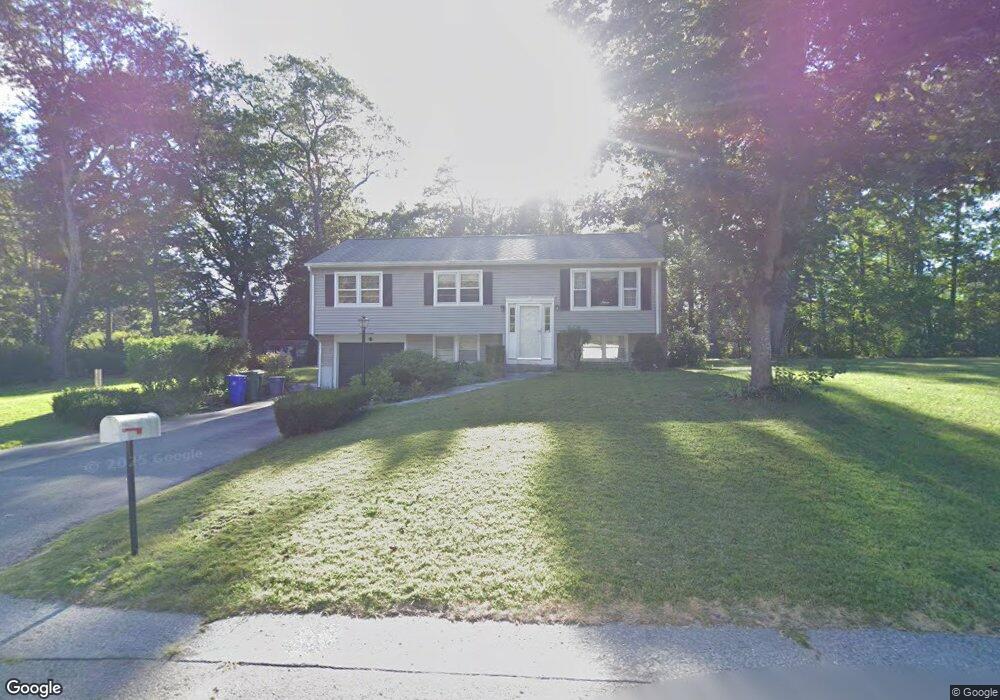
59 Melody Dr Attleboro, MA 02703
Estimated Value: $498,000 - $534,000
3
Beds
2
Baths
1,668
Sq Ft
$312/Sq Ft
Est. Value
About This Home
This home is located at 59 Melody Dr, Attleboro, MA 02703 and is currently estimated at $520,168, approximately $311 per square foot. 59 Melody Dr is a home located in Bristol County with nearby schools including A. Irvin Studley Elementary School, Cyril K. Brennan Middle School, and Attleboro High School.
Ownership History
Date
Name
Owned For
Owner Type
Purchase Details
Closed on
Mar 30, 2001
Sold by
Francisco Jose and Francisco Maria D
Bought by
Henningsen Michael A and Henningsen Diane M
Current Estimated Value
Purchase Details
Closed on
Sep 30, 1992
Sold by
Leighton Stephanie R
Bought by
Francisco Jose and Dinis Maria C
Purchase Details
Closed on
Nov 17, 1988
Sold by
Bentley Scott T
Bought by
Leighton Stephanie R
Create a Home Valuation Report for This Property
The Home Valuation Report is an in-depth analysis detailing your home's value as well as a comparison with similar homes in the area
Home Values in the Area
Average Home Value in this Area
Purchase History
| Date | Buyer | Sale Price | Title Company |
|---|---|---|---|
| Henningsen Michael A | $194,500 | -- | |
| Francisco Jose | $117,000 | -- | |
| Leighton Stephanie R | $143,500 | -- |
Source: Public Records
Mortgage History
| Date | Status | Borrower | Loan Amount |
|---|---|---|---|
| Open | Leighton Stephanie R | $153,000 | |
| Closed | Leighton Stephanie R | $159,500 |
Source: Public Records
Tax History Compared to Growth
Tax History
| Year | Tax Paid | Tax Assessment Tax Assessment Total Assessment is a certain percentage of the fair market value that is determined by local assessors to be the total taxable value of land and additions on the property. | Land | Improvement |
|---|---|---|---|---|
| 2025 | $5,324 | $424,200 | $169,000 | $255,200 |
| 2024 | $5,107 | $401,200 | $152,100 | $249,100 |
| 2023 | $5,039 | $368,100 | $153,600 | $214,500 |
| 2022 | $4,815 | $333,200 | $146,400 | $186,800 |
| 2021 | $0 | $303,800 | $141,000 | $162,800 |
| 2020 | $0 | $290,300 | $134,800 | $155,500 |
| 2019 | $4,002 | $282,600 | $132,000 | $150,600 |
| 2018 | $3,867 | $260,900 | $128,200 | $132,700 |
| 2017 | $20 | $258,200 | $124,900 | $133,300 |
| 2016 | $3,505 | $236,500 | $116,800 | $119,700 |
| 2015 | $3,467 | $235,700 | $116,800 | $118,900 |
| 2014 | $3,332 | $224,400 | $111,800 | $112,600 |
Source: Public Records
Map
Nearby Homes
- 660 Thacher St Unit 1402
- 101 South Ave Unit 803
- 31 Verndale Ave
- 52 Hawthorne St
- 34 Hawthorne St
- 49 Bushee St
- 0 Woodside Ave
- 17 Jewel Ave
- 46 Berwick Rd
- 22 Oakland Ave Unit 1
- 24 Oakland Ave Unit 1
- 21 Dennis St
- 49 Dennis St
- 62 Elizabeth St
- 309 Thacher St
- 30 Water St Unit 4
- 804 County St
- 74 West St Unit 5
- 74 West St Unit 18
- 125 County St