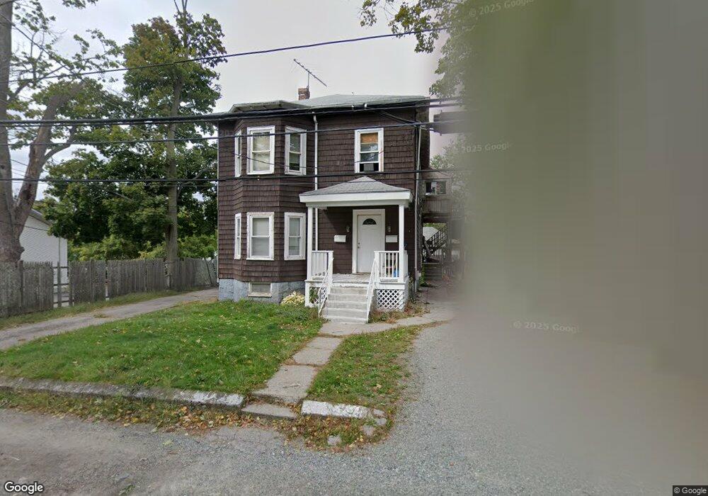
59 Paine St Roslindale, MA 02131
Roslindale NeighborhoodEstimated Value: $758,000 - $1,023,000
3
Beds
2
Baths
2,284
Sq Ft
$381/Sq Ft
Est. Value
About This Home
This home is located at 59 Paine St, Roslindale, MA 02131 and is currently estimated at $870,031, approximately $380 per square foot. 59 Paine St is a home located in Suffolk County with nearby schools including Brooke Charter School Roslindale, Sacred Heart STEM School, and Berea Seventh-day Adventist Academy.
Ownership History
Date
Name
Owned For
Owner Type
Purchase Details
Closed on
Mar 28, 1997
Sold by
Source One Mtg Svcs
Bought by
Richards Edward N and Richards Andrea A
Current Estimated Value
Home Financials for this Owner
Home Financials are based on the most recent Mortgage that was taken out on this home.
Original Mortgage
$99,360
Outstanding Balance
$12,510
Interest Rate
7.59%
Mortgage Type
Purchase Money Mortgage
Estimated Equity
$857,521
Purchase Details
Closed on
Jul 24, 1996
Sold by
Fernandez Felix and Source One Mtg Svcs
Bought by
Source One Mtg Svcs
Create a Home Valuation Report for This Property
The Home Valuation Report is an in-depth analysis detailing your home's value as well as a comparison with similar homes in the area
Home Values in the Area
Average Home Value in this Area
Purchase History
| Date | Buyer | Sale Price | Title Company |
|---|---|---|---|
| Richards Edward N | $110,400 | -- | |
| Source One Mtg Svcs | $123,201 | -- |
Source: Public Records
Mortgage History
| Date | Status | Borrower | Loan Amount |
|---|---|---|---|
| Open | Richards Edward N | $24,000 | |
| Open | Richards Edward N | $99,360 |
Source: Public Records
Tax History Compared to Growth
Tax History
| Year | Tax Paid | Tax Assessment Tax Assessment Total Assessment is a certain percentage of the fair market value that is determined by local assessors to be the total taxable value of land and additions on the property. | Land | Improvement |
|---|---|---|---|---|
| 2025 | $8,708 | $752,000 | $228,900 | $523,100 |
| 2024 | $8,666 | $795,000 | $237,300 | $557,700 |
| 2023 | $8,132 | $757,200 | $226,000 | $531,200 |
| 2022 | $7,627 | $701,000 | $209,200 | $491,800 |
| 2021 | $7,057 | $661,400 | $197,400 | $464,000 |
| 2020 | $6,109 | $578,500 | $168,900 | $409,600 |
| 2019 | $5,873 | $557,200 | $152,900 | $404,300 |
| 2018 | $5,407 | $515,900 | $152,900 | $363,000 |
| 2017 | $5,103 | $481,900 | $152,900 | $329,000 |
| 2016 | $5,049 | $459,000 | $152,900 | $306,100 |
| 2015 | $4,667 | $385,400 | $163,000 | $222,400 |
| 2014 | $4,489 | $356,800 | $163,000 | $193,800 |
Source: Public Records
Map
Nearby Homes
- 29 Paine St
- 579 American Legion Hwy
- 602 Canterbury St Unit 14
- 602 Canterbury St Unit 4
- 602 Canterbury St Unit 5
- 602 Canterbury St Unit 2
- 602 Canterbury St Unit 9
- 577-579 American Legion Hwy
- 24 Waterman Rd
- 103 Neponset Ave Unit 103A
- 103-105 Neponset Ave
- 105 Neponset Ave Unit 105
- 12 Finch St Unit 12
- 1 Finch St Unit 1
- 8 Mount Calvary Rd Unit 4
- 84 W Main St Unit 84
- 36 Neponset Ave Unit 1
- 32 Jewett St
- 50 Southbourne Rd
- 348-350 Hyde Park Ave Unit 2
- 55 Paine St
- 65 Paine St
- 51 Paine St
- 67 Paine St
- 45 Paine St
- 69 Paine St
- 71 Paine St
- 41 Paine St
- 5 Curley St
- 7 Curley St
- 3 Curley St
- 35 Paine St
- 590 American Legion Hwy Unit 12
- 590 American Legion Hwy Unit 11
- 590 American Legion Hwy Unit 10
- 590 American Legion Hwy Unit 9
- 590 American Legion Hwy Unit 8
- 590 American Legion Hwy Unit 7
- 590 American Legion Hwy Unit 6
- 590 American Legion Hwy Unit 5