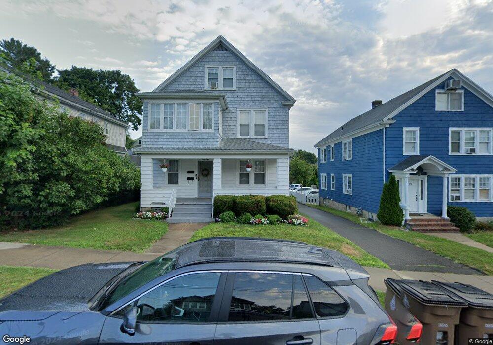
59 Plymouth Rd Stamford, CT 06906
Glenbrook NeighborhoodEstimated Value: $861,000 - $924,933
6
Beds
3
Baths
3,110
Sq Ft
$288/Sq Ft
Est. Value
About This Home
This home is located at 59 Plymouth Rd, Stamford, CT 06906 and is currently estimated at $896,483, approximately $288 per square foot. 59 Plymouth Rd is a home located in Fairfield County with nearby schools including Julia A. Stark Elementary School, Dolan School, and Stamford High School.
Ownership History
Date
Name
Owned For
Owner Type
Purchase Details
Closed on
Dec 29, 2009
Sold by
Hussey Joy A
Bought by
Olson Mary A
Current Estimated Value
Purchase Details
Closed on
Dec 14, 2009
Sold by
Olson Mary A
Bought by
Olson Mary A and Hussey Joy A
Purchase Details
Closed on
Jun 29, 1976
Bought by
Olson Mary Ann
Create a Home Valuation Report for This Property
The Home Valuation Report is an in-depth analysis detailing your home's value as well as a comparison with similar homes in the area
Home Values in the Area
Average Home Value in this Area
Purchase History
| Date | Buyer | Sale Price | Title Company |
|---|---|---|---|
| Olson Mary A | -- | -- | |
| Olson Mary A | -- | -- | |
| Olson Mary A | -- | -- | |
| Olson Mary A | -- | -- | |
| Olson Mary Ann | -- | -- |
Source: Public Records
Mortgage History
| Date | Status | Borrower | Loan Amount |
|---|---|---|---|
| Open | Olson Mary Ann | $299,000 |
Source: Public Records
Tax History Compared to Growth
Tax History
| Year | Tax Paid | Tax Assessment Tax Assessment Total Assessment is a certain percentage of the fair market value that is determined by local assessors to be the total taxable value of land and additions on the property. | Land | Improvement |
|---|---|---|---|---|
| 2025 | $12,028 | $502,830 | $205,810 | $297,020 |
| 2024 | $11,746 | $502,830 | $205,810 | $297,020 |
| 2023 | $12,691 | $502,830 | $205,810 | $297,020 |
| 2022 | $10,372 | $381,750 | $157,980 | $223,770 |
| 2021 | $10,284 | $381,750 | $157,980 | $223,770 |
| 2020 | $10,059 | $381,750 | $157,980 | $223,770 |
| 2019 | $10,059 | $381,750 | $157,980 | $223,770 |
| 2018 | $9,746 | $381,750 | $157,980 | $223,770 |
| 2017 | $7,997 | $297,400 | $132,710 | $164,690 |
| 2016 | $7,768 | $297,400 | $132,710 | $164,690 |
| 2015 | $7,563 | $297,400 | $132,710 | $164,690 |
| 2014 | $7,373 | $297,400 | $132,710 | $164,690 |
Source: Public Records
Map
Nearby Homes
- 88 Pine Hill Ave
- 59 Holbrook Dr
- 75 Coolidge Ave
- 237 Strawberry Hill Ave Unit 2
- 1 Strawberry Hill Ct Unit 2A
- 21 Holcomb Ave
- 100 Hope St Unit 10
- 100 Hope St Unit 8
- 108 Strawberry Hill Ave Unit 1
- 51 Glendale Rd
- 104 Strawberry Hill Ave Unit 2
- 31 Bellmere Ave
- 71 Strawberry Hill Ave Unit 421
- 71 Strawberry Hill Ave Unit 118
- 71 Strawberry Hill Ave Unit 203
- 71 Strawberry Hill Ave Unit 305
- 8 Windell Place
- 91 Strawberry Hill Ave Unit 1127
- 91 Strawberry Hill Ave Unit 129
- 91 Strawberry Hill Ave Unit 1128
- 55 Plymouth Rd
- 63 Plymouth Rd
- 51 Plymouth Rd
- 56 Plymouth Rd
- 67 Plymouth Rd
- 60 Plymouth Rd
- 64 Plymouth Rd
- 52 Plymouth Rd
- 71 Plymouth Rd
- 68 Plymouth Rd
- 48 Plymouth Rd
- 72 Plymouth Rd
- 43 Plymouth Rd
- 75 Plymouth Rd
- 35 Puritan Ln
- 96 Colonial Rd
- 96 Colonial Rd Unit 1ST
- 102 Colonial Rd
- 41 Puritan Ln
- 44 Plymouth Rd