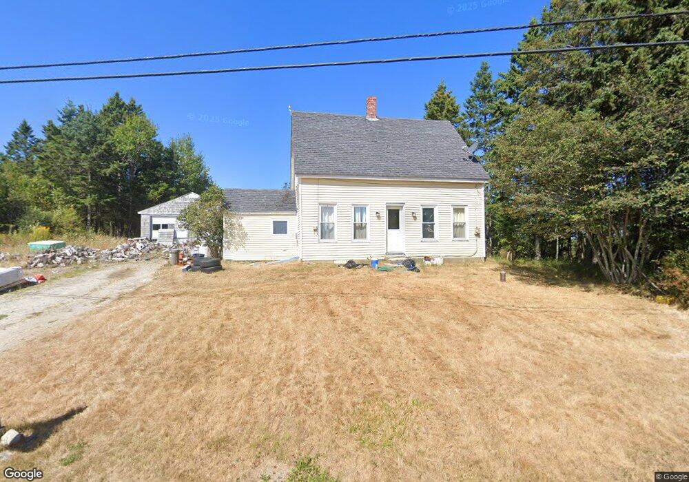
59 Ridge Rd MacHiasport, ME 04655
Estimated Value: $152,000 - $207,000
3
Beds
1
Bath
1,004
Sq Ft
$178/Sq Ft
Est. Value
About This Home
This home is located at 59 Ridge Rd, MacHiasport, ME 04655 and is currently estimated at $178,212, approximately $177 per square foot. 59 Ridge Rd is a home with nearby schools including Fort O'Brien School.
Ownership History
Date
Name
Owned For
Owner Type
Purchase Details
Closed on
Oct 2, 2025
Sold by
Stone Laurie D
Bought by
Erickson Gavin B
Current Estimated Value
Home Financials for this Owner
Home Financials are based on the most recent Mortgage that was taken out on this home.
Original Mortgage
$99,000
Outstanding Balance
$98,912
Interest Rate
6.58%
Mortgage Type
Purchase Money Mortgage
Estimated Equity
$79,300
Purchase Details
Closed on
May 26, 2022
Sold by
Good Mary J
Bought by
Stone Laurie D
Home Financials for this Owner
Home Financials are based on the most recent Mortgage that was taken out on this home.
Original Mortgage
$119,900
Interest Rate
5%
Mortgage Type
Purchase Money Mortgage
Create a Home Valuation Report for This Property
The Home Valuation Report is an in-depth analysis detailing your home's value as well as a comparison with similar homes in the area
Home Values in the Area
Average Home Value in this Area
Purchase History
| Date | Buyer | Sale Price | Title Company |
|---|---|---|---|
| Erickson Gavin B | $125,000 | -- | |
| Stone Laurie D | $129,900 | None Available |
Source: Public Records
Mortgage History
| Date | Status | Borrower | Loan Amount |
|---|---|---|---|
| Open | Erickson Gavin B | $99,000 | |
| Previous Owner | Stone Laurie D | $119,900 |
Source: Public Records
Tax History Compared to Growth
Tax History
| Year | Tax Paid | Tax Assessment Tax Assessment Total Assessment is a certain percentage of the fair market value that is determined by local assessors to be the total taxable value of land and additions on the property. | Land | Improvement |
|---|---|---|---|---|
| 2024 | $1,026 | $78,930 | $11,760 | $67,170 |
| 2023 | $921 | $73,100 | $10,780 | $62,320 |
| 2022 | $825 | $67,100 | $10,290 | $56,810 |
| 2021 | $731 | $67,100 | $10,290 | $56,810 |
| 2020 | $839 | $67,100 | $10,290 | $56,810 |
| 2019 | $972 | $56,525 | $9,605 | $46,920 |
| 2018 | $1,046 | $56,525 | $9,605 | $46,920 |
| 2017 | $989 | $56,525 | $9,605 | $46,920 |
| 2016 | $989 | $56,525 | $9,605 | $46,920 |
| 2015 | $1,029 | $56,525 | $9,605 | $46,920 |
| 2014 | $1,029 | $56,525 | $9,605 | $46,920 |
| 2013 | $1,023 | $56,525 | $9,605 | $46,920 |
Source: Public Records
Map
Nearby Homes
- 1323 Port Rd
- 47 Yoho Head Rd
- 19 Yoho Head Rd
- 14 Overlook Ln
- 246 Marsh Stream Ln
- Lot 95 N Duck Cove Rd
- 1 Puffins Ln
- MarkayEast Puffins Ln
- 604 Duck Cove Rd
- 2-2A-001-A Holway Point Rd
- Lot2A-2 Holway Rd
- 576 Port Rd
- Lot #139 Duck Cove Rd
- 366 Port Rd
- 37 Corn Hill Rd
- 4-28 Old Town Rd Old County Rd Rd
- 070 Bobcat Path
- 406 W Kennebec Rd
- 90 Johnson Cove Rd
- 787 Cutler Rd