M
Seller's Agent in 2025
Michael Misilo
eXp Realty
1 in this area
2 Total Sales
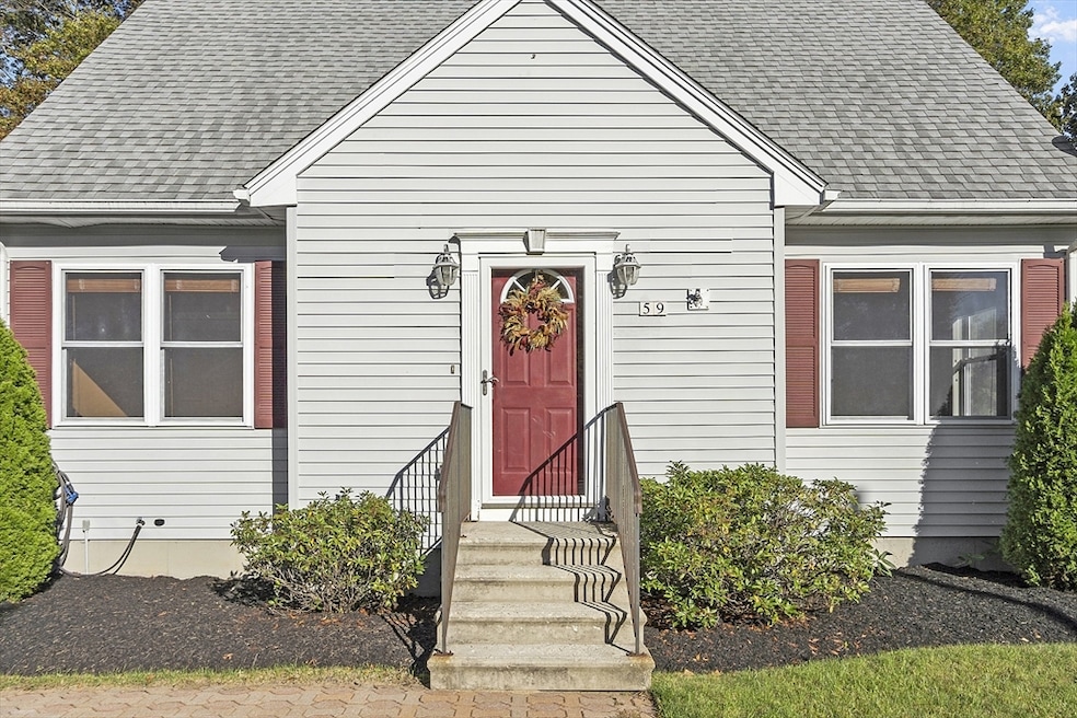
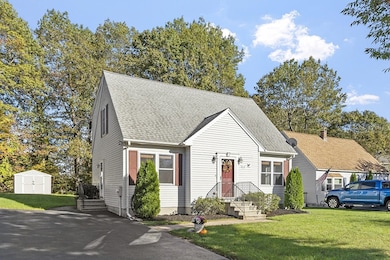
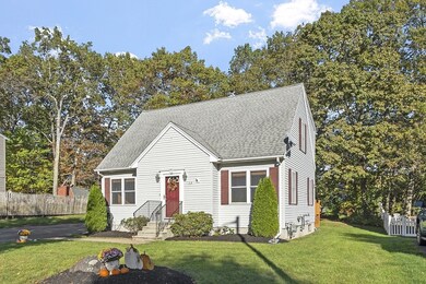
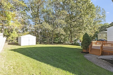
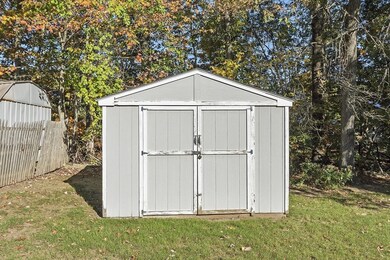
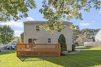
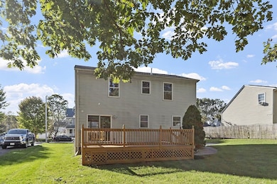
PRICE REDUCTION-Welcome to this inviting 3-bedroom, 1.5-bath Cape-style home offering comfort and convenience for today’s lifestyle. The homes main level features a bright updated kitchen and living room ideal for everyday living and entertaining. A dedicated dining area offers additional space for gatherings and meals. The flexible floor plan includes a first floor bedroom for guests or one level living. Upstairs you'll find two spacious bedrooms with ample closet space and a full bath. This home includes a full unfinished basement for future finishing opportunities. The basement is also equipped with a generator hookup adding peace of mind during seasonal storms. Step outside to enjoy a generously sized deck that overlooks a beautiful well maintained backyard. This home is Conveniently located near local amenities. Don’t miss out on this great opportunity!
| Date | Type | Sale Price | Title Company |
|---|---|---|---|
| Quit Claim Deed | $450,000 | -- | |
| Deed | $193,000 | -- | |
| Deed | $112,000 | -- | |
| Deed | $34,500 | -- |
| Date | Status | Loan Amount | Loan Type |
|---|---|---|---|
| Open | $436,500 | New Conventional | |
| Previous Owner | $74,600 | No Value Available | |
| Previous Owner | $151,000 | No Value Available | |
| Previous Owner | $150,000 | Purchase Money Mortgage |
| Date | Event | Price | List to Sale | Price per Sq Ft |
|---|---|---|---|---|
| 12/03/2025 12/03/25 | Sold | $450,000 | -6.2% | $329 / Sq Ft |
| 11/03/2025 11/03/25 | Pending | -- | -- | -- |
| 10/27/2025 10/27/25 | Price Changed | $479,900 | -4.0% | $351 / Sq Ft |
| 10/16/2025 10/16/25 | For Sale | $499,999 | -- | $365 / Sq Ft |
| Year | Tax Paid | Tax Assessment Tax Assessment Total Assessment is a certain percentage of the fair market value that is determined by local assessors to be the total taxable value of land and additions on the property. | Land | Improvement |
|---|---|---|---|---|
| 2025 | $5,123 | $388,400 | $118,300 | $270,100 |
| 2024 | $5,101 | $371,000 | $118,300 | $252,700 |
| 2023 | $4,896 | $341,400 | $102,800 | $238,600 |
| 2022 | $4,496 | $295,600 | $82,300 | $213,300 |
| 2021 | $4,277 | $262,700 | $65,800 | $196,900 |
| 2020 | $4,165 | $245,000 | $65,800 | $179,200 |
| 2019 | $3,962 | $220,100 | $59,200 | $160,900 |
| 2018 | $3,971 | $210,000 | $59,200 | $150,800 |
| 2017 | $3,800 | $197,700 | $59,200 | $138,500 |
| 2016 | $3,749 | $181,900 | $43,300 | $138,600 |
| 2015 | $3,651 | $181,900 | $43,300 | $138,600 |
| 2014 | $3,554 | $181,900 | $43,300 | $138,600 |
M
Seller's Agent in 2025
Michael Misilo
eXp Realty
1 in this area
2 Total Sales

Buyer's Agent in 2025
Nathan Clark
Your Home Sold Guaranteed Realty, The Nathan Clark Team
(401) 232-8301
1 in this area
2,079 Total Sales
Source: MLS Property Information Network (MLS PIN)
MLS Number: 73444840
APN: WORC-000053-000009D-000026
Disclaimer: Certain information contained herein is derived from information provided by parties other than Homes.com. All information provided is deemed reliable, but is not guaranteed to be accurate and should be independently verified.
![]() The property listing data and information, or the Images, set forth herein were provided to MLS Property Information Network, Inc. from third party sources, including sellers, lessors and public records, and were compiled by MLS Property Information Network, Inc. The property listing data and information, and the Images, are for the personal, non-commercial use of consumers having a good faith interest in purchasing or leasing listed properties of the type displayed to them and may not be used for any purpose other than to identify prospective properties which such consumers may have a good faith interest in purchasing or leasing. MLS Property Information Network, Inc. and its subscribers disclaim any and all representations and warranties as to the accuracy of the property listing data and information, or as to the accuracy of any of the Images, set forth herein.
The property listing data and information, or the Images, set forth herein were provided to MLS Property Information Network, Inc. from third party sources, including sellers, lessors and public records, and were compiled by MLS Property Information Network, Inc. The property listing data and information, and the Images, are for the personal, non-commercial use of consumers having a good faith interest in purchasing or leasing listed properties of the type displayed to them and may not be used for any purpose other than to identify prospective properties which such consumers may have a good faith interest in purchasing or leasing. MLS Property Information Network, Inc. and its subscribers disclaim any and all representations and warranties as to the accuracy of the property listing data and information, or as to the accuracy of any of the Images, set forth herein.
Ask me questions while you tour the home.