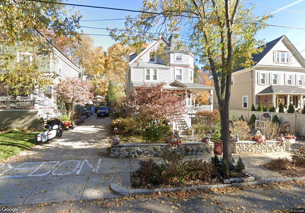
59 Sargent St Melrose, MA 02176
Melrose Highlands NeighborhoodEstimated Value: $932,000 - $1,126,000
4
Beds
1
Bath
2,041
Sq Ft
$495/Sq Ft
Est. Value
About This Home
This home is located at 59 Sargent St, Melrose, MA 02176 and is currently estimated at $1,010,041, approximately $494 per square foot. 59 Sargent St is a home located in Middlesex County with nearby schools including Horace Mann Elementary School, Roosevelt Elementary School, and Winthrop Elementary School.
Create a Home Valuation Report for This Property
The Home Valuation Report is an in-depth analysis detailing your home's value as well as a comparison with similar homes in the area
Home Values in the Area
Average Home Value in this Area
Tax History Compared to Growth
Tax History
| Year | Tax Paid | Tax Assessment Tax Assessment Total Assessment is a certain percentage of the fair market value that is determined by local assessors to be the total taxable value of land and additions on the property. | Land | Improvement |
|---|---|---|---|---|
| 2025 | $79 | $796,000 | $472,500 | $323,500 |
| 2024 | $7,693 | $774,700 | $458,600 | $316,100 |
| 2023 | $7,447 | $714,700 | $416,900 | $297,800 |
| 2022 | $7,495 | $709,100 | $416,900 | $292,200 |
| 2021 | $7,307 | $667,300 | $389,100 | $278,200 |
| 2020 | $6,914 | $625,700 | $347,400 | $278,300 |
| 2019 | $6,276 | $580,600 | $321,000 | $259,600 |
| 2018 | $6,247 | $551,400 | $291,800 | $259,600 |
| 2017 | $6,012 | $509,500 | $278,000 | $231,500 |
| 2016 | $6,081 | $493,200 | $271,000 | $222,200 |
| 2015 | $5,507 | $424,900 | $236,300 | $188,600 |
| 2014 | $5,273 | $397,100 | $208,500 | $188,600 |
Source: Public Records
Map
Nearby Homes
- 2 Overlook Rd
- 51 Melrose St Unit 1C
- 24 Ellsworth Ave
- 128 Green St Unit 128
- 569 Franklin St Unit 1
- 22 Mount Zion Rd
- 109 Linden Rd
- 225 Howard St
- 8 Crystal St Unit 2
- 8 Crystal St Unit 3
- 41 Orris St
- 24 Myrtle Ave
- 15 Shore Rd
- 65 Lincoln St
- 81 Spring St
- 1 Ludlow Ave
- 3 Hickory Hill Rd Unit 1
- 218 Upham St
- 236-238 Main St
- 220 Essex St Unit 1