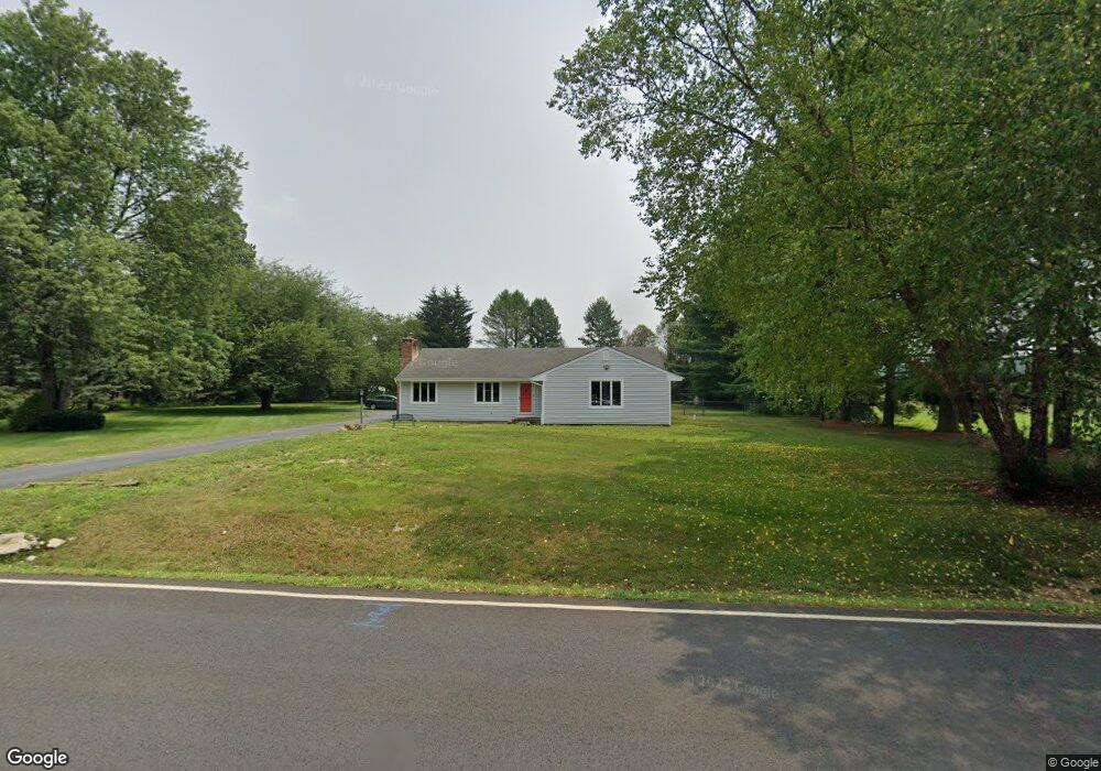
59 Scotts Corner Rd Cranbury, NJ 08512
Estimated Value: $695,541 - $916,000
--
Bed
--
Bath
2,144
Sq Ft
$367/Sq Ft
Est. Value
About This Home
This home is located at 59 Scotts Corner Rd, Cranbury, NJ 08512 and is currently estimated at $787,385, approximately $367 per square foot. 59 Scotts Corner Rd is a home located in Middlesex County with nearby schools including Town Center Elementary School, Millstone River School, and Thomas R. Grover Middle School.
Ownership History
Date
Name
Owned For
Owner Type
Purchase Details
Closed on
Nov 29, 2022
Sold by
Mary Kotz Revocable Family Trust
Bought by
Kaur Ravinder
Current Estimated Value
Home Financials for this Owner
Home Financials are based on the most recent Mortgage that was taken out on this home.
Original Mortgage
$332,500
Outstanding Balance
$321,472
Interest Rate
6.58%
Estimated Equity
$465,913
Purchase Details
Closed on
Nov 19, 2009
Sold by
Kotz Robert
Bought by
Kotz Robert
Create a Home Valuation Report for This Property
The Home Valuation Report is an in-depth analysis detailing your home's value as well as a comparison with similar homes in the area
Home Values in the Area
Average Home Value in this Area
Purchase History
| Date | Buyer | Sale Price | Title Company |
|---|---|---|---|
| Kaur Ravinder | $465,000 | Title Authority | |
| Kotz Robert | -- | None Available |
Source: Public Records
Mortgage History
| Date | Status | Borrower | Loan Amount |
|---|---|---|---|
| Open | Kaur Ravinder | $332,500 |
Source: Public Records
Tax History Compared to Growth
Tax History
| Year | Tax Paid | Tax Assessment Tax Assessment Total Assessment is a certain percentage of the fair market value that is determined by local assessors to be the total taxable value of land and additions on the property. | Land | Improvement |
|---|---|---|---|---|
| 2025 | $13,496 | $516,500 | $195,700 | $320,800 |
| 2024 | $13,171 | $516,500 | $195,700 | $320,800 |
| 2023 | $13,171 | $516,500 | $195,700 | $320,800 |
| 2022 | $12,969 | $516,500 | $195,700 | $320,800 |
| 2021 | $12,081 | $516,500 | $195,700 | $320,800 |
| 2020 | $12,355 | $516,500 | $195,700 | $320,800 |
| 2019 | $12,081 | $516,500 | $195,700 | $320,800 |
| 2018 | $11,812 | $516,500 | $195,700 | $320,800 |
| 2017 | $11,477 | $516,500 | $195,700 | $320,800 |
| 2016 | $10,970 | $516,500 | $195,700 | $320,800 |
| 2015 | $12,052 | $477,500 | $205,300 | $272,200 |
| 2014 | $11,933 | $477,500 | $205,300 | $272,200 |
Source: Public Records
Map
Nearby Homes
- 69 Franklin Dr
- 8 Mount Dr
- 22 Brewer Way Unit 25
- 26 Brewer Way
- 47 Brewer Way
- 3 Monroe Ct
- 15 Martin Way
- 45 Brewer Way
- 182 Hampshire Dr
- 9207 Tamarron Dr Unit 9207
- 199 Hampshire Dr
- 8508 Tamarron Dr
- 2415 Ravens Crest Dr
- 8408 Tamarron Dr
- 1905 Ravens Crest Dr
- 1917 Ravens Crest Dr
- 7703 Tamarron Dr
- 1812 Ravens Crest Dr
- Stanwyck Plan at Serenity Walk at Plainsboro
- 37 Brewer Way
- 59 Scotts Corner Rd
- 61 Scotts Corner Rd
- 12 Poplar Dr
- 3 Mockingbird Ln
- 1 Woodland Dr
- 14 Poplar Dr
- 1 Linden Ln
- 4 Mockingbird Ln
- 4 Mockingbird Ct
- 63 Scott Corner Rd
- 63 Scotts Corner Rd
- 3 Woodland Dr
- 4 Osprey Ln
- 1 Mockingbird Ln
- 16 Poplar Dr
- 4 Walnut Ct
- 3 S Linden Ln
- 11 Poplar Dr
- 2 Woodland Dr
- 2 Mockingbird Ln