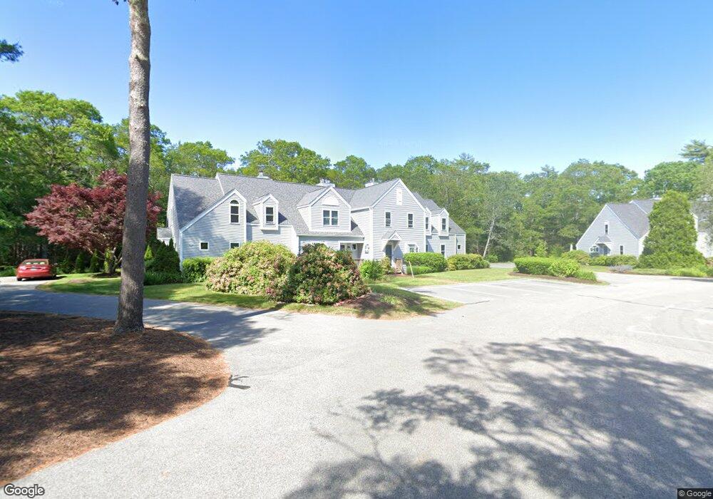
59 Southpoint Dr Sandwich, MA 02563
Estimated Value: $398,000 - $467,000
2
Beds
2
Baths
1,330
Sq Ft
$324/Sq Ft
Est. Value
About This Home
This home is located at 59 Southpoint Dr, Sandwich, MA 02563 and is currently estimated at $430,820, approximately $323 per square foot. 59 Southpoint Dr is a home located in Barnstable County with nearby schools including Sandwich Middle High School and Sandwich Montessori School.
Ownership History
Date
Name
Owned For
Owner Type
Purchase Details
Closed on
Aug 1, 2005
Sold by
Napoleone John P
Bought by
Napoleone Daniel N
Current Estimated Value
Purchase Details
Closed on
Feb 11, 2005
Sold by
Napoleone Angela
Bought by
Napoleone Daniel N
Purchase Details
Closed on
Oct 23, 2000
Sold by
Richard S Mosher T and Mosher Richard S
Bought by
Napoleone Angela and Napoleone John
Purchase Details
Closed on
Jun 26, 1996
Sold by
Kilduff Patricia R
Bought by
Mosher Richard S and Mosher Barbara S
Create a Home Valuation Report for This Property
The Home Valuation Report is an in-depth analysis detailing your home's value as well as a comparison with similar homes in the area
Home Values in the Area
Average Home Value in this Area
Purchase History
| Date | Buyer | Sale Price | Title Company |
|---|---|---|---|
| Napoleone Daniel N | $130,000 | -- | |
| Napoleone Daniel N | -- | -- | |
| Napoleone Angela | $167,500 | -- | |
| Mosher Richard S | $96,500 | -- |
Source: Public Records
Mortgage History
| Date | Status | Borrower | Loan Amount |
|---|---|---|---|
| Previous Owner | Mosher Richard S | $86,000 |
Source: Public Records
Tax History Compared to Growth
Tax History
| Year | Tax Paid | Tax Assessment Tax Assessment Total Assessment is a certain percentage of the fair market value that is determined by local assessors to be the total taxable value of land and additions on the property. | Land | Improvement |
|---|---|---|---|---|
| 2025 | $3,554 | $336,200 | $0 | $336,200 |
| 2024 | $3,452 | $319,600 | $0 | $319,600 |
| 2023 | $3,562 | $309,700 | $0 | $309,700 |
| 2022 | $3,574 | $271,600 | $0 | $271,600 |
| 2021 | $3,437 | $249,600 | $0 | $249,600 |
| 2020 | $3,356 | $234,500 | $0 | $234,500 |
| 2019 | $3,138 | $219,100 | $0 | $219,100 |
| 2018 | $3,087 | $216,000 | $0 | $216,000 |
| 2017 | $3,065 | $205,300 | $0 | $205,300 |
| 2016 | $2,893 | $199,900 | $0 | $199,900 |
| 2015 | $2,908 | $196,200 | $0 | $196,200 |
Source: Public Records
Map
Nearby Homes
- 59 Southpoint Dr Unit 59
- 58 Southpoint Dr Unit J
- 5 Aviators Ln
- 22 Sconset Cir
- 3 Glenwood Ln
- 93 Deerfield Rd
- 10 Wintergreen Ln
- 185 Cotuit Rd Unit BE4
- 185 Cotuit Rd Unit JP1
- 185 Cotuit Rd Unit C5 Aspen
- 15 Hunters Tr
- 15 Hunters Trail
- 96 Pimlico Pond Rd
- 7 Open Trail Rd
- 6 Southfield Ln
- 3 Anne Cir
- 4 Lan Rd
- 18 Katian Way
- 57 Southpoint Dr Unit J
- 14 Southpoint Dr Unit 14
- 14 Southpoint Dr Unit 64 K
- 57 Southpoint Dr
- 44 Southpoint Dr
- 19 Southpoint Dr
- 14 Southpoint Dr
- 57 Southpoint Dr Unit J57
- 57 Southpoint Dr Unit 57J
- 57j Southpoint Dr
- 19 Southpoint Dr Unit C
- 57 Southpoint Dr Unit J
- 64 Southpoint Dr Unit K
- 64 Southpoint Dr
- 61 Southpoint Dr
- 49 Southpoint Dr
- 48 Southpoint Dr
- 21 Southpoint Dr
- 17 Southpoint Dr
- 9 Southpoint Dr