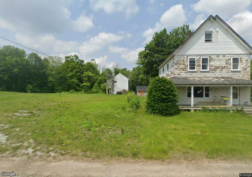
59 State Rt 23 Franklin, NJ 07416
Studio
--
Bath
1,152
Sq Ft
0.67
Acres
About This Home
This home is located at 59 State Rt 23, Franklin, NJ 07416. 59 State Rt 23 is a home located in Sussex County with nearby schools including Franklin Elementary School, Wallkill Valley Regional High School, and Immaculate Conception Regional School.
Ownership History
Date
Name
Owned For
Owner Type
Purchase Details
Closed on
Jul 20, 2023
Sold by
53-55-59 Route 23 Llc
Bought by
Adris Property Llc
Purchase Details
Closed on
Aug 30, 2021
Sold by
Purani Surnitra B
Bought by
5355-59 Route 23 Llc
Home Financials for this Owner
Home Financials are based on the most recent Mortgage that was taken out on this home.
Original Mortgage
$63,750
Interest Rate
5.1%
Mortgage Type
New Conventional
Purchase Details
Closed on
Feb 15, 1999
Sold by
Purani Ramakant R and Purani Bipin R
Bought by
Purani Bipin R
Create a Home Valuation Report for This Property
The Home Valuation Report is an in-depth analysis detailing your home's value as well as a comparison with similar homes in the area
Home Values in the Area
Average Home Value in this Area
Purchase History
| Date | Buyer | Sale Price | Title Company |
|---|---|---|---|
| Adris Property Llc | $175,000 | Chicago Title | |
| 5355-59 Route 23 Llc | $75,000 | Residential Commercial Title | |
| Purani Bipin R | -- | -- |
Source: Public Records
Mortgage History
| Date | Status | Borrower | Loan Amount |
|---|---|---|---|
| Previous Owner | 5355-59 Route 23 Llc | $63,750 |
Source: Public Records
Tax History
| Year | Tax Paid | Tax Assessment Tax Assessment Total Assessment is a certain percentage of the fair market value that is determined by local assessors to be the total taxable value of land and additions on the property. | Land | Improvement |
|---|---|---|---|---|
| 2025 | $13,238 | $110,000 | $110,000 | -- |
| 2024 | $13,752 | $498,800 | $498,800 | $0 |
Source: Public Records
Map
Nearby Homes
- 69 New Jersey 23
- 109 Munsonhurst Rd
- 11 Zimmer Dr
- 111 Munsonhurst Rd
- 113 Munsonhurst Rd
- 65 Buckwheat Rd
- 34 Ben Franklin Dr
- 8 Fowler St Unit 10
- 149 Maple Rd
- 52 High St
- 62 High St
- 63 Liberty Ln Unit 7
- 35 Liberty Ln Unit Y2
- 7 Fox Hill Dr
- 20 High Point CI
- 70 Davis Rd
- 66 Nestor St
- 276 Wild Cat Rd
- 270 Munsonhurst Rd
- 19-21 John Wilton St
- 59 State Rt 23
- 59 New Jersey 23
- 63 State Rt 23
- 63 New Jersey 23
- 53-55 New Jersey 23
- 53 State Rt 23 Unit 55
- 69 New Jersey 23 Unit 4
- 51 Route 23 Unit 3
- 51 Route 23 Unit 2 Unit 2
- 51 Old Route 23
- 51 New Jersey 23 Unit 1
- 51 State Rt 23 Unit D
- 51 Route 23 Unit 1
- 51 State Rt 23 Unit A
- 51 State Rt 23 Unit 1
- 51 State Rt 23
- 51 State Rt 23 Unit 3
- 75 State Rt 23
- 68 New Jersey 23 Unit 1
- 68 New Jersey 23