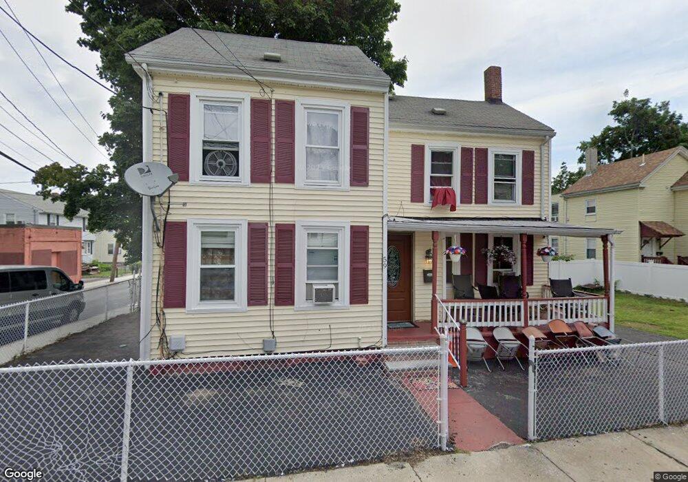
59 Sturbridge St Mattapan, MA 02126
West Codman Hill-West Lowe NeighborhoodEstimated Value: $571,000 - $631,000
2
Beds
2
Baths
1,349
Sq Ft
$450/Sq Ft
Est. Value
About This Home
This home is located at 59 Sturbridge St, Mattapan, MA 02126 and is currently estimated at $606,944, approximately $449 per square foot. 59 Sturbridge St is a home located in Suffolk County with nearby schools including Conservatory Lab Upper School, Saint John Paul II Catholic Academy, and Epiphany School.
Ownership History
Date
Name
Owned For
Owner Type
Purchase Details
Closed on
Jul 18, 2025
Sold by
Petion Bernadette
Bought by
Cineus Cassandra
Current Estimated Value
Purchase Details
Closed on
Oct 20, 2003
Sold by
Petion Beradette and Cineus Gerard Y
Bought by
Petion Bernadette
Purchase Details
Closed on
Dec 7, 1992
Sold by
Walsh Jean H
Bought by
Petion Bernardette and Cineus Gerard T
Home Financials for this Owner
Home Financials are based on the most recent Mortgage that was taken out on this home.
Original Mortgage
$61,750
Interest Rate
8.22%
Mortgage Type
Purchase Money Mortgage
Create a Home Valuation Report for This Property
The Home Valuation Report is an in-depth analysis detailing your home's value as well as a comparison with similar homes in the area
Home Values in the Area
Average Home Value in this Area
Purchase History
| Date | Buyer | Sale Price | Title Company |
|---|---|---|---|
| Cineus Cassandra | -- | -- | |
| Cineus Cassandra | -- | -- | |
| Petion Bernadette | -- | -- | |
| Petion Bernadette | -- | -- | |
| Petion Bernardette | $65,000 | -- | |
| Petion Bernardette | $65,000 | -- |
Source: Public Records
Mortgage History
| Date | Status | Borrower | Loan Amount |
|---|---|---|---|
| Previous Owner | Petion Bernardette | $160,000 | |
| Previous Owner | Petion Bernardette | $61,750 |
Source: Public Records
Tax History
| Year | Tax Paid | Tax Assessment Tax Assessment Total Assessment is a certain percentage of the fair market value that is determined by local assessors to be the total taxable value of land and additions on the property. | Land | Improvement |
|---|---|---|---|---|
| 2025 | $5,932 | $512,300 | $143,000 | $369,300 |
| 2024 | $5,280 | $484,400 | $140,200 | $344,200 |
| 2023 | $5,003 | $465,800 | $134,800 | $331,000 |
| 2022 | $4,693 | $431,300 | $124,800 | $306,500 |
| 2021 | $4,485 | $420,300 | $124,800 | $295,500 |
| 2020 | $4,247 | $402,200 | $122,000 | $280,200 |
| 2019 | $3,925 | $372,400 | $94,000 | $278,400 |
| 2018 | $3,562 | $339,900 | $94,000 | $245,900 |
| 2017 | $3,395 | $320,600 | $94,000 | $226,600 |
| 2016 | $3,266 | $296,900 | $94,000 | $202,900 |
| 2015 | $3,268 | $269,900 | $88,900 | $181,000 |
| 2014 | $3,171 | $252,100 | $88,900 | $163,200 |
Source: Public Records
Map
Nearby Homes
- 67 Idaho St
- 35 Standard St
- 23 Maryknoll St
- 14 Avondale St
- 30 Pleasant Hill Ave Unit 32
- 1241-1255 Adams St Unit F213
- 1241-1255 Adams St Unit B302
- 1245 Adams St Unit B503
- 14 Valley Rd
- 88 Wharf St Unit 105
- 988 Morton St
- 56 Fairmount St Unit 2
- 57 Fairmount St Unit A
- 20 Fairmount St
- 2 Ogden St Unit 1
- 2089 Dorchester Ave Unit 1
- 99 Capen St
- 124 Selden St
- 64 Stockton St
- 139 Selden St
- 55 Sturbridge St Unit 1
- 55 Sturbridge St Unit 3
- 55 Sturbridge St Unit 2
- 58 Sanford St
- 64 Sanford St
- 56 Sturbridge St
- 65 Sanford St
- 3 Caddy Rd Unit 3
- 47 Sturbridge St Unit 49
- 69 Sanford St Unit 69
- 1 Caddy Rd
- 48 Sturbridge St
- 63 Sanford St
- 5 Caddy Rd
- 47-49 Sturbridge St Unit 1
- 47-49 Sturbridge St
- 70 Sanford St Unit 72
- 70 Sanford St Unit 1
- 72 Sanford St Unit 1
- 72 Sanford St Unit 72
Your Personal Tour Guide
Ask me questions while you tour the home.