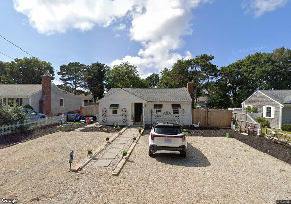
59 Susan Ruth Rd Dennis Port, MA 02639
Dennis Port NeighborhoodEstimated Value: $440,000 - $678,000
2
Beds
1
Bath
918
Sq Ft
$575/Sq Ft
Est. Value
About This Home
This home is located at 59 Susan Ruth Rd, Dennis Port, MA 02639 and is currently estimated at $527,416, approximately $574 per square foot. 59 Susan Ruth Rd is a home located in Barnstable County with nearby schools including Dennis-Yarmouth Regional High School and St. Pius X. School.
Ownership History
Date
Name
Owned For
Owner Type
Purchase Details
Closed on
Aug 13, 2013
Sold by
Mcgibbon Cape Cod T R and Mcgibbon Mcghee
Bought by
Mcghee Glenn G
Current Estimated Value
Purchase Details
Closed on
Jun 17, 2004
Sold by
Mcghee Carol J and Mcghee Glenn G
Bought by
Mcghee Carol J and Mcghee Glenn G
Purchase Details
Closed on
May 28, 2004
Sold by
Mcghee Carol J and Mcghee Carole J
Bought by
Mcghee Carol J and Mcghee Glenn G
Create a Home Valuation Report for This Property
The Home Valuation Report is an in-depth analysis detailing your home's value as well as a comparison with similar homes in the area
Home Values in the Area
Average Home Value in this Area
Purchase History
| Date | Buyer | Sale Price | Title Company |
|---|---|---|---|
| Mcghee Glenn G | -- | -- | |
| Mcghee Glenn G | -- | -- | |
| Mcghee Carol J | -- | -- | |
| Mcghee Carol J | $176,666 | -- |
Source: Public Records
Tax History Compared to Growth
Tax History
| Year | Tax Paid | Tax Assessment Tax Assessment Total Assessment is a certain percentage of the fair market value that is determined by local assessors to be the total taxable value of land and additions on the property. | Land | Improvement |
|---|---|---|---|---|
| 2025 | $2,272 | $524,700 | $283,900 | $240,800 |
| 2024 | $2,141 | $487,700 | $273,000 | $214,700 |
| 2023 | $2,071 | $443,400 | $248,200 | $195,200 |
| 2022 | $1,923 | $343,400 | $195,600 | $147,800 |
| 2021 | $3,476 | $312,900 | $191,800 | $121,100 |
| 2020 | $1,840 | $301,700 | $191,800 | $109,900 |
| 2019 | $1,862 | $301,800 | $204,200 | $97,600 |
| 2018 | $3,146 | $283,100 | $194,400 | $88,700 |
| 2017 | $1,629 | $264,800 | $179,000 | $85,800 |
| 2016 | $1,570 | $240,500 | $168,800 | $71,700 |
| 2015 | $1,539 | $240,500 | $168,800 | $71,700 |
| 2014 | $1,462 | $230,300 | $158,600 | $71,700 |
Source: Public Records
Map
Nearby Homes
- 37 Ocean Dr Unit 2
- 64 Beaten Rd
- 112 Old Wharf Rd Unit E4
- 112 Old Wharf Rd Unit E1
- 120 Old Wharf Rd Unit 11
- 154 Old Wharf Rd Unit 26
- 154 Old Wharf Rd Unit 14
- 217 Old Wharf Rd Unit 64
- 80 Michaels Ave
- 241 Old Wharf Rd Unit 82
- 241 Old Wharf Rd Unit 127
- 241 Old Wharf Rd Unit 90
- 31 Easy St
- 262 Old Wharf Rd Unit 67
- 262 Old Wharf Rd Unit 5
- 262 Old Wharf Rd Unit 5
- 262 Old Wharf Rd Unit 20
- 262 Old Wharf Rd Unit 87
- 37 Beach Hills Rd
- 6 Baker Way
- 55 Susan Ruth Rd
- 53 Susan Ruth Rd
- 49 Susan Ruth Rd
- 61 Susan Ruth Rd
- 50 Ocean Dr
- 65 Beaten Rd
- 48 Ocean Dr
- 57 Beaten Rd
- 52 Ocean Dr
- 67 Beaten Rd
- 44 Ocean Dr
- 65 Susan Ruth Rd
- 53 Beaten Rd
- 69 Susan Ruth Rd
- 54 Ocean Dr
- 40 Ocean Dr
- 69 Beaten Rd Unit 13
- 69 Beaten Rd Unit 8
- 69 Beaten Rd Unit 4
- 69 Beaten Rd Unit 12