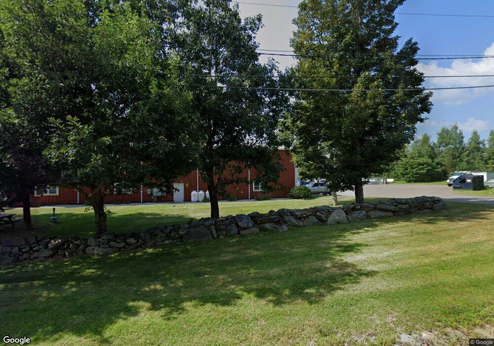
59 Technology Park Rd Sturbridge, MA 01566
Estimated Value: $2,719,123
--
Bed
--
Bath
4,000
Sq Ft
$680/Sq Ft
Est. Value
About This Home
This home is located at 59 Technology Park Rd, Sturbridge, MA 01566 and is currently estimated at $2,719,123, approximately $679 per square foot. 59 Technology Park Rd is a home located in Worcester County with nearby schools including Burgess Elementary School, Tantasqua Regional Junior High School, and Tantasqua Regional High School.
Ownership History
Date
Name
Owned For
Owner Type
Purchase Details
Closed on
Oct 5, 2015
Sold by
Pioneer Oil Llc
Bought by
Sail Energy Llc
Current Estimated Value
Home Financials for this Owner
Home Financials are based on the most recent Mortgage that was taken out on this home.
Original Mortgage
$1,272,000
Outstanding Balance
$1,003,169
Interest Rate
3.95%
Mortgage Type
Commercial
Estimated Equity
$1,715,954
Create a Home Valuation Report for This Property
The Home Valuation Report is an in-depth analysis detailing your home's value as well as a comparison with similar homes in the area
Home Values in the Area
Average Home Value in this Area
Purchase History
| Date | Buyer | Sale Price | Title Company |
|---|---|---|---|
| Sail Energy Llc | $1,300,000 | -- |
Source: Public Records
Mortgage History
| Date | Status | Borrower | Loan Amount |
|---|---|---|---|
| Open | Sail Energy Llc | $1,272,000 |
Source: Public Records
Tax History Compared to Growth
Tax History
| Year | Tax Paid | Tax Assessment Tax Assessment Total Assessment is a certain percentage of the fair market value that is determined by local assessors to be the total taxable value of land and additions on the property. | Land | Improvement |
|---|---|---|---|---|
| 2025 | $12,680 | $796,000 | $143,600 | $652,400 |
| 2024 | $12,674 | $768,600 | $140,500 | $628,100 |
| 2023 | $12,998 | $719,300 | $122,000 | $597,300 |
| 2022 | $11,802 | $616,300 | $108,700 | $507,600 |
| 2021 | $12,327 | $648,100 | $108,700 | $539,400 |
| 2020 | $12,327 | $648,100 | $108,700 | $539,400 |
| 2019 | $12,135 | $633,700 | $111,600 | $522,100 |
| 2018 | $12,146 | $624,800 | $106,400 | $518,400 |
| 2017 | $11,879 | $612,300 | $102,700 | $509,600 |
| 2016 | $11,712 | $609,700 | $99,800 | $509,900 |
| 2015 | $11,169 | $580,500 | $99,800 | $480,700 |
Source: Public Records
Map
Nearby Homes
- 7 Woodlawn Dr
- 1 Chase Rd
- 101 Mcgilpin Rd
- 149 Berry Corner Rd
- 20 Audubon Way
- 41 Bushnell Rd
- 150 Podunk Rd
- 0 Fiske Hill Rd
- 2 Sprucedale Dr
- 86 Berry Corner Rd
- 29 Sampson Rd
- 6 Jerry Rd
- 73 New Boston Rd
- 29, 31, 33 Ladd Rd
- 22 Mountain Brook Rd
- 6 Mcgilpin Rd
- 43 Mountain Brook Rd
- 14 Maple St
- 28 Woodside Cir
- 7 Haynes St
- 51 Technology Park Rd
- 1 Picker Rd
- 1000 Fiske Hill Rd
- 000 Fiske Hill Rd
- 000 Fiske Hill Rd
- 1000 Fiske Hill Rd Unit 1
- 251 Fiske Hill Rd
- 244 Fiske Hill Rd
- 1 Old Village Rd
- 64 Walker Pond Rd
- Lot 1 Route 20
- 63 Walker Pond Rd
- 3 Old Village Rd
- 246 Fiske Hill Rd
- LOT 13 Mcgregory
- Lot 43 Audubon Way
- LOT 15 Paradise Ln
- 6 Old Village Rd
- 8 Wells Park Rd
- 5 Wells Park Rd