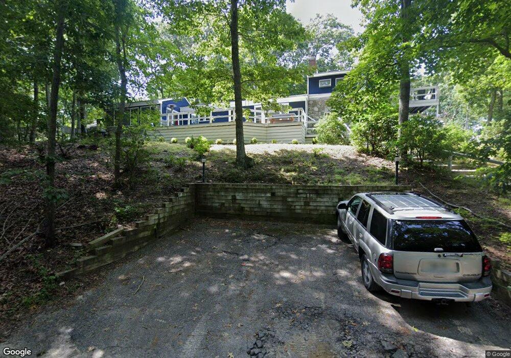
59 Whalebone Landing Rd Southampton, NY 11968
Estimated Value: $1,145,000 - $2,200,000
4
Beds
2
Baths
2,200
Sq Ft
$760/Sq Ft
Est. Value
About This Home
This home is located at 59 Whalebone Landing Rd, Southampton, NY 11968 and is currently estimated at $1,672,486, approximately $760 per square foot. 59 Whalebone Landing Rd is a home located in Suffolk County with nearby schools including Southampton Elementary School, Southampton Intermediate School, and Southampton High School.
Ownership History
Date
Name
Owned For
Owner Type
Purchase Details
Closed on
Dec 15, 2022
Sold by
Koke Christopher T and Paunikar Pooja
Bought by
Deaddio Jenna and Deaddio Michael
Current Estimated Value
Home Financials for this Owner
Home Financials are based on the most recent Mortgage that was taken out on this home.
Original Mortgage
$800,000
Interest Rate
4.8%
Mortgage Type
Purchase Money Mortgage
Purchase Details
Closed on
Oct 3, 2019
Sold by
Cullen John P Est and Cullen
Bought by
Koke Christopher T and Paunikar Pooja
Home Financials for this Owner
Home Financials are based on the most recent Mortgage that was taken out on this home.
Original Mortgage
$878,750
Interest Rate
3.63%
Mortgage Type
Adjustable Rate Mortgage/ARM
Create a Home Valuation Report for This Property
The Home Valuation Report is an in-depth analysis detailing your home's value as well as a comparison with similar homes in the area
Home Values in the Area
Average Home Value in this Area
Purchase History
| Date | Buyer | Sale Price | Title Company |
|---|---|---|---|
| Deaddio Jenna | $1,297,000 | None Available | |
| Koke Christopher T | $925,000 | None Available |
Source: Public Records
Mortgage History
| Date | Status | Borrower | Loan Amount |
|---|---|---|---|
| Previous Owner | Deaddio Jenna | $800,000 | |
| Previous Owner | Koke Christopher T | $878,750 |
Source: Public Records
Tax History Compared to Growth
Tax History
| Year | Tax Paid | Tax Assessment Tax Assessment Total Assessment is a certain percentage of the fair market value that is determined by local assessors to be the total taxable value of land and additions on the property. | Land | Improvement |
|---|---|---|---|---|
| 2024 | $3,428 | $780,200 | $404,600 | $375,600 |
| 2023 | $3,428 | $780,200 | $404,600 | $375,600 |
| 2022 | $3,253 | $780,200 | $404,600 | $375,600 |
| 2021 | $3,253 | $760,900 | $385,300 | $375,600 |
| 2020 | $2,856 | $765,600 | $385,300 | $380,300 |
| 2019 | $2,856 | $0 | $0 | $0 |
| 2018 | -- | $733,900 | $385,300 | $348,600 |
| 2017 | $2,994 | $733,900 | $385,300 | $348,600 |
| 2016 | $3,094 | $733,900 | $385,300 | $348,600 |
| 2015 | -- | $733,900 | $385,300 | $348,600 |
| 2014 | -- | $733,900 | $385,300 | $348,600 |
Source: Public Records
Map
Nearby Homes
- 59 Whalebone Landing Rd
- 40 Scrimshaw Dr
- 28 Bay View Rd N
- 22 Bay View Rd W
- 40 Highlands Dr
- 22 Fern Rd
- 31 Rolling Hill Ct W
- 2222 Noyack Rd
- 26 Pine Tree Rd
- 9 Shadyrest Dr
- 14 Oak Grove Rd
- 24 Shadyrest Dr
- 125 Laurel Valley Dr
- 2587 Deerfield Rd
- 2421 Noyac Rd
- 2268 Deerfield Rd
- 2524 Noyack Rd
- 2885 Deerfield Rd
- 86 Roses Grove Rd
- 37 Peconic Bay Ave
- 61 Whalebone Landin Rd
- 61 Whalebone Landing Rd
- 66 Whalebone Landing Rd
- 65 Whalebone Landing Rd
- 53 Whalebone Landing Rd
- 69 Whalebone Landing Rd
- 67 Whalebone Landing Rd
- 70 Whalebone Landing Rd
- 63 Whalebone Landing Rd
- 17 Larboard Dr
- 15 Larboard Dr
- 17 Scrimshaw Dr
- 74 Whalebone Landing Rd
- 43 Scrimshaw Dr
- 1769 Noyack Rd
- 75 Whalebone Landing Rd
- 47 Whalebone Landing Rd
- 50 Whalebone Landing Rd
- 78 Whalebone Landing Rd
- 1771 Noyack Rd