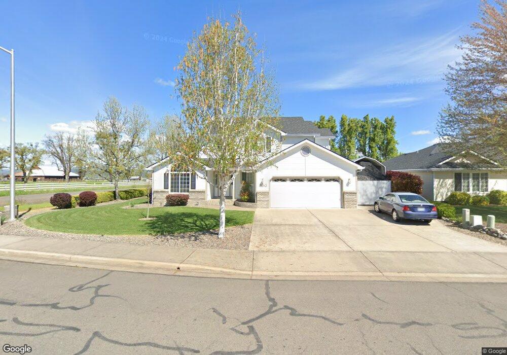
590 Mitchell Way Central Point, OR 97502
Estimated Value: $470,814 - $532,000
3
Beds
2
Baths
1,844
Sq Ft
$274/Sq Ft
Est. Value
About This Home
This home is located at 590 Mitchell Way, Central Point, OR 97502 and is currently estimated at $504,454, approximately $273 per square foot. 590 Mitchell Way is a home located in Jackson County with nearby schools including Richardson Elementary School, Scenic Middle School, and Crater High School.
Ownership History
Date
Name
Owned For
Owner Type
Purchase Details
Closed on
Aug 18, 1998
Sold by
Tom Malot Construction Co Inc
Bought by
Campbell Rick A and Campbell Debora L
Current Estimated Value
Home Financials for this Owner
Home Financials are based on the most recent Mortgage that was taken out on this home.
Original Mortgage
$134,150
Outstanding Balance
$25,711
Interest Rate
6.88%
Estimated Equity
$478,743
Purchase Details
Closed on
Apr 28, 1998
Sold by
Suncrest Homes Llc
Bought by
Tom Malot Construction Co Inc
Purchase Details
Closed on
Jan 29, 1998
Sold by
Corporation Of The Presiding Bishop Of
Bought by
Suncrest Homes Llc
Purchase Details
Closed on
Oct 2, 1997
Sold by
Kimmons Charlene D
Bought by
Suncrest Llc
Create a Home Valuation Report for This Property
The Home Valuation Report is an in-depth analysis detailing your home's value as well as a comparison with similar homes in the area
Purchase History
| Date | Buyer | Sale Price | Title Company |
|---|---|---|---|
| Campbell Rick A | $167,729 | Key Title Company | |
| Tom Malot Construction Co Inc | $608,000 | Jackson County Title | |
| Suncrest Homes Llc | -- | Jackson County Title | |
| Suncrest Llc | $160,000 | Crater Title Insurance |
Source: Public Records
Mortgage History
| Date | Status | Borrower | Loan Amount |
|---|---|---|---|
| Open | Campbell Rick A | $134,150 |
Source: Public Records
Tax History Compared to Growth
Tax History
| Year | Tax Paid | Tax Assessment Tax Assessment Total Assessment is a certain percentage of the fair market value that is determined by local assessors to be the total taxable value of land and additions on the property. | Land | Improvement |
|---|---|---|---|---|
| 2026 | $5,075 | $301,480 | $148,000 | $153,480 |
| 2025 | $4,951 | $297,770 | $120,110 | $177,660 |
| 2024 | $4,951 | $289,100 | $116,610 | $172,490 |
| 2023 | $4,791 | $280,680 | $113,220 | $167,460 |
| 2022 | $4,680 | $280,680 | $113,220 | $167,460 |
| 2021 | $4,546 | $272,510 | $109,920 | $162,590 |
| 2020 | $4,413 | $264,580 | $106,720 | $157,860 |
| 2019 | $4,304 | $249,400 | $100,600 | $148,800 |
| 2018 | $4,173 | $242,140 | $97,670 | $144,470 |
| 2017 | $4,068 | $242,140 | $97,670 | $144,470 |
| 2016 | $3,950 | $228,250 | $92,070 | $136,180 |
| 2015 | $3,784 | $228,250 | $92,070 | $136,180 |
| 2014 | $3,688 | $215,160 | $86,780 | $128,380 |
Source: Public Records
Map
Nearby Homes
- 420 Mayberry Ln
- 407 Silver Creek Dr
- 1134 Steamboat Dr
- 2021 Taylor Rd
- 626 Griffin Oaks Dr
- 606 Blue Moon Dr
- 166 Nadine Ln
- 21 Hickory Ln
- 349 W Pine St
- 465 Creekside Cir
- 0 Boulder Ridge St
- 3307 Freeland Rd
- 1167 Boulder Ridge St
- 1317 River Run St
- 545 Bridge Creek Dr
- 3220 Freeland Rd
- 348 Cascade Dr
- 871 Holley Way
- 369 Cascade Dr
- 342 Hazel St
- 582 Mitchell Way
- 3834 Grant Rd
- 574 Mitchell Way
- 3832 Grant Rd
- 566 Mitchell Way
- 575 Mitchell Way
- 567 Mitchell Way
- 558 Mitchell Way
- 345 Meadow Lark Way
- 557 Mitchell Way
- 340 Meadow Lark Way
- 550 Mitchell Way
- 335 Meadow Lark Way
- 551 Mitchell Way
- 542 Mitchell Way
- 330 Meadow Lark Way
- 543 Mitchell Way
- 0 Meadow Lark Way
- 3817 Grant Rd
- 325 Meadow Lark Way