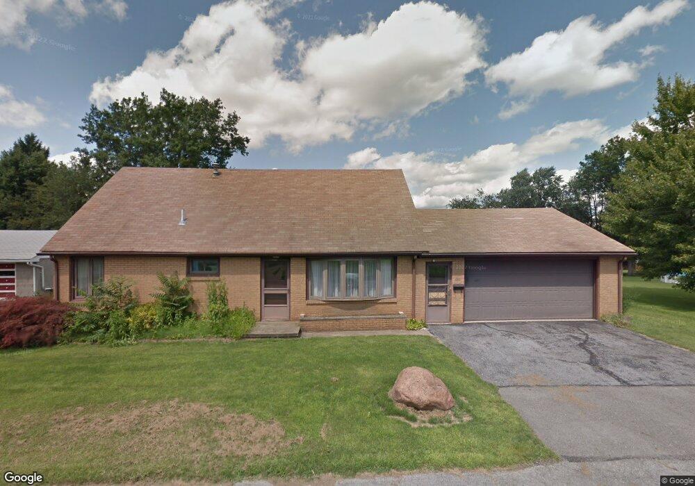
590 Quarry Way Sharpsville, PA 16150
Estimated Value: $116,877 - $208,000
4
Beds
3
Baths
--
Sq Ft
0.49
Acres
About This Home
This home is located at 590 Quarry Way, Sharpsville, PA 16150 and is currently estimated at $171,219. 590 Quarry Way is a home located in Mercer County with nearby schools including Sharpsville Area Elementary School, Sharpsville Area Middle School, and Sharpsville Area Senior High School.
Ownership History
Date
Name
Owned For
Owner Type
Purchase Details
Closed on
May 2, 2017
Sold by
Boca Frank A
Bought by
Prosser Jason
Current Estimated Value
Home Financials for this Owner
Home Financials are based on the most recent Mortgage that was taken out on this home.
Original Mortgage
$80,510
Outstanding Balance
$67,114
Interest Rate
4.1%
Mortgage Type
New Conventional
Estimated Equity
$104,105
Create a Home Valuation Report for This Property
The Home Valuation Report is an in-depth analysis detailing your home's value as well as a comparison with similar homes in the area
Home Values in the Area
Average Home Value in this Area
Purchase History
| Date | Buyer | Sale Price | Title Company |
|---|---|---|---|
| Prosser Jason | $83,000 | None Available |
Source: Public Records
Mortgage History
| Date | Status | Borrower | Loan Amount |
|---|---|---|---|
| Open | Prosser Jason | $32,500 | |
| Open | Prosser Jason | $80,510 |
Source: Public Records
Tax History Compared to Growth
Tax History
| Year | Tax Paid | Tax Assessment Tax Assessment Total Assessment is a certain percentage of the fair market value that is determined by local assessors to be the total taxable value of land and additions on the property. | Land | Improvement |
|---|---|---|---|---|
| 2025 | $2,832 | $20,700 | $2,100 | $18,600 |
| 2024 | $2,832 | $20,700 | $2,100 | $18,600 |
| 2023 | $2,760 | $20,700 | $2,100 | $18,600 |
| 2022 | $2,708 | $20,700 | $2,100 | $18,600 |
| 2021 | $2,708 | $20,700 | $2,100 | $18,600 |
| 2020 | $2,677 | $20,700 | $2,100 | $18,600 |
| 2019 | $2,636 | $20,700 | $2,100 | $18,600 |
| 2018 | $2,548 | $20,700 | $2,100 | $18,600 |
| 2017 | $2,558 | $20,700 | $2,100 | $18,600 |
| 2016 | -- | $20,700 | $2,100 | $18,600 |
| 2015 | -- | $20,700 | $2,100 | $18,600 |
| 2014 | -- | $20,700 | $2,100 | $18,600 |
Source: Public Records
Map
Nearby Homes
- 498 S 7th St
- 570 S 7th St
- 890 Woodland Rd
- 585 S 8th St
- 331 S 9th St
- 433 W Ridge Ave
- 934 W Ridge Ave
- 109 W Ridge Ave
- 50 Davis Dr
- 143 S Walnut St
- 1107 W Ridge Ave
- 1263 Monticello Ave
- 1700 Forker Blvd
- 2220 Wakefield Dr
- 1370 Coronado Dr
- 114 Prospect St
- 1428 W Ridge Ave
- 1506 Skyline Dr
- 1524 W Ridge Ave
- 736 Richmond Dr