Estimated Value: $206,734 - $223,000
3
Beds
2
Baths
1,040
Sq Ft
$205/Sq Ft
Est. Value
About This Home
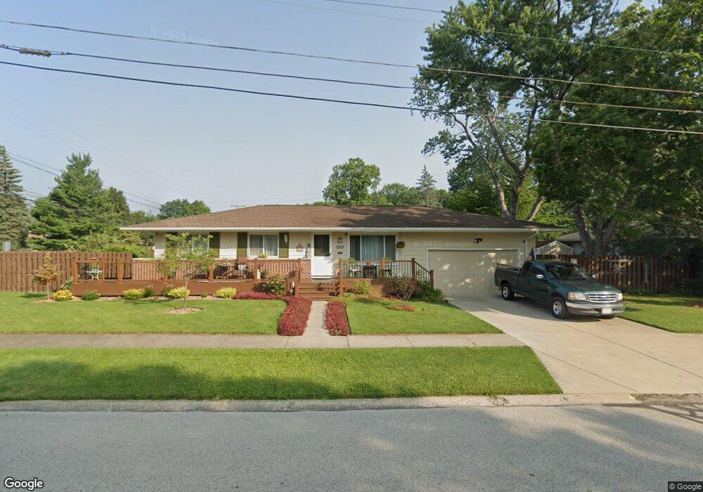
This home is located at 590 Sherry Ln, Berea, OH 44017 and is currently estimated at $213,434, approximately $205 per square foot. 590 Sherry Ln is a home with nearby schools including Grindstone Elementary School, Berea-Midpark Middle School, and Berea-Midpark High School.
Ownership History
Date
Name
Owned For
Owner Type
Purchase Details
Closed on
Aug 19, 1988
Sold by
Weaver Thomas
Bought by
Cordon Patrick J
Current Estimated Value
Purchase Details
Closed on
Sep 4, 1986
Sold by
Weaver Michael P
Bought by
Weaver Thomas
Purchase Details
Closed on
Sep 27, 1985
Sold by
Schultz Debra
Bought by
Weaver Michael P
Purchase Details
Closed on
Jun 21, 1985
Sold by
Schultz William
Bought by
Schultz Debra
Purchase Details
Closed on
Jun 18, 1976
Sold by
Frank Helge G and Frank Dolores F
Bought by
Schultz William
Purchase Details
Closed on
Jan 1, 1975
Bought by
Frank Helge G and Frank Dolores F
Create a Home Valuation Report for This Property
The Home Valuation Report is an in-depth analysis detailing your home's value as well as a comparison with similar homes in the area
Home Values in the Area
Average Home Value in this Area
Purchase History
| Date | Buyer | Sale Price | Title Company |
|---|---|---|---|
| Cordon Patrick J | $74,700 | -- | |
| Weaver Thomas | -- | -- | |
| Weaver Michael P | $62,000 | -- | |
| Schultz Debra | -- | -- | |
| Schultz William | $45,000 | -- | |
| Frank Helge G | -- | -- |
Source: Public Records
Tax History
| Year | Tax Paid | Tax Assessment Tax Assessment Total Assessment is a certain percentage of the fair market value that is determined by local assessors to be the total taxable value of land and additions on the property. | Land | Improvement |
|---|---|---|---|---|
| 2024 | $3,605 | $62,265 | $13,020 | $49,245 |
| 2023 | $3,440 | $48,730 | $11,100 | $37,630 |
| 2022 | $3,344 | $48,720 | $11,100 | $37,630 |
| 2021 | $3,316 | $48,720 | $11,100 | $37,630 |
| 2020 | $3,169 | $41,300 | $9,420 | $31,890 |
| 2019 | $3,083 | $118,000 | $26,900 | $91,100 |
| 2018 | $3,106 | $40,670 | $9,420 | $31,260 |
| 2017 | $3,420 | $42,740 | $8,440 | $34,300 |
| 2016 | $3,394 | $42,740 | $8,440 | $34,300 |
| 2015 | $3,113 | $42,740 | $8,440 | $34,300 |
| 2014 | $3,113 | $41,480 | $8,190 | $33,290 |
Source: Public Records
Map
Nearby Homes
- 379 Laurel Dr
- 160 Stonepointe Dr
- 109 Marble Ct
- 452 N Rocky River Dr
- 6574 Burton Dr
- 445 Berea St
- 121 Slippery Rock Ln
- 0 River Rd Unit 5169658
- 34 Zeller Ct
- 93 W 5th Ave
- 41 W 5th Ave
- 146 Marian Ln
- 628 Lindbergh Blvd
- 404 Crescent Dr
- 160 Marian Ln Unit 6A
- 56 3rd Ave
- 281-12-007 River Rd
- 281-12-024 River Rd
- 200 Gibson St
- 216 Kraft St