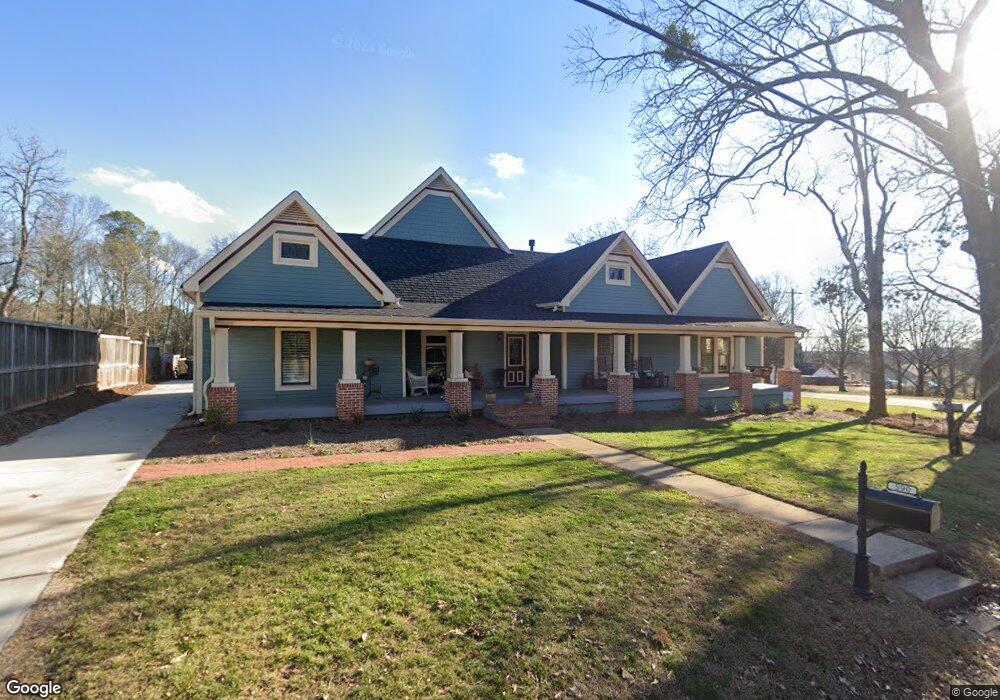
590 South St Buford, GA 30518
Estimated Value: $361,398 - $602,000
3
Beds
3
Baths
2,668
Sq Ft
$179/Sq Ft
Est. Value
About This Home
This home is located at 590 South St, Buford, GA 30518 and is currently estimated at $478,850, approximately $179 per square foot. 590 South St is a home located in Gwinnett County with nearby schools including Buford Elementary School, Buford Senior Academy, and Buford Academy.
Ownership History
Date
Name
Owned For
Owner Type
Purchase Details
Closed on
Nov 1, 2021
Sold by
Sosebee Roberta D
Bought by
Thompson John T and Thompson Denise B
Current Estimated Value
Purchase Details
Closed on
Feb 28, 1995
Sold by
Pass Kenneth
Bought by
Sosebee Roberta D
Purchase Details
Closed on
Feb 27, 1995
Sold by
Merritt Marilyn E Stephen
Bought by
Pass Kenneth
Create a Home Valuation Report for This Property
The Home Valuation Report is an in-depth analysis detailing your home's value as well as a comparison with similar homes in the area
Home Values in the Area
Average Home Value in this Area
Purchase History
| Date | Buyer | Sale Price | Title Company |
|---|---|---|---|
| Thompson John T | $245,000 | -- | |
| Sosebee Roberta D | $68,100 | -- | |
| Pass Kenneth | $44,000 | -- |
Source: Public Records
Mortgage History
| Date | Status | Borrower | Loan Amount |
|---|---|---|---|
| Closed | Sosebee Roberta D | $0 |
Source: Public Records
Tax History Compared to Growth
Tax History
| Year | Tax Paid | Tax Assessment Tax Assessment Total Assessment is a certain percentage of the fair market value that is determined by local assessors to be the total taxable value of land and additions on the property. | Land | Improvement |
|---|---|---|---|---|
| 2025 | $3,237 | $245,600 | $26,000 | $219,600 |
| 2024 | $3,237 | $245,600 | $26,000 | $219,600 |
| 2023 | $3,237 | $289,240 | $26,000 | $263,240 |
| 2022 | $1,270 | $88,520 | $26,000 | $62,520 |
| 2021 | $224 | $40,880 | $16,800 | $24,080 |
| 2020 | $224 | $40,880 | $16,800 | $24,080 |
| 2019 | $202 | $40,880 | $16,800 | $24,080 |
| 2018 | $202 | $30,360 | $5,600 | $24,760 |
| 2016 | $203 | $30,360 | $5,600 | $24,760 |
| 2015 | $210 | $30,360 | $5,600 | $24,760 |
| 2014 | -- | $28,480 | $5,600 | $22,880 |
Source: Public Records
Map
Nearby Homes
- 550 South St
- 240 Smokey Rd
- 0 Smokey Rd Unit 7388364
- 595 South St
- 585 South St
- 520 S Lee St
- 255 Smokey Rd
- 355 Elliott St
- 630 Adams St
- 245 Elliott St
- 355 Smokey Rd
- 0 Adams St Unit 8782823
- 0 Adams St Unit 8110803
- 375 Elliott St
- 225 Elliott St
- 640 Adams St
- 394 Elliott St
- 260 Elliott St
- 365 Smokey Rd
- 660 Adams St