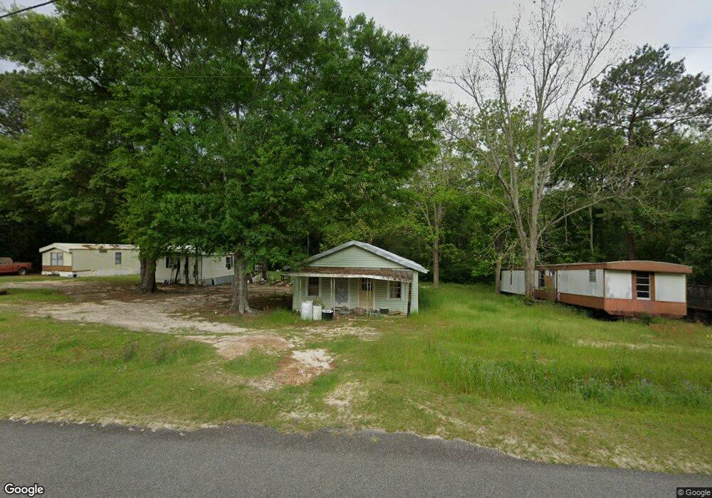
590 Tree Farm Rd Moultrie, GA 31768
Estimated Value: $71,394 - $217,000
--
Bed
1
Bath
1,261
Sq Ft
$99/Sq Ft
Est. Value
About This Home
This home is located at 590 Tree Farm Rd, Moultrie, GA 31768 and is currently estimated at $125,349, approximately $99 per square foot. 590 Tree Farm Rd is a home located in Colquitt County with nearby schools including Funston Elementary School, C.A. Gray Junior High School, and Willie J. Williams Middle School.
Ownership History
Date
Name
Owned For
Owner Type
Purchase Details
Closed on
Jul 17, 2025
Sold by
Beaty Bobby R
Bought by
Barrios Randy Bartolon and Bartolon Barrios Randy
Current Estimated Value
Purchase Details
Closed on
Aug 28, 2015
Sold by
Ruddell Deborah B
Bought by
Beaty Bobby R
Purchase Details
Closed on
Aug 4, 2015
Sold by
Strickland Deborah
Bought by
Ruddell Deborah B
Purchase Details
Closed on
Sep 3, 2009
Sold by
Strickland Deborah
Bought by
Folsom Mark and Folsom Melinda
Purchase Details
Closed on
Aug 30, 1994
Bought by
Strickland John S
Create a Home Valuation Report for This Property
The Home Valuation Report is an in-depth analysis detailing your home's value as well as a comparison with similar homes in the area
Home Values in the Area
Average Home Value in this Area
Purchase History
| Date | Buyer | Sale Price | Title Company |
|---|---|---|---|
| Barrios Randy Bartolon | $1,500 | -- | |
| Beaty Bobby R | $25,000 | -- | |
| Ruddell Deborah B | -- | -- | |
| Folsom Mark | $33,000 | -- | |
| Strickland John S | $12,000 | -- |
Source: Public Records
Tax History Compared to Growth
Tax History
| Year | Tax Paid | Tax Assessment Tax Assessment Total Assessment is a certain percentage of the fair market value that is determined by local assessors to be the total taxable value of land and additions on the property. | Land | Improvement |
|---|---|---|---|---|
| 2024 | $395 | $17,487 | $5,499 | $11,988 |
| 2023 | $346 | $15,307 | $5,499 | $9,808 |
| 2022 | $341 | $14,307 | $4,886 | $9,421 |
| 2021 | $306 | $12,618 | $4,886 | $7,732 |
| 2020 | $304 | $12,284 | $4,886 | $7,398 |
| 2019 | $339 | $12,340 | $4,886 | $7,454 |
| 2018 | $316 | $12,340 | $4,886 | $7,454 |
| 2017 | $296 | $10,861 | $3,407 | $7,454 |
| 2016 | $276 | $10,861 | $3,407 | $7,454 |
| 2015 | $302 | $10,861 | $3,407 | $7,454 |
| 2014 | -- | $10,861 | $3,407 | $7,454 |
| 2013 | -- | $0 | $0 | $0 |
Source: Public Records
Map
Nearby Homes
- 219 Cox Dairy Rd
- 182 Mcginty Rd
- 216 Circle Rd
- 2010 West Blvd
- 1215 12th St SW
- 0 Gatewood Cir Unit 1652303
- 904 Barbara Cir
- 905 Barbara Cir
- 1321 Hallmark Dr
- 1159 6th St SW
- 2393 Georgia 37
- 410 West Bypass NW
- 908 3rd Ave SW
- 515 8th St SW
- 410 W Bypass Pass NW
- 1160 4th St SW
- 610 4th Ave SW
- 601 4th Ave SW
- 1175 4th St SW
- 618 2nd Ave SW
- 574 Tree Farm Rd
- 638 Tree Farm Rd
- 534 Tree Farm Rd
- 668 Tree Farm Rd
- 516 Tree Farm Rd
- 488 Tree Farm Rd
- 490 Tree Farm Rd
- 476 Tree Farm Rd
- 821 Tree Farm Rd
- 470 Tree Farm Rd
- 612 Tree Farm Rd
- 482 Tree Farm Rd
- 750 Tree Farm Rd
- 181 Arwood Ln
- 362 Tree Farm Rd
- 823 Tree Farm Rd
- 180 Cw Cooper Rd
- 874 Tree Farm Rd
- 239 Pine Meadows Subdivision Rd
- 223 Pine Meadows Subdivision Rd