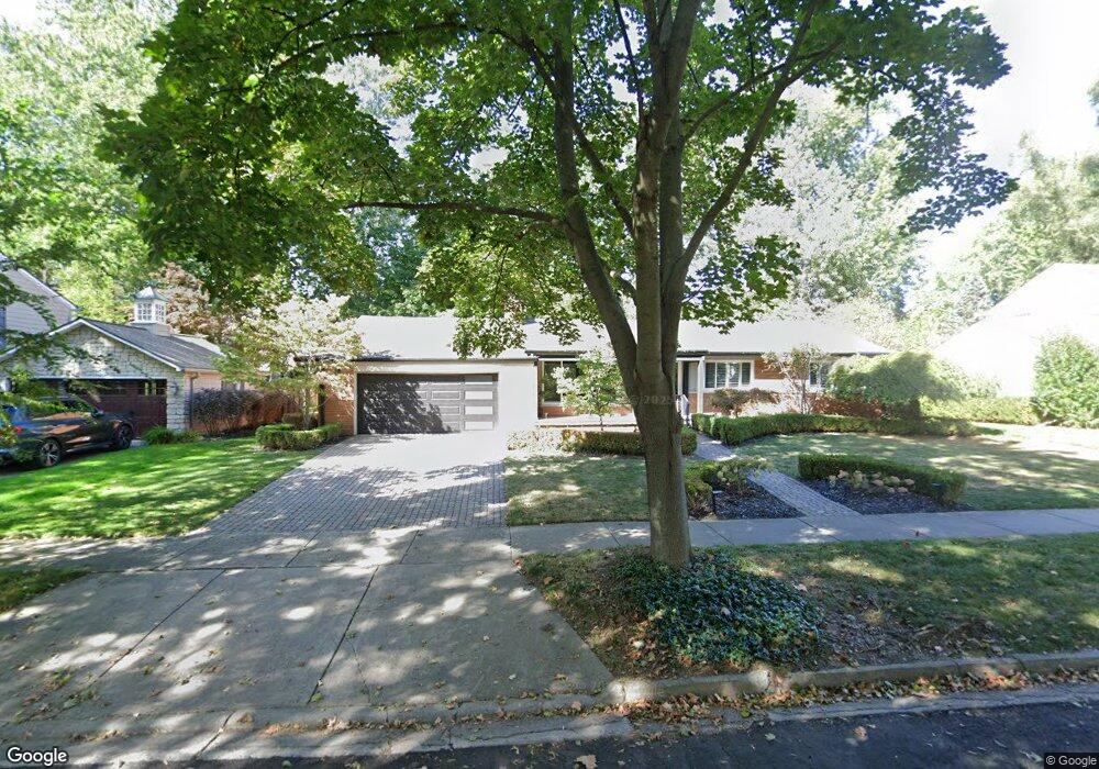
590 Wellesley St Unit Bldg-Unit Birmingham, MI 48009
Estimated Value: $693,000 - $812,000
3
Beds
3
Baths
1,903
Sq Ft
$393/Sq Ft
Est. Value
About This Home
This home is located at 590 Wellesley St Unit Bldg-Unit, Birmingham, MI 48009 and is currently estimated at $748,487, approximately $393 per square foot. 590 Wellesley St Unit Bldg-Unit is a home located in Oakland County with nearby schools including Pierce Elementary School, Derby Middle School, and Ernest W. Seaholm High School.
Ownership History
Date
Name
Owned For
Owner Type
Purchase Details
Closed on
May 31, 2019
Sold by
Garas Stanley C and Garas Nadia
Bought by
Riley Lin Liu
Current Estimated Value
Home Financials for this Owner
Home Financials are based on the most recent Mortgage that was taken out on this home.
Original Mortgage
$376,000
Outstanding Balance
$331,259
Interest Rate
4.2%
Mortgage Type
New Conventional
Estimated Equity
$417,228
Create a Home Valuation Report for This Property
The Home Valuation Report is an in-depth analysis detailing your home's value as well as a comparison with similar homes in the area
Home Values in the Area
Average Home Value in this Area
Purchase History
| Date | Buyer | Sale Price | Title Company |
|---|---|---|---|
| Riley Lin Liu | $470,000 | None Available |
Source: Public Records
Mortgage History
| Date | Status | Borrower | Loan Amount |
|---|---|---|---|
| Open | Riley Lin Liu | $376,000 |
Source: Public Records
Tax History Compared to Growth
Tax History
| Year | Tax Paid | Tax Assessment Tax Assessment Total Assessment is a certain percentage of the fair market value that is determined by local assessors to be the total taxable value of land and additions on the property. | Land | Improvement |
|---|---|---|---|---|
| 2024 | $8,853 | $281,890 | $0 | $0 |
| 2023 | $8,484 | $282,120 | $0 | $0 |
| 2022 | $9,097 | $257,310 | $0 | $0 |
| 2021 | $9,177 | $253,700 | $0 | $0 |
| 2020 | $8,190 | $225,470 | $0 | $0 |
| 2019 | $6,800 | $222,470 | $0 | $0 |
| 2018 | $6,748 | $217,820 | $0 | $0 |
| 2017 | $6,737 | $215,950 | $0 | $0 |
| 2016 | $6,749 | $214,480 | $0 | $0 |
| 2015 | -- | $204,430 | $0 | $0 |
| 2014 | -- | $171,000 | $0 | $0 |
| 2011 | -- | $168,830 | $0 | $0 |
Source: Public Records
Map
Nearby Homes
- 397 S Cranbrook Rd
- 421 S Williamsbury Rd
- 394 S Glenhurst Dr
- 786 S Cranbrook Rd
- 2802 Heathfield Rd
- 2721 Heathfield Rd
- 695 Westchester Way
- 120 Westchester Way
- 2330 Fairway Dr
- 520 Pleasant St
- 345 Kimberly St
- 1834 Fairview St
- 100 Overhill Rd
- 1777 Fairway Dr
- 999 Pleasant Ave
- 2579 Amberly Rd
- 231 Wadsworth Ln
- 222 Arlington St
- 1882 Melbourne St
- 1570 Northlawn Blvd
- 590 Wellesley St
- 564 Wellesley St
- 602 Wellesley St
- 463 Bryn Mawr St
- 505 Bryn Mawr St
- 520 Wellesley St
- 585 Wellesley St
- 457 Bryn Mawr St
- 597 Wellesley St
- 672 Wellesley St
- 563 Wellesley St
- 651 Wellesley St
- 2450 Midvale St
- 468 Wellesley St
- 449 Bryn Mawr St
- 545 Wellesley St
- 525 Bryn Mawr St
- 500 Bryn Mawr St
- 560 Berwyn St Unit Bldg-Unit
- 560 Berwyn St