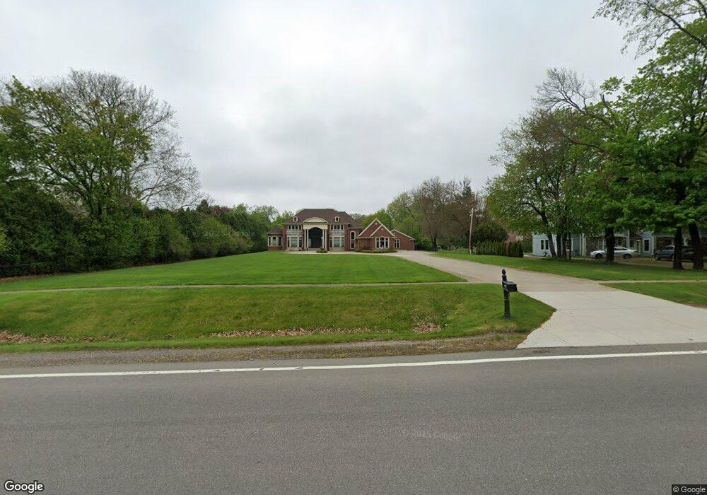
5901 N Adams Rd Bloomfield Hills, MI 48304
Estimated Value: $869,000 - $2,328,000
4
Beds
7
Baths
5,806
Sq Ft
$325/Sq Ft
Est. Value
About This Home
This home is located at 5901 N Adams Rd, Bloomfield Hills, MI 48304 and is currently estimated at $1,885,048, approximately $324 per square foot. 5901 N Adams Rd is a home located in Oakland County with nearby schools including Eastover Elementary School, Bloomfield Hills High School, and Academy of Sacred Heart.
Ownership History
Date
Name
Owned For
Owner Type
Purchase Details
Closed on
Sep 29, 2006
Sold by
Zawaideh Gabe and Zawaideh Ranee
Bought by
Zawaideh Nabil L and Zawaideh Nidal M
Current Estimated Value
Purchase Details
Closed on
Oct 10, 2005
Sold by
King Mark G and King David C
Bought by
Zawaideh Nabil L and Zawaideh Nidal M
Purchase Details
Closed on
Apr 24, 2004
Sold by
King Bertha E and King Max Frederick
Bought by
King Bertha E and Bertha E King Trust
Create a Home Valuation Report for This Property
The Home Valuation Report is an in-depth analysis detailing your home's value as well as a comparison with similar homes in the area
Home Values in the Area
Average Home Value in this Area
Purchase History
| Date | Buyer | Sale Price | Title Company |
|---|---|---|---|
| Zawaideh Nabil L | -- | None Available | |
| Zawaideh Nabil L | $235,000 | Devon Title Agency | |
| King Bertha E | -- | -- |
Source: Public Records
Tax History Compared to Growth
Tax History
| Year | Tax Paid | Tax Assessment Tax Assessment Total Assessment is a certain percentage of the fair market value that is determined by local assessors to be the total taxable value of land and additions on the property. | Land | Improvement |
|---|---|---|---|---|
| 2024 | $12,233 | $859,860 | $0 | $0 |
| 2023 | $11,839 | $790,150 | $0 | $0 |
| 2022 | $22,249 | $764,830 | $0 | $0 |
| 2021 | $22,091 | $724,680 | $0 | $0 |
| 2020 | $10,828 | $700,680 | $0 | $0 |
| 2019 | $20,783 | $674,530 | $0 | $0 |
| 2018 | $20,878 | $663,300 | $0 | $0 |
| 2017 | $20,728 | $640,980 | $0 | $0 |
| 2016 | $20,767 | $613,360 | $0 | $0 |
| 2015 | -- | $579,890 | $0 | $0 |
| 2014 | -- | $550,740 | $0 | $0 |
| 2011 | -- | $514,000 | $0 | $0 |
Source: Public Records
Map
Nearby Homes
- 2953 Squire Ct
- 2928 Vineyards Dr
- 952 Dursley Rd
- 1339 Knollcrest Cir
- 1470 Timberview Trail
- 1136 Meadowglen Ct Unit S80
- 1105 Ivyglen Cir
- 4.8 Acres Westview Rd
- 1204 S Timberview Trail Unit E 23
- 1289 Greenglen Ct
- 1285 Greenglen Ct
- 2576 Homewood Dr
- 2456 Red Maple Dr
- 2333 Tall Oaks Dr
- 5218 Cherokee Ct
- 790 Hidden Pine Rd
- 3370 BlooMcRest Dr
- 1926 Hickory Bark Ln
- 2156 Park Ridge Dr
- 1916 Squirrel Valley Dr