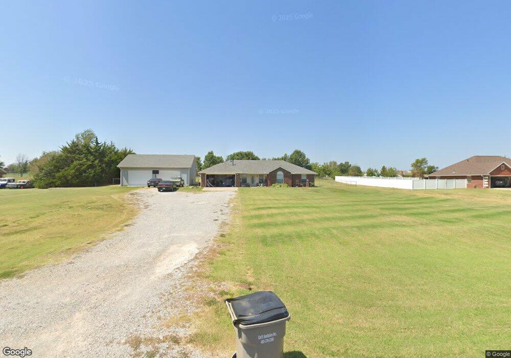
5902 Earl Dr Shawnee, OK 74804
Estimated Value: $244,000 - $306,000
3
Beds
2
Baths
1,644
Sq Ft
$160/Sq Ft
Est. Value
About This Home
This home is located at 5902 Earl Dr, Shawnee, OK 74804 and is currently estimated at $263,651, approximately $160 per square foot. 5902 Earl Dr is a home located in Pottawatomie County.
Ownership History
Date
Name
Owned For
Owner Type
Purchase Details
Closed on
May 18, 2021
Sold by
Westerman Kevin and Westerman Candace
Bought by
Westerman Kevin and Westerman Candace
Current Estimated Value
Home Financials for this Owner
Home Financials are based on the most recent Mortgage that was taken out on this home.
Original Mortgage
$144,000
Outstanding Balance
$109,021
Interest Rate
3.1%
Mortgage Type
New Conventional
Estimated Equity
$154,630
Purchase Details
Closed on
Mar 15, 2000
Sold by
Snider Clinton
Bought by
Collins Loyd and Collins Wilma
Create a Home Valuation Report for This Property
The Home Valuation Report is an in-depth analysis detailing your home's value as well as a comparison with similar homes in the area
Home Values in the Area
Average Home Value in this Area
Purchase History
| Date | Buyer | Sale Price | Title Company |
|---|---|---|---|
| Westerman Kevin | -- | First American Title Ins Co | |
| Collins Loyd | $93,000 | -- |
Source: Public Records
Mortgage History
| Date | Status | Borrower | Loan Amount |
|---|---|---|---|
| Open | Westerman Kevin | $144,000 |
Source: Public Records
Tax History Compared to Growth
Tax History
| Year | Tax Paid | Tax Assessment Tax Assessment Total Assessment is a certain percentage of the fair market value that is determined by local assessors to be the total taxable value of land and additions on the property. | Land | Improvement |
|---|---|---|---|---|
| 2024 | $2,268 | $21,385 | $894 | $20,491 |
| 2023 | $2,268 | $20,762 | $876 | $19,886 |
| 2022 | $2,173 | $20,158 | $859 | $19,299 |
| 2021 | $2,170 | $20,158 | $859 | $19,299 |
| 2020 | $2,134 | $19,000 | $825 | $18,175 |
| 2019 | $2,054 | $18,448 | $793 | $17,655 |
| 2018 | $1,925 | $17,911 | $766 | $17,145 |
| 2017 | $1,870 | $17,388 | $728 | $16,660 |
| 2016 | $1,495 | $16,882 | $704 | $16,178 |
| 2015 | $1,446 | $16,390 | $759 | $15,631 |
| 2014 | $1,401 | $15,912 | $751 | $15,161 |
Source: Public Records
Map
Nearby Homes
- 5707 Earl Dr
- 5505 Capricorn
- 219 Hope Ave
- 213 Hope Ave
- 127 Castle Rock Ln
- 41208 Hazel Dell Rd
- 207 Hope Ave
- 139 Trimble Dr
- 126 Hope Ave
- 43289 Garrett's Lake Rd
- 7777 Arthur Rd
- 407 Butler Dr
- 8888 Arthur Rd
- 103 Trimble Dr
- 138 Trimble Dr
- 42829 Garrett's Lake Rd
- 110 Cuyler Dr
- 42773 Garrett's Lake Rd
- 43844 Limestone Dr
- 7110 Brangus Rd