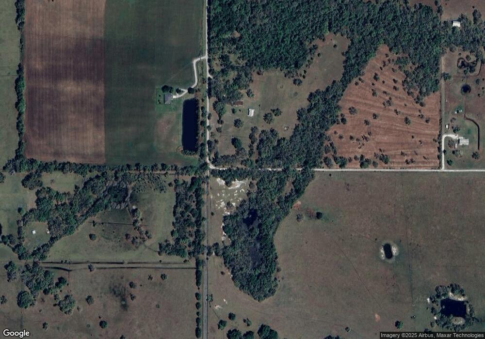
5902 SW Smith Ave Arcadia, FL 34266
Estimated Value: $248,000 - $417,000
2
Beds
2
Baths
1,138
Sq Ft
$296/Sq Ft
Est. Value
About This Home
This home is located at 5902 SW Smith Ave, Arcadia, FL 34266 and is currently estimated at $336,434, approximately $295 per square foot. 5902 SW Smith Ave is a home located in DeSoto County with nearby schools including Nocatee Elementary School, DeSoto Middle School, and DeSoto County High School.
Ownership History
Date
Name
Owned For
Owner Type
Purchase Details
Closed on
Sep 30, 2005
Sold by
Rice Ronald A and Rice Eva J
Bought by
Matthews Geraldine Virginia and Kram Earl
Current Estimated Value
Home Financials for this Owner
Home Financials are based on the most recent Mortgage that was taken out on this home.
Original Mortgage
$126,000
Outstanding Balance
$66,240
Interest Rate
5.77%
Mortgage Type
Fannie Mae Freddie Mac
Estimated Equity
$270,194
Create a Home Valuation Report for This Property
The Home Valuation Report is an in-depth analysis detailing your home's value as well as a comparison with similar homes in the area
Home Values in the Area
Average Home Value in this Area
Purchase History
| Date | Buyer | Sale Price | Title Company |
|---|---|---|---|
| Matthews Geraldine Virginia | $180,000 | Arcadia Abstract & Title Com |
Source: Public Records
Mortgage History
| Date | Status | Borrower | Loan Amount |
|---|---|---|---|
| Open | Matthews Geraldine Virginia | $126,000 |
Source: Public Records
Tax History Compared to Growth
Tax History
| Year | Tax Paid | Tax Assessment Tax Assessment Total Assessment is a certain percentage of the fair market value that is determined by local assessors to be the total taxable value of land and additions on the property. | Land | Improvement |
|---|---|---|---|---|
| 2024 | $1,268 | $92,484 | -- | -- |
| 2023 | $1,230 | $89,790 | $0 | $0 |
| 2022 | $1,140 | $84,234 | $0 | $0 |
| 2021 | $1,133 | $81,781 | $0 | $0 |
| 2020 | $1,072 | $78,044 | $0 | $0 |
| 2019 | $1,044 | $76,289 | $0 | $0 |
| 2018 | $1,022 | $74,867 | $0 | $74,867 |
| 2017 | $574 | $73,327 | $0 | $73,327 |
| 2016 | $969 | $71,819 | $0 | $71,819 |
| 2015 | $883 | $65,654 | $0 | $65,654 |
| 2014 | $817 | $65,133 | $0 | $65,133 |
Source: Public Records
Map
Nearby Homes
- 0 Unit MFRB4901948
- 6918 SW Miami Ave
- 2464 SW Kleis Dr
- 2451 SW Brandy Dr
- 0 County Road 760a Unit MFRA4673399
- 2491 SW Stroud St
- 4415 & 4413 SW Welles Ave
- 4951 SE Airport Rd
- 0 SW Boll Weevil Rd
- 4327 SE Airport Rd
- 0 SE Airport Rd Unit MFRB4901950
- 1996 SW Highway 17
- 0 Cr-763 Unit A MFRC7511651
- 2404 SE Rice St
- 0 SE Reynolds St
- 3389 SW Kabrich Terrace
- 0 SE Piggy Back Rd Unit MFRC7515949
- 4865 SE North Hog Bay Extension
- 2902 SE Piggy Back Rd
- 5618 County Road 763
- 5682, 5750, 5788 SW Smith Ave
- 5750 SW Smith Ave
- 5576 SW Smith Ave
- 6227 SW Smith Ave
- 1847 SW Grady St
- 5480 SW Smith Ave
- 5769 SW Smith Ave
- 0 SW Smith Ave
- 5385 SW Dees Ave
- 5730 SW Carlton Ave
- 1 SW Carlton Ave
- 0 SW Carlton Ave Unit C7444333
- 0 SW Carlton Ave Unit C7443213
- 0 SW Carlton Ave Unit C7441353
- 0 SW Carlton Ave Unit C7441347
- 0 SW Carlton Ave Unit F1001426
- 0 SW Carlton Ave Unit F1001430
- 0 SW Carlton Ave Unit C7432786
- 0 SW Carlton Ave Unit C7432780
- 0 SW Carlton Ave Unit 220008004
