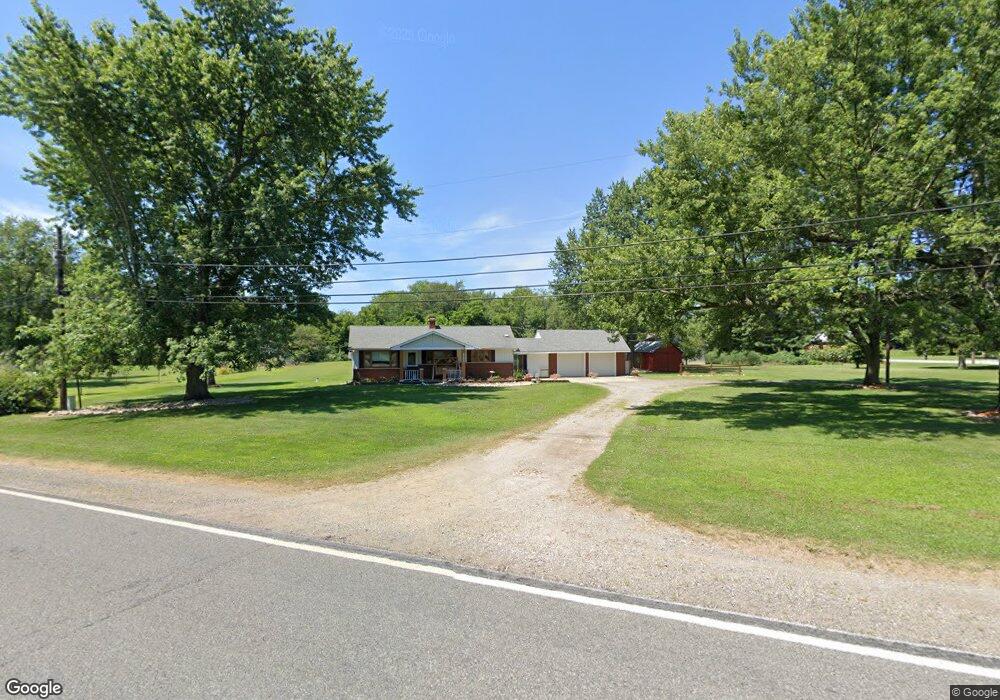
59035 Crumstown Hwy North Liberty, IN 46554
Estimated Value: $211,385 - $271,000
2
Beds
1
Bath
1,040
Sq Ft
$225/Sq Ft
Est. Value
About This Home
This home is located at 59035 Crumstown Hwy, North Liberty, IN 46554 and is currently estimated at $234,096, approximately $225 per square foot. 59035 Crumstown Hwy is a home located in St. Joseph County with nearby schools including Wilson Elementary School, Clay Intermediate Center, and Navarre Middle School.
Ownership History
Date
Name
Owned For
Owner Type
Purchase Details
Closed on
Nov 16, 2017
Sold by
Kesler M Roger
Bought by
Wise Annette Marie
Current Estimated Value
Home Financials for this Owner
Home Financials are based on the most recent Mortgage that was taken out on this home.
Original Mortgage
$110,461
Outstanding Balance
$92,610
Interest Rate
3.87%
Mortgage Type
FHA
Estimated Equity
$141,486
Purchase Details
Closed on
Apr 12, 2013
Sold by
Kesler Shannah S
Bought by
Kesler M Roger
Home Financials for this Owner
Home Financials are based on the most recent Mortgage that was taken out on this home.
Original Mortgage
$99,100
Interest Rate
3.51%
Mortgage Type
New Conventional
Create a Home Valuation Report for This Property
The Home Valuation Report is an in-depth analysis detailing your home's value as well as a comparison with similar homes in the area
Home Values in the Area
Average Home Value in this Area
Purchase History
| Date | Buyer | Sale Price | Title Company |
|---|---|---|---|
| Wise Annette Marie | -- | -- | |
| Kesler M Roger | -- | Meridian Title |
Source: Public Records
Mortgage History
| Date | Status | Borrower | Loan Amount |
|---|---|---|---|
| Open | Wise Annette Marie | $110,461 | |
| Previous Owner | Kesler M Roger | $99,100 |
Source: Public Records
Tax History Compared to Growth
Tax History
| Year | Tax Paid | Tax Assessment Tax Assessment Total Assessment is a certain percentage of the fair market value that is determined by local assessors to be the total taxable value of land and additions on the property. | Land | Improvement |
|---|---|---|---|---|
| 2024 | $1,579 | $164,700 | $51,800 | $112,900 |
| 2023 | $1,524 | $145,300 | $51,800 | $93,500 |
| 2022 | $2,155 | $177,400 | $63,200 | $114,200 |
| 2021 | $1,601 | $139,100 | $28,600 | $110,500 |
| 2020 | $1,177 | $116,100 | $23,900 | $92,200 |
| 2019 | $923 | $111,300 | $22,300 | $89,000 |
| 2018 | $861 | $105,300 | $21,100 | $84,200 |
| 2017 | $889 | $105,400 | $21,100 | $84,300 |
| 2016 | $903 | $105,400 | $21,100 | $84,300 |
| 2014 | $598 | $86,700 | $17,600 | $69,100 |
Source: Public Records
Map
Nearby Homes
- 27180 Harrison Rd
- 26541 Gaited Horse Trail
- 57210 White Pine Trail
- 57115 White Pine Trail
- 57860 Crumstown Hwy
- 57845 Crumstown Hwy
- 25599 Peach Trail
- 57248 Mcquade St
- 30390 Inwood Rd
- 56915 Tulip Rd
- 24845 State Road 23
- 56803 Tulip Rd
- 56763 Tulip Rd
- 56729 Tulip Rd
- 56659 Tulip Rd
- 56611 Tulip Rd
- 29805 Grant Rd
- 30750 Inwood Rd
- 58521 Strawberry Rd
- 29750 Indiana 2
- 59015 Crumstown Hwy
- 59050 Crumstown Hwy
- 59110 Crumstown Hwy
- 59105 Crumstown Hwy
- 58999 Crumstown Hwy
- 27433 Inwood Rd
- 59120 Crumstown Hwy
- 27480 Inwood Rd
- 58985 Crumstown Hwy
- 27477 Inwood Rd
- 59130 Crumstown Hwy
- 59088 Crumstown Hwy
- 27522 Inwood Rd
- 59131 Crumstown Hwy
- 58955 Crumstown Hwy
- 59180 Crumstown Hwy
- 58976 Crumstown Hwy
- 27451 Inwood Rd
- 58931 Crumstown Hwy
- 58915 Crumstown Hwy