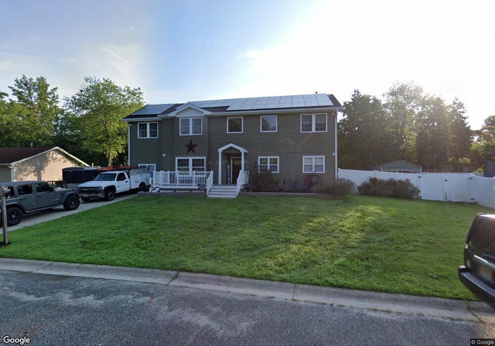
5905 Elmhurst Dr Mays Landing, NJ 08330
Estimated Value: $389,000 - $472,767
5
Beds
3
Baths
2,844
Sq Ft
$157/Sq Ft
Est. Value
About This Home
This home is located at 5905 Elmhurst Dr, Mays Landing, NJ 08330 and is currently estimated at $445,942, approximately $156 per square foot. 5905 Elmhurst Dr is a home located in Atlantic County with nearby schools including Joseph Shaner School, George L. Hess Educational Complex, and William Davies Middle School.
Ownership History
Date
Name
Owned For
Owner Type
Purchase Details
Closed on
Feb 11, 2011
Sold by
Federal National Mortgage Association
Bought by
Gabriel Frank
Current Estimated Value
Home Financials for this Owner
Home Financials are based on the most recent Mortgage that was taken out on this home.
Original Mortgage
$191,496
Outstanding Balance
$130,849
Interest Rate
4.75%
Mortgage Type
FHA
Estimated Equity
$315,093
Purchase Details
Closed on
Jun 2, 2010
Sold by
Evangelista Nicholas and Evangelista Kris Joan
Bought by
Federal National Mortgage Association
Purchase Details
Closed on
Apr 30, 2002
Sold by
Connor Jessica M and Connor John R
Bought by
Evangelista Nicholas
Home Financials for this Owner
Home Financials are based on the most recent Mortgage that was taken out on this home.
Original Mortgage
$108,000
Interest Rate
8.37%
Purchase Details
Closed on
Jan 31, 2000
Sold by
Piccolo Jessica M
Bought by
Doyle Jessica M and Conner John B
Home Financials for this Owner
Home Financials are based on the most recent Mortgage that was taken out on this home.
Original Mortgage
$31,900
Interest Rate
8.4%
Mortgage Type
Stand Alone Second
Purchase Details
Closed on
Jul 19, 1996
Sold by
Picciolo Vincent J and Picciolo Jessica M
Bought by
Picciolo Jessica M
Purchase Details
Closed on
Sep 30, 1994
Sold by
Meridian Mortgage
Bought by
Picciolo Vincent and Picciolo Jessica
Home Financials for this Owner
Home Financials are based on the most recent Mortgage that was taken out on this home.
Original Mortgage
$80,000
Interest Rate
8.43%
Purchase Details
Closed on
Dec 15, 1988
Sold by
Trout Robert A and Trout Patti S
Bought by
Thress Michael
Create a Home Valuation Report for This Property
The Home Valuation Report is an in-depth analysis detailing your home's value as well as a comparison with similar homes in the area
Home Values in the Area
Average Home Value in this Area
Purchase History
| Date | Buyer | Sale Price | Title Company |
|---|---|---|---|
| Gabriel Frank | $170,000 | Foundation Title | |
| Federal National Mortgage Association | -- | None Available | |
| Evangelista Nicholas | $135,000 | Lloyds & Handson Title | |
| Doyle Jessica M | -- | -- | |
| Picciolo Jessica M | -- | -- | |
| Picciolo Vincent | $84,000 | -- | |
| Thress Michael | $87,000 | -- |
Source: Public Records
Mortgage History
| Date | Status | Borrower | Loan Amount |
|---|---|---|---|
| Open | Gabriel Frank | $191,496 | |
| Previous Owner | Evangelista Nicholas | $108,000 | |
| Previous Owner | Doyle Jessica M | $31,900 | |
| Previous Owner | Picciolo Vincent | $80,000 |
Source: Public Records
Tax History Compared to Growth
Tax History
| Year | Tax Paid | Tax Assessment Tax Assessment Total Assessment is a certain percentage of the fair market value that is determined by local assessors to be the total taxable value of land and additions on the property. | Land | Improvement |
|---|---|---|---|---|
| 2025 | $7,469 | $217,700 | $48,100 | $169,600 |
| 2024 | $7,469 | $217,700 | $48,100 | $169,600 |
| 2023 | $7,023 | $217,700 | $48,100 | $169,600 |
| 2022 | $7,023 | $217,700 | $48,100 | $169,600 |
| 2021 | $7,008 | $217,700 | $48,100 | $169,600 |
| 2020 | $7,008 | $217,700 | $48,100 | $169,600 |
| 2019 | $7,025 | $217,700 | $48,100 | $169,600 |
| 2018 | $6,779 | $217,700 | $48,100 | $169,600 |
| 2017 | $6,673 | $217,700 | $48,100 | $169,600 |
| 2016 | $6,485 | $217,700 | $48,100 | $169,600 |
| 2015 | $6,265 | $217,700 | $48,100 | $169,600 |
| 2014 | $5,911 | $225,000 | $53,100 | $171,900 |
Source: Public Records
Map
Nearby Homes
- 5926 Berry Dr
- 5910 Redwood Ct
- 5906 Vine Dr
- 5910 Somerset Dr
- 000 Apple St
- 0 Apple St
- 55 Lewis Dr
- 40 Vender Ln
- 18 Lewis Dr
- 94 Merlino Ln
- Rt 50 and Cedar
- 5761 Cedar Ave
- 42 Ernst Ct
- Bl 531 Lot 8&9 Adams Ave
- 0 Cape May Ave
- Lot:11.02-12.02 Estelle Ave
- B:534 L:11.01 Estelle Ave
- B:534 L:12.02 Estelle Ave
- B:534 L:11.02 Estelle Ave
- 22 Ernst Ct
- 5907 Elmhurst Dr
- 5907 Cedarcroft Dr
- 5909 Cedarcroft Dr
- 5911 Cedarcroft Dr
- 1804 Pond Ave
- 5929 Berry Dr
- 5906 Elmhurst Dr
- 5927 Berry Dr
- 5913 Cedarcroft Dr
- 5908 Cedarcroft Dr
- 5910 Cedarcroft Dr
- 1805 Pond Ave
- 5906 Cedarcroft Dr
- 5928 Berry Dr
- 1803 Pond Ave
- 5904 Cedarcroft Dr
- 5908 Elmhurst Dr
- 5915 Cedarcroft Dr
- 5925 Berry Dr
- 1714 Candlewood Dr